Falcon Mesa, Texas
| Falcon Mesa, Texas | |
|---|---|
| CDP | |
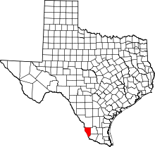
 Location of Falcon Mesa, Texas | |
 | |
| Coordinates: 26°52′22″N 99°17′20″W / 26.87278°N 99.28889°WCoordinates: 26°52′22″N 99°17′20″W / 26.87278°N 99.28889°W | |
| Country | United States |
| State | Texas |
| County | Zapata |
| Area | |
| • Total | 1.5 sq mi (4.0 km2) |
| • Land | 1.5 sq mi (4.0 km2) |
| • Water | 0.0 sq mi (0.0 km2) |
| Elevation | 367 ft (112 m) |
| Population (2010) | |
| • Total | 405 |
| • Density | 331.1/sq mi (127.8/km2) |
| Time zone | Central (CST) (UTC-6) |
| • Summer (DST) | CDT (UTC-5) |
| FIPS code | 48-25352[1] |
| GNIS feature ID | 1335665[2] |
Falcon Mesa is a census-designated place (CDP) in Zapata County, Texas, United States. The population was 405 at the 2010 census.
Geography
Falcon Mesa is located at 26°52′22″N 99°17′20″W / 26.87278°N 99.28889°W (26.872812, -99.288953).[3]
According to the United States Census Bureau, the CDP has a total area of 1.5 square miles (4.0 km²), all of it land.
Demographics
| Historical population | |||
|---|---|---|---|
| Census | Pop. | %± | |
| 2000 | 506 | — | |
| 2010 | 405 | −20.0% | |
As of the census[1] of 2000, there were 506 people, 242 households, and 168 families residing in the CDP. The population density was 331.1 people per square mile (127.7/km²). There were 546 housing units at an average density of 357.3/sq mi (137.8/km²). The racial makeup of the CDP was 91.50% White, 0.40% African American, 0.40% Native American, 0.20% Asian, 5.93% from other races, and 1.58% from two or more races. Hispanic or Latino of any race were 30.63% of the population.
There were 242 households out of which 13.6% had children under the age of 18 living with them, 65.3% were married couples living together, 3.7% had a female householder with no husband present, and 30.2% were non-families. 28.1% of all households were made up of individuals and 22.7% had someone living alone who was 65 years of age or older. The average household size was 2.09 and the average family size was 2.51.
In the CDP the population was spread out with 14.0% under the age of 18, 4.3% from 18 to 24, 12.3% from 25 to 44, 24.9% from 45 to 64, and 44.5% who were 65 years of age or older. The median age was 62 years. For every 100 females there were 99.2 males. For every 100 females age 18 and over, there were 95.1 males.
The median income for a household in the CDP was $24,792, and the median income for a family was $26,645. Males had a median income of $16,250 versus $48,021 for females. The per capita income for the CDP was $12,150. About 19.8% of families and 21.0% of the population were below the poverty line, including 25.5% of those under age 18 and 15.0% of those age 65 or over.
Education
All of Zapata County is a part of the Zapata County Independent School District.
References
- 1 2 "American FactFinder". United States Census Bureau. Retrieved 2008-01-31.
- ↑ "US Board on Geographic Names". United States Geological Survey. 2007-10-25. Retrieved 2008-01-31.
- ↑ "US Gazetteer files: 2010, 2000, and 1990". United States Census Bureau. 2011-02-12. Retrieved 2011-04-23.
Municipalities and communities of Zapata County, Texas, United States | ||
|---|---|---|
| CDPs |
|  |