Fairview Beach, Virginia
| Fairview Beach, Virginia | |
|---|---|
| CDP | |
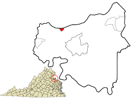 Location in King George County and the state of Virginia. | |
| Coordinates: 38°19′45″N 77°14′31″W / 38.32917°N 77.24194°WCoordinates: 38°19′45″N 77°14′31″W / 38.32917°N 77.24194°W | |
| Country | United States |
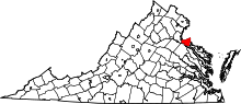
| State | Virginia |
| County | King George |
| Area | |
| • Total | 0.2 sq mi (0.5 km2) |
| • Land | 0.2 sq mi (0.4 km2) |
| • Water | 0.0 sq mi (0.1 km2) |
| Elevation | 10 ft (3 m) |
| Population (2010) | |
| • Total | 391 |
| • Density | 2,000/sq mi (780/km2) |
| Time zone | Eastern (EST) (UTC-5) |
| • Summer (DST) | EDT (UTC-4) |
| FIPS code | 51-27040[1] |
| GNIS feature ID | 1495523[2] |
Fairview Beach is a census-designated place (CDP) in King George County, Virginia, United States. The population was 391 at the 2010 census, which was up significantly from the 230 reported in 2000. It is located within the Northern Neck George Washington Birthplace American Viticultural Area winemaking appellation.
Geography
Fairview Beach is located at 38°19′45″N 77°14′31″W / 38.329155°N 77.241928°W (38.329155, -77.241928).[3]
According to the United States Census Bureau, the CDP has a total area of 0.2 square miles (0.5 km2), of which, 0.2 square miles (0.4 km2) of it is land and 0.04 square miles (0.1 km2) of it (11.11%) is water.
Demographics
As of the census[1] of 2000, there were 230 people, 112 households, and 63 families residing in the CDP. The population density was 1,507.7 people per square mile (592.0/km2). There were 222 housing units at an average density of 1,455.3/sq mi (571.4/km2). The racial makeup of the CDP was 97.39% White, 0.87% Asian, and 1.74% from two or more races.
There were 112 households out of which 17.9% had children under the age of 18 living with them, 39.3% were married couples living together, 11.6% had a female householder with no husband present, and 43.8% were non-families. 34.8% of all households were made up of individuals and 8.0% had someone living alone who was 65 years of age or older. The average household size was 2.05 and the average family size was 2.56.
In the CDP the population was spread out with 13.9% under the age of 18, 10.0% from 18 to 24, 23.5% from 25 to 44, 30.9% from 45 to 64, and 21.7% who were 65 years of age or older. The median age was 46 years. For every 100 females there were 107.2 males. For every 100 females age 18 and over, there were 112.9 males.
The median income for a household in the CDP was $47,188, and the median income for a family was $48,056. Males had a median income of $46,528 versus $25,156 for females. The per capita income for the CDP was $22,231. None of the families and 2.8% of the population were living below the poverty line.
References
- 1 2 "American FactFinder". United States Census Bureau. Retrieved 2008-01-31.
- ↑ "US Board on Geographic Names". United States Geological Survey. 2007-10-25. Retrieved 2008-01-31.
- ↑ "US Gazetteer files: 2010, 2000, and 1990". United States Census Bureau. 2011-02-12. Retrieved 2011-04-23.