Fairton, New Jersey
| Fairton, New Jersey | |
|---|---|
| Census-designated place | |
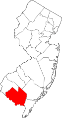
 Map of Fairton highlighted within Cumberland County. Right: Location of Cumberland County in New Jersey. | |
| Coordinates: 39°22′24″N 75°12′32″W / 39.373352°N 75.208845°WCoordinates: 39°22′24″N 75°12′32″W / 39.373352°N 75.208845°W | |
| Country |
|
| State |
|
| County | Cumberland |
| Township | Fairfield |
| Area[1] | |
| • Total | 2.988 sq mi (7.739 km2) |
| • Land | 2.860 sq mi (7.407 km2) |
| • Water | 0.128 sq mi (0.332 km2) 4.29% |
| Elevation[2] | 26 ft (8 m) |
| Population (2010 Census)[3] | |
| • Total | 1,264 |
| • Density | 442.0/sq mi (170.7/km2) |
| Time zone | Eastern (EST) (UTC-5) |
| • Summer (DST) | Eastern (EDT) (UTC-4) |
| ZIP code | 08320[4][5] |
| Area code(s) | 856 |
| FIPS code | 3422530[6] |
| GNIS feature ID | 02389066[7] |
Fairton is an unincorporated community and census-designated place (CDP) located within Fairfield Township, in Cumberland County, New Jersey, United States.[8] It is part of the Vineland-Millville-Bridgeton Primary Metropolitan Statistical Area for statistical purposes. As of the 2010 United States Census, the CDP's population was 2,253.[3]
History
This area was occupied historically by the Lenape and Nanticoke peoples, both part of the Algonquian languages family of the Atlantic coast. Their territory was encroached on by European-American settlers from colonial times.
The first industry in Fairfield was a mill, established by English settler Samuel Fithian. He owned part of the Grist Mill on Forke Creek before 1702. No information has been discovered on the other owners, but the shares were probably held in common. At some time before 1763, the owners moved the mill dam to near Clarks Pond Road. The mill was owned by David Clark from 1759 to 1843.
In the 1810s, a pork and beef business was the principal industry in this area. In the center of town was a busy public wharf, from which were shipped vegetables, fish and lumber to large city markets. Fairton was also active in the boat building industry; between 1850 and 1897, its yards built three sloops.[9]
In 1978, the indigenous peoples based in Cumberland County reorganized as the Nanticoke Lenni-Lenape Tribal Nation. Their cultural center is based in Fairton, and their tribal headquarters in Bridgeton, New Jersey.[10] The tribe says that in 2016 they have 3,000 enrolled members; membership is based on documented descent from core families and blood quantum. The tribe has not achieved federal recognition. They contend that a state resolution recognized them, but in March 2016 a state court of New Jersey said that the state has not officially recognized any American Indian tribe in its territory and had no process to do so.[11][12] Tribal members have lived for centuries in Cumberland and Salem counties in present-day New Jersey.[10]
Geography
According to the United States Census Bureau, the CDP had a total area of 2.988 square miles (7.739 km2), including 2.860 square miles (7.407 km2) of land and 0.128 square mile (0.332 km2) of water (4.29%).[1][13]
Demographics
| Historical population | |||
|---|---|---|---|
| Census | Pop. | %± | |
| 1990 | 1,359 | — | |
| 2000 | 2,253 | 65.8% | |
| 2010 | 1,264 | −43.9% | |
| Population sources: 2000[14] 2010[3] | |||
Census 2010
At the 2010 United States Census, there were 1,264 people, 529 households, and 353.9 families residing in the CDP. The population density was 442.0 per square mile (170.7/km2). There were 573 housing units at an average density of 200.4 per square mile (77.4/km2). The racial makeup of the CDP was 71.76% (907) White, 12.82% (162) Black or African American, 4.83% (61) Native American, 0.71% (9) Asian, 0.00% (0) Pacific Islander, 4.03% (51) from other races, and 5.85% (74) from two or more races. Hispanics or Latinos of any race were 8.07% (102) of the population.[3]
There were 529 households, of which 23.4% had children under the age of 18 living with them, 45.4% were married couples living together, 16.3% had a female householder with no husband present, and 33.1% were non-families. 28.4% of all households were made up of individuals, and 12.7% had someone living alone who was 65 years of age or older. The average household size was 2.39 and the average family size was 2.90.[3]
In the CDP, 20.1% of the population were under the age of 18, 8.7% from 18 to 24, 23.3% from 25 to 44, 29.4% from 45 to 64, and 18.6% who were 65 years of age or older. The median age was 43.7 years. For every 100 females there were 92.7 males. For every 100 females age 18 and over, there were 89.1 males.[3]
Census 2000
As of the 2000 United States Census[6] there were 2,253 people, 474 households, and 334 families residing in the CDP. The population density was 308.5/km2 (798.7/mi2). There were 511 housing units at an average density of 70.0/km2 (181.1/mi2). The racial makeup of the CDP was 61.43% White, 33.38% African American, 2.35% Native American, 1.20% Asian, 0.18% from other races, and 1.46% from two or more races. Hispanic or Latino of any race were 11.54% of the population.[14]
There were 474 households out of which 26.8% had children under the age of 18 living with them, 53.0% were married couples living together, 11.8% had a female householder with no husband present, and 29.5% were non-families. 24.9% of all households were made up of individuals and 11.4% had someone living alone who was 65 years of age or older. The average household size was 2.46 and the average family size was 2.92.[14]
In the CDP the population was spread out with 11.5% under the age of 18, 9.0% from 18 to 24, 48.0% from 25 to 44, 23.3% from 45 to 64, and 8.3% who were 65 years of age or older. The median age was 36 years. For every 100 females there were 265.7 males. For every 100 females age 18 and over, there were 313.9 males.[14]
The median income for a household in the CDP was $37,962, and the median income for a family was $41,000. Males had a median income of $30,750 versus $25,326 for females. The per capita income for the CDP was $20,005. About 3.1% of families and 5.9% of the population were below the poverty line, including 4.6% of those under age 18 and none of those age 65 or over.[14]
Notable people
People who were born in, residents of, or otherwise closely associated with Fairton include:
- Nathaniel Clark Burt (1825–1874), Presbyterian clergyman.[15]
- John T. Nixon (1820–1889), represented New Jersey's 1st congressional district in the United States House of Representatives from 1859 to 1863.[16]
References
- 1 2 Gazetteer of New Jersey Places, United States Census Bureau. Accessed July 21, 2016.
- ↑ U.S. Geological Survey Geographic Names Information System: Fairton Census Designated Place, Geographic Names Information System. Accessed November 2, 2012.
- 1 2 3 4 5 6 DP-1 - Profile of General Population and Housing Characteristics: 2010 Demographic Profile Data for Fairton CDP, New Jersey, United States Census Bureau. Accessed November 2, 2012.
- ↑ Look Up a ZIP Code for Fairton, NJ, United States Postal Service. Accessed November 2, 2012.
- ↑ Zip Codes, State of New Jersey. Accessed August 28, 2013.
- 1 2 American FactFinder, United States Census Bureau. Accessed September 4, 2014.
- ↑ US Board on Geographic Names, United States Geological Survey. Accessed September 4, 2014.
- ↑ New Jersey: 2010 - Population and Housing Unit Counts - 2010 Census of Population and Housing (CPH-2-32), United States Census Bureau, August 2012. Accessed October 18, 2012.
- ↑ Conahey Sr., Patrick W. "A look back at history of Fairton", Cumberland County Voices, September 29, 2009. Accessed September 18, 2016.
- 1 2 "Meet Native America: Mark Gould, Chief of the Nanticoke Lenni-Lenape Tribal Nation", National Museum of the American Indian, September 6, 2016. Accessed September 18, 2016. "Our tribal headquarters is located in Bridgeton, in Cumberland County, New Jersey. Our cultural center is located on 51 acres in Fairton, in Cumberland County. Most of our tribal members live and have always lived in Cumberland and Salem counties."
- ↑ "New Jersey judge dismisses lawsuit to recognize American Indian tribes", KYW-TV, March 9, 2016. Accessed September 18, 2016.
- ↑ O'Sullivan, Jeannie. "New Jersey never formally recognized tribe, judge rules", Law 360, March 9, 2016. Accessed September 18, 2016.
- ↑ US Gazetteer files: 2010, 2000, and 1990, United States Census Bureau. Accessed September 4, 2014.
- 1 2 3 4 5 DP-1 - Profile of General Demographic Characteristics: 2000 from the Census 2000 Summary File 1 (SF 1) 100-Percent Data for Fairton CDP, New Jersey, United States Census Bureau. Accessed November 2, 2012.
- ↑ "Nathaniel Clark Burt", American Writers and Compilers of Sacred Music. Accessed August 28, 2013. "Nathaniel Clark Burt, born in Fairton, New Jersey, April 23, 1825, graduated from Princeton in 1846, and from its theological seminary three years later."
- ↑ John Thompson Nixon, Biographical Directory of the United States Congress. Accessed August 24, 2007.