Fair Oaks, Georgia
| Fair Oaks, Georgia | |
|---|---|
| CDP | |
 Location in Cobb County and the state of Georgia | |
| Coordinates: 33°55′11″N 84°32′40″W / 33.91972°N 84.54444°WCoordinates: 33°55′11″N 84°32′40″W / 33.91972°N 84.54444°W | |
| Country | United States |
| State | Georgia |
| County | Cobb |
| Area | |
| • Total | 2 sq mi (5.1 km2) |
| • Land | 2 sq mi (5.1 km2) |
| • Water | 0 sq mi (0 km2) |
| Elevation | 1,102 ft (336 m) |
| Population (2010) | |
| • Total | 8,225 |
| • Density | 4,100/sq mi (1,600/km2) |
| Time zone | Eastern (EST) (UTC-5) |
| • Summer (DST) | EDT (UTC-4) |
| Area code(s) | 770/678/470 |
| FIPS code | 13-28520[1] |
| GNIS feature ID | 0331684[2] |
Fair Oaks is a census-designated place (CDP) in Cobb County, Georgia, United States. The population was 8,225 at the 2010 census.
Fair Oaks lies just outside the city limits of Smyrna, Georgia and Marietta, Georgia, and the area uses "Smyrna" or "Marietta" for its mailing addresses. Except for actual residents of Fair Oaks, very few locals even know it exists as a separately-counted area. The name is also rarely used by local businesses, even in the immediate area. Mableton and Vinings, the only other CDPs in the county, are far better known.
The area was named for its many mature native oak trees. This, however, is threatened by nearby Dobbins Air Reserve Base and new Federal Aviation Administration regulations regarding flight paths for takeoff and landing. In 2005, the lower house of the Georgia General Assembly passed a resolution in support of the community, which was built in the early 20th century, well before the military base.
Geography
Fair Oaks is located at 33°55′11″N 84°32′40″W / 33.91972°N 84.54444°W (33.919802, -84.544507).[3]
According to the United States Census Bureau, the CDP has a total area of 2.0 square miles (5.2 km2), of which 0.51% is water.
Demographics
As of the census[1] of 2000, there were 8,443 people, 2,952 households, and 1,791 families residing in the CDP. The population density was 4,325.4 people per square mile (1,671.7/km²). There were 3,136 housing units at an average density of 1,606.6/sq mi (620.9/km²). The racial makeup of the CDP was 50.76% White, 23.83% African American, 0.72% Native American, 0.98% Asian, 0.01% Pacific Islander, 20.43% from other races, and 3.26% from two or more races. Hispanic or Latino of any race were 36.54% of the population.
There were 2,952 households out of which 33.7% had children under the age of 18 living with them, 35.7% were married couples living together, 15.8% had a female householder with no husband present, and 39.3% were non-families. 28.4% of all households were made up of individuals and 6.5% had someone living alone who was 65 years of age or older. The average household size was 2.80 and the average family size was 3.32.
In the CDP the population was spread out with 25.7% under the age of 18, 15.6% from 18 to 24, 37.6% from 25 to 44, 14.6% from 45 to 64, and 6.5% who were 65 years of age or older. The median age was 28 years. For every 100 females there were 123.6 males. For every 100 females age 18 and over, there were 128.5 males.
The median income for a household in the CDP was $31,766, and the median income for a family was $34,491. Males had a median income of $22,401 versus $21,491 for females. The per capita income for the CDP was $13,245. About 11.9% of families and 15.0% of the population were below the poverty line, including 11.1% of those under age 18 and 15.7% of those age 65 or over.
References
- 1 2 "American FactFinder". United States Census Bureau. Retrieved 2008-01-31.
- ↑ "US Board on Geographic Names". United States Geological Survey. 2007-10-25. Retrieved 2008-01-31.
- ↑ "US Gazetteer files: 2010, 2000, and 1990". United States Census Bureau. 2011-02-12. Retrieved 2011-04-23.
Municipalities and communities of Cobb County, Georgia, United States | ||
|---|---|---|
| Cities | 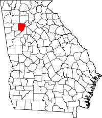 | |
| CDPs | ||
| Unincorporated communities | ||
| Footnotes | ‡This populated place also has portions in an adjacent county or counties | |