Fair Bluff, North Carolina
The town of Fair Bluff was destroyed by Hurricane Matthew in October 2016. The Lumber River rose to a record crest and flooded the businesses and homes. All of the busineses are still closed and more than half of the residents in this town of 917 people were evacuated. As of now it seems that the town will not come back.
| Fair Bluff, North Carolina | |
|---|---|
| Town | |
|
Downtown Fair Bluff | |
 Fair Bluff Location within the state of North Carolina | |
| Coordinates: 34°18′40″N 79°1′57″W / 34.31111°N 79.03250°WCoordinates: 34°18′40″N 79°1′57″W / 34.31111°N 79.03250°W | |
| Country | United States |
| State | North Carolina |
| County | Columbus |
| Government | |
| • Mayor | Billy Hammond |
| Area | |
| • Total | 2.2 sq mi (5.6 km2) |
| • Land | 2.2 sq mi (5.6 km2) |
| • Water | 0.0 sq mi (0.0 km2) |
| Elevation | 66 ft (20 m) |
| Population (2010) | |
| • Total | 951 |
| • Density | 547.4/sq mi (211.4/km2) |
| Time zone | Eastern (EST) (UTC-5) |
| • Summer (DST) | EDT (UTC-4) |
| ZIP code | 28439 |
| Area code(s) | 910 |
| FIPS code | 37-22240[1] |
| GNIS feature ID | 1020187[2] |
| Website | Official Fair Bluff, NC website |

Fair Bluff is a town in Columbus County, North Carolina, United States. The population was 951 at the 2010 census.
History
The Powell House was listed on the National Register of Historic Places in 1978.[3]
Geography
Fair Bluff is located at 34°18′40″N 79°1′57″W / 34.31111°N 79.03250°W (34.311212, -79.032387),[4] along the banks of the Lumber River. It is one of the oldest towns in Columbus County, appearing on maps from the early 19th century, and was once a center of timber production.
According to the United States Census Bureau, the town has a total area of 2.2 square miles (5.7 km2), all of it land.
Demographics
| Historical population | |||
|---|---|---|---|
| Census | Pop. | %± | |
| 1880 | 218 | — | |
| 1890 | 243 | 11.5% | |
| 1900 | 328 | 35.0% | |
| 1910 | 441 | 34.5% | |
| 1920 | 397 | −10.0% | |
| 1930 | 806 | 103.0% | |
| 1940 | 970 | 20.3% | |
| 1950 | 1,056 | 8.9% | |
| 1960 | 1,030 | −2.5% | |
| 1970 | 1,039 | 0.9% | |
| 1980 | 1,095 | 5.4% | |
| 1990 | 1,068 | −2.5% | |
| 2000 | 1,181 | 10.6% | |
| 2010 | 951 | −19.5% | |
| Est. 2015 | 917 | [5] | −3.6% |
As of the census[1] of 2000, there were 1,181 people, 505 households, and 308 families residing in the town. The population density was 547.4 people per square mile (211.1/km²). There were 588 housing units at an average density of 272.6 per square mile (105.1/km²). The racial makeup of the town was 37.93% White, 59.27% African American, 0.68% Native American, 1.19% from other races, and 0.93% from two or more races. Hispanic or Latino of any race were 1.44% of the population.
There were 505 households out of which 26.7% had children under the age of 18 living with them, 37.2% were married couples living together, 20.8% had a female householder with no husband present, and 39.0% were non-families. 36.0% of all households were made up of individuals and 19.8% had someone living alone who was 65 years of age or older. The average household size was 2.32 and the average family size was 2.98.
In the town the population was spread out with 25.2% under the age of 18, 7.6% from 18 to 24, 24.1% from 25 to 44, 23.6% from 45 to 64, and 19.4% who were 65 years of age or older. The median age was 39 years. For every 100 females there were 77.3 males. For every 100 females age 18 and over, there were 72.5 males.
The median income for a household in the town was $17,008, and the median income for a family was $22,969. Males had a median income of $20,764 versus $16,731 for females. The per capita income for the town was $9,829. About 31.8% of families and 37.1% of the population were below the poverty line, including 50.9% of those under age 18 and 24.3% of those age 65 or over.
References
- 1 2 "American FactFinder". United States Census Bureau. Retrieved 2008-01-31.
- ↑ "US Board on Geographic Names". United States Geological Survey. 2007-10-25. Retrieved 2008-01-31.
- ↑ National Park Service (2010-07-09). "National Register Information System". National Register of Historic Places. National Park Service.
- ↑ "US Gazetteer files: 2010, 2000, and 1990". United States Census Bureau. 2011-02-12. Retrieved 2011-04-23.
- ↑ "Annual Estimates of the Resident Population for Incorporated Places: April 1, 2010 to July 1, 2015". Retrieved July 2, 2016.
- ↑ "Census of Population and Housing". Census.gov. Retrieved June 4, 2015.
Municipalities and communities of Columbus County, North Carolina, United States | ||
|---|---|---|
| City | 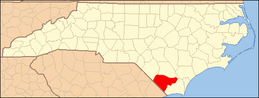 | |
| Towns | ||
| CDPs | ||
| Unincorporated communities | ||