Ethel, Mississippi
| Ethel, Mississippi | |
|---|---|
| Town | |
 Location of Ethel, Mississippi | |
 Ethel, Mississippi Location in the United States | |
| Coordinates: 33°7′25″N 89°27′55″W / 33.12361°N 89.46528°WCoordinates: 33°7′25″N 89°27′55″W / 33.12361°N 89.46528°W | |
| Country | United States |
| State | Mississippi |
| County | Attala |
| Area | |
| • Total | 0.6 sq mi (1.5 km2) |
| • Land | 0.6 sq mi (1.5 km2) |
| • Water | 0.0 sq mi (0.0 km2) |
| Elevation | 423 ft (129 m) |
| Population (2010) | |
| • Total | 418 |
| • Density | 716/sq mi (276.5/km2) |
| Time zone | Central (CST) (UTC-6) |
| • Summer (DST) | CDT (UTC-5) |
| ZIP code | 39067 |
| Area code(s) | 662 |
| FIPS code | 28-23220 |
| GNIS feature ID | 0669815 |
Ethel is a town in Attala County, Mississippi, United States. The population was 418 at the 2010 census.[1]
History
Ethel is named for the daughter of Capt. S. B. McConnico.[2]
Geography
Ethel is located at 33°7′25″N 89°27′55″W / 33.12361°N 89.46528°W (33.123524, -89.465275),[3] along the Yockanookany River.
According to the United States Census Bureau, the town has a total area of 0.58 square miles (1.5 km2), all land.[1]
Demographics
| Historical population | |||
|---|---|---|---|
| Census | Pop. | %± | |
| 1920 | 466 | — | |
| 1930 | 571 | 22.5% | |
| 1940 | 828 | 45.0% | |
| 1950 | 723 | −12.7% | |
| 1960 | 566 | −21.7% | |
| 1970 | 560 | −1.1% | |
| 1980 | 486 | −13.2% | |
| 1990 | 454 | −6.6% | |
| 2000 | 452 | −0.4% | |
| 2010 | 418 | −7.5% | |
| Est. 2015 | 407 | [4] | −2.6% |
As of the census[6] of 2000, there were 452 people, 173 households, and 125 families residing in the town. The population density was 752.3 people per square mile (290.9/km²). There were 208 housing units at an average density of 346.2 per square mile (133.8/km²). The racial makeup of the town was 54.42% White, 44.91% African American, and 0.66% from two or more races. Hispanic or Latino of any race were 0.44% of the population.
There were 173 households out of which 39.9% had children under the age of 18 living with them, 43.4% were married couples living together, 22.5% had a female householder with no husband present, and 27.7% were non-families. 25.4% of all households were made up of individuals and 11.6% had someone living alone who was 65 years of age or older. The average household size was 2.61 and the average family size was 3.07.
In the town the population was spread out with 28.8% under the age of 18, 10.8% from 18 to 24, 26.3% from 25 to 44, 21.7% from 45 to 64, and 12.4% who were 65 years of age or older. The median age was 32 years. For every 100 females there were 98.2 males. For every 100 females age 18 and over, there were 83.0 males.
The median income for a household in the town was $20,114, and the median income for a family was $21,667. Males had a median income of $22,083 versus $13,409 for females. The per capita income for the town was $8,240. About 30.4% of families and 32.8% of the population were below the poverty line, including 48.5% of those under age 18 and 19.3% of those age 65 or over.
Education
The town of Ethel is served by the Attala County School District.
Notable people
- Archie Dees, professional basketball player.
- Myrtis Methvin, the second woman to serve as mayor of a community in the U.S. state of Louisiana.
References
- 1 2 "Geographic Identifiers: 2010 Demographic Profile Data (G001): Ethel town, Mississippi". U.S. Census Bureau, American Factfinder. Retrieved June 19, 2013.
- ↑ Gannett, Henry (1905). The Origin of Certain Place Names in the United States. Govt. Print. Off. p. 121.
- ↑ "US Gazetteer files: 2010, 2000, and 1990". United States Census Bureau. 2011-02-12. Retrieved 2011-04-23.
- ↑ "Annual Estimates of the Resident Population for Incorporated Places: April 1, 2010 to July 1, 2015". Retrieved July 2, 2016.
- ↑ "Census of Population and Housing". Census.gov. Archived from the original on May 11, 2015. Retrieved June 4, 2015.
- ↑ "American FactFinder". United States Census Bureau. Archived from the original on September 11, 2013. Retrieved 2008-01-31.
Municipalities and communities of Attala County, Mississippi, United States | ||
|---|---|---|
| Cities | 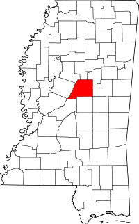 | |
| Towns | ||
| Unincorporated communities | ||
| Ghost town | ||