Enniscoffey (civil parish)
| Enniscoffey Inis Cofaigh | |
|---|---|
| Civil parish | |
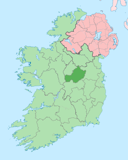
 Enniscoffey Location of Enniscoffey within County Westmeath in the Republic of Ireland | |
| Coordinates: 53°27′39″N 7°16′28″W / 53.46083°N 7.27444°WCoordinates: 53°27′39″N 7°16′28″W / 53.46083°N 7.27444°W | |
| Country |
|
| Province | Leinster |
| County | County Westmeath |
| Irish grid reference | N482458 |
Enniscoffey (Irish: Inis Cofaigh)[1] is a civil parish in County Westmeath, Ireland. It is located about 8.5 kilometres (5 mi) south–south–east of Mullingar.
Enniscoffey is one of 10 civil parishes in the barony of Fartullagh in the Province of Leinster. The civil parish covers 4,454.4 acres (18.026 km2).
Enniscoffey civil parish comprises 9 townlands: Ballintlevy, Bellfield aka Brannockstown, Blackislands aka Windmill, Brannockstown aka Bellfield, Caran aka Enniscoffey, Claremount aka Cummingstown, Cummingstown aka Claremount, Enniscoffey aka Caran, Gaybrook Demesne, Lemongrove aka Rathcam, Mahonstown, Rathcam aka Lemongrove, Simonstown and Windmill aka Blackislands.
The neighbouring civil parishes are Lynn to the north, Killucan (barony of Farbill) to the east, Kilbride to the south and Pass of Kilbride and Moylisker to the west.[2][3]
References
- ↑ Enniscoffey civil parish Placenames Database of Ireland Retrieved on 11 July 2015.
- ↑ Enniscoffey civil parish, Co. Westmeath townlands.ie Retrieved on 11 July 2015.
- ↑ Enniscoffey civil parish, Co. Westmeath The IreAtlas Townland Data Base Retrieved on 11 July 2015.
External links
- Enniscoffey civil parish at the IreAtlas Townland Data Base
- Enniscoffey civil parish at townlands.ie
- Enniscoffey civil parish at the Placenames Database of Ireland