Ellerbe, North Carolina
| Ellerbe, North Carolina | |
|---|---|
| Town | |
 Ellerbe, North Carolina Location within the state of North Carolina | |
| Coordinates: 35°4′20″N 79°45′42″W / 35.07222°N 79.76167°WCoordinates: 35°4′20″N 79°45′42″W / 35.07222°N 79.76167°W | |
| Country | United States |
| State | North Carolina |
| County | Richmond |
| Government | |
| • Mayor | Lee Berry[1] |
| Area | |
| • Total | 1.5 sq mi (3.8 km2) |
| • Land | 1.5 sq mi (3.8 km2) |
| • Water | 0.0 sq mi (0.0 km2) |
| Elevation | 584 ft (178 m) |
| Population (2010) | |
| • Total | 1,054 |
| • Density | 696.9/sq mi (269.1/km2) |
| Time zone | Eastern (EST) (UTC-5) |
| • Summer (DST) | EDT (UTC-4) |
| ZIP code | 28338 |
| Area code(s) | 910 |
| FIPS code | 37-20840[2] |
| GNIS feature ID | 1020134[3] |
Ellerbe is a town in Richmond County, North Carolina, United States. The population was 1,054 at the 2010 census. It is perhaps best known as the one-time home of professional wrestler André the Giant, who operated a nearby ranch/farm in his spare time and retirement. His ashes were scattered on his ranch after his death. Ellerbe is notable for its peaches, fruit stands and peach ice cream shops.
History
The Bostick School, Ellerbe Springs Hotel, Liberty Hill School, and Powell-Brookshire-Parker Farm are listed on the National Register of Historic Places.[4]
Geography
Ellerbe is located at 35°4′20″N 79°45′42″W / 35.07222°N 79.76167°W (35.072129, -79.761796).[5]
According to the United States Census Bureau, the town has a total area of 1.5 square miles (3.9 km2), all of it land.
Demographics
| Historical population | |||
|---|---|---|---|
| Census | Pop. | %± | |
| 1920 | 473 | — | |
| 1930 | 615 | 30.0% | |
| 1940 | 693 | 12.7% | |
| 1950 | 773 | 11.5% | |
| 1960 | 843 | 9.1% | |
| 1970 | 913 | 8.3% | |
| 1980 | 1,129 | 23.7% | |
| 1990 | 1,132 | 0.3% | |
| 2000 | 1,021 | −9.8% | |
| 2010 | 1,054 | 3.2% | |
| Est. 2015 | 1,005 | [6] | −4.6% |
As of the census[2] of 2000, there were 1,021 people, 398 households, and 269 families residing in the town. The population density was 696.9 people per square mile (268.2/km²). There were 447 housing units at an average density of 305.1 per square mile (117.4/km²). The racial makeup of the town was 48.68% White, 46.13% African American, 0.20% Native American, 0.10% Asian, 4.90% from other races. Hispanic or Latino of any race were 8.42% of the population.
There were 398 households out of which 32.7% had children under the age of 18 living with them, 37.9% were married couples living together, 25.4% had a female householder with no husband present, and 32.4% were non-families. 29.6% of all households were made up of individuals and 13.8% had someone living alone who was 65 years of age or older. The average household size was 2.55 and the average family size was 3.16.
In the town the population was spread out with 30.7% under the age of 18, 7.8% from 18 to 24, 26.2% from 25 to 44, 19.8% from 45 to 64, and 15.5% who were 65 years of age or older. The median age was 33 years. For every 100 females there were 82.3 males. For every 100 females age 18 and over, there were 74.8 males.
The median income for a household in the town was $21,118, and the median income for a family was $29,091. Males had a median income of $25,625 versus $16,544 for females. The per capita income for the town was $12,327. About 27.9% of families and 29.5% of the population were below the poverty line, including 42.9% of those under age 18 and 17.5% of those age 65 or over.
Notable people
- André the Giant—Professional wrestler (lived in Ellerbe until his death)
- Benny Parsons—NASCAR driver and television analyst who won the 1973 Winston Cup Championship and the 1975 Daytona 500.
References
- ↑ Town Government Information
- 1 2 "American FactFinder". United States Census Bureau. Retrieved 2008-01-31.
- ↑ "US Board on Geographic Names". United States Geological Survey. 2007-10-25. Retrieved 2008-01-31.
- ↑ National Park Service (2010-07-09). "National Register Information System". National Register of Historic Places. National Park Service.
- ↑ "US Gazetteer files: 2010, 2000, and 1990". United States Census Bureau. 2011-02-12. Retrieved 2011-04-23.
- ↑ "Annual Estimates of the Resident Population for Incorporated Places: April 1, 2010 to July 1, 2015". Retrieved July 2, 2016.
- ↑ "Census of Population and Housing". Census.gov. Retrieved June 4, 2015.
Municipalities and communities of Richmond County, North Carolina, United States | ||
|---|---|---|
| City | 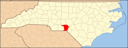 | |
| Towns | ||
| CDPs | ||
| Unincorporated communities | ||