Egan, South Dakota
| Egan, South Dakota | |
|---|---|
| City | |
 Location in Moody County and the state of South Dakota | |
| Coordinates: 43°59′56″N 96°38′58″W / 43.99889°N 96.64944°WCoordinates: 43°59′56″N 96°38′58″W / 43.99889°N 96.64944°W | |
| Country | United States |
| State | South Dakota |
| County | Moody |
| Incorporated | 1881[1] |
| Area[2] | |
| • Total | 1.07 sq mi (2.77 km2) |
| • Land | 1.07 sq mi (2.77 km2) |
| • Water | 0 sq mi (0 km2) |
| Elevation | 1,529 ft (466 m) |
| Population (2010)[3] | |
| • Total | 278 |
| • Estimate (2012[4]) | 275 |
| • Density | 259.8/sq mi (100.3/km2) |
| Time zone | Central (CST) (UTC-6) |
| • Summer (DST) | CDT (UTC-5) |
| ZIP code | 57024 |
| Area code(s) | 605 |
| FIPS code | 46-18460[5] |
| GNIS feature ID | 1254887[6] |
Egan is a city in Moody County, South Dakota, United States. The population was 278 at the 2010 census.
The city has the name of a railroad employee.[7]
Geography
Egan is located at 43°59′56″N 96°38′58″W / 43.99889°N 96.64944°W (43.998971, -96.649434),[8] along the Big Sioux River.[9]
According to the United States Census Bureau, the city has a total area of 1.07 square miles (2.77 km2), all of it land.[2]
Egan has been assigned the ZIP code 57024 and the FIPS place code 18460.
Demographics
| Historical population | |||
|---|---|---|---|
| Census | Pop. | %± | |
| 1880 | 23 | — | |
| 1890 | 399 | 1,634.8% | |
| 1900 | 503 | 26.1% | |
| 1910 | 516 | 2.6% | |
| 1920 | 569 | 10.3% | |
| 1930 | 419 | −26.4% | |
| 1940 | 418 | −0.2% | |
| 1950 | 347 | −17.0% | |
| 1960 | 310 | −10.7% | |
| 1970 | 281 | −9.4% | |
| 1980 | 248 | −11.7% | |
| 1990 | 208 | −16.1% | |
| 2000 | 265 | 27.4% | |
| 2010 | 278 | 4.9% | |
| Est. 2015 | 274 | [10] | −1.4% |
2010 census
As of the census[3] of 2010, there were 278 people, 117 households, and 76 families residing in the city. The population density was 259.8 inhabitants per square mile (100.3/km2). There were 127 housing units at an average density of 118.7 per square mile (45.8/km2). The racial makeup of the city was 86.3% White, 8.6% Native American, 0.7% Asian, 0.4% from other races, and 4.0% from two or more races. Hispanic or Latino of any race were 2.2% of the population.
There were 117 households of which 25.6% had children under the age of 18 living with them, 51.3% were married couples living together, 7.7% had a female householder with no husband present, 6.0% had a male householder with no wife present, and 35.0% were non-families. 30.8% of all households were made up of individuals and 10.3% had someone living alone who was 65 years of age or older. The average household size was 2.38 and the average family size was 2.92.
The median age in the city was 41.6 years. 23.7% of residents were under the age of 18; 5.9% were between the ages of 18 and 24; 24.5% were from 25 to 44; 31% were from 45 to 64; and 15.1% were 65 years of age or older. The gender makeup of the city was 51.8% male and 48.2% female.
2000 census
As of the census[5] of 2000, there were 265 people, 111 households, and 67 families residing in the city. The population density was 380.5 people per square mile (146.2/km²). There were 119 housing units at an average density of 170.9 per square mile (65.6/km²). The racial makeup of the city was 93.96% White, 4.91% Native American, and 1.13% from two or more races.
There were 111 households out of which 34.2% had children under the age of 18 living with them, 47.7% were married couples living together, 7.2% had a female householder with no husband present, and 39.6% were non-families. 34.2% of all households were made up of individuals and 13.5% had someone living alone who was 65 years of age or older. The average household size was 2.39 and the average family size was 3.15.
In the city the population was spread out with 26.8% under the age of 18, 7.2% from 18 to 24, 28.7% from 25 to 44, 24.9% from 45 to 64, and 12.5% who were 65 years of age or older. The median age was 36 years. For every 100 females there were 115.4 males. For every 100 females age 18 and over, there were 110.9 males.
The median income for a household in the city was $26,979, and the median income for a family was $30,000. Males had a median income of $25,357 versus $17,188 for females. The per capita income for the city was $13,392. About 1.4% of families and 5.7% of the population were below the poverty line, including 2.2% of those under the age of eighteen and 20.0% of those sixty five or over.
References
- ↑ "SD Towns" (PDF). South Dakota State Historical Society. Retrieved 2010-02-11.
- 1 2 "US Gazetteer files 2010". United States Census Bureau. Retrieved 2012-06-21.
- 1 2 "American FactFinder". United States Census Bureau. Retrieved 2012-06-21.
- ↑ "Population Estimates". United States Census Bureau. Retrieved 2013-05-29.
- 1 2 "American FactFinder". United States Census Bureau. Retrieved 2008-01-31.
- ↑ "US Board on Geographic Names". United States Geological Survey. 2007-10-25. Retrieved 2008-01-31.
- ↑ Federal Writers' Project (1940). South Dakota place-names, v.1-3. University of South Dakota. p. 36.
- ↑ "US Gazetteer files: 2010, 2000, and 1990". United States Census Bureau. 2011-02-12. Retrieved 2011-04-23.
- ↑ DeLorme (2001). South Dakota Atlas & Gazetteer. Yarmouth, Maine: DeLorme. ISBN 0-89933-330-3
- ↑ "Annual Estimates of the Resident Population for Incorporated Places: April 1, 2010 to July 1, 2015". Retrieved July 2, 2016.
- ↑ "Census of Population and Housing". Census.gov. Retrieved June 4, 2015.
Municipalities and communities of Moody County, South Dakota, United States | ||
|---|---|---|
| Cities | 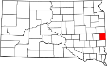 | |
| Towns | ||
| Indian reservations | ||