East End, Saint Thomas, U.S. Virgin Islands
| East End, Saint Thomas | |
|---|---|
| Subdistrict | |
|
The ferry port in Red Hook, USVI. | |
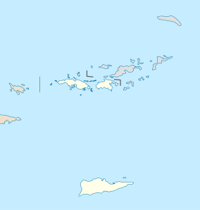 East End, Saint Thomas Location within the United States Virgin Islands | |
| Coordinates: 18°19′N 64°51′W / 18.317°N 64.850°WCoordinates: 18°19′N 64°51′W / 18.317°N 64.850°W | |
| Country |
|
| Territory |
|
| Population (2010) | |
| • Total | 6,658 |

East End is an administrative subdistrict of the island of Saint Thomas in the United States Virgin Islands.[1] The largest community here is Red Hook, while smaller communities include Benner, Nazareth, Nadir, Frydendal, and Smith Bay. Some of the offshore islands here include Great Saint James Island, Little Saint James Island, Bovoni Cay, Patricia Cay, Cas Cay, Rotto Cay, Thatch Cay, Shark Island, and Dog Island. The East End subdistrict received 731 new residents between the 2000 U.S. Census and the 2010 U.S. Census,[2] and has a 2010 population of 6,658. The East End region offers a more secluded character and less population density than subdistricts as Charlotte Amalie, Southside, and the Tutu subdistricts. This subdistrict is home to numerous of the islands’ largest resorts, in addition to many shopping areas and entertainment venues, as well as the Coral World Marine Park & Underwater Observatory in Coki Point, which is the most popular tourist attraction on Saint Thomas.[3] East End is located about 7.4 miles east of the territorial capital of Charlotte Amalie, which is an approximately thirty-minute drive on the windy, small and narrow Saint Thomas roads. There are buses and taxis leaving from the East End. A typical fare for a taxi drive to the capital costs $20.[4] The hotels on Saint Thomas are evenly divided between the two subdistricts of Charlotte Amalie, and the more expensive resort-style hotels by their own beachside in East End. The East End resorts are therefore generally more expensive than those found elsewhere on the island.[5] Some of the famous beaches found here are Lindquist- and Sapphire Beaches, while others include Pineapple Beach (Renaissance Beach) and Vessup Beach amongst others.
The twenty-minute ferry-ride to Cruz Bay on the island of Saint John, which is a part of the Virgin Islands National Park, leaves from the town of Red Hook.[6] Other ferry destinations from Red Hook includes the islands of Tortola and Virgin Gorda in the British Virgin Islands, as well as Saint Croix.[7]
Places of interest
- The 4 and a half acre Coral World Marine Park & Underwater Observatory at Coki Point is the most popular tourist attraction of Saint Thomas, and takes you to coral reefs fifteen feet under the ocean surface. There are wild iguanas and other native wildlife, in addition to a sea turtle pool, shark tank, marine lagoon and gardens.[8]
- American Yacht Harbor: Waterfront shopping area with bars and restaurants in Red Hook.[9] The Red Hook Plaza and Red Hook Shopping Mall are additional areas with retail stores for shopping.
- The Color of Joy: An art gallery in Red Hook, VI offering local made arts and crafts.[10]
- Marina Market: an outdoor market across from the Red Hook ferry terminal that serves fresh fish, meat and other fresh foods.[11]
References
- ↑ Bonsu, Ammie A. (2008). American Indian/Alaska Native/Native Hawaiian Resource Kit: Fetal Alcohol Spectrum Disorders. DIANE Publishing. Page 1. ISBN 9781428987937.
- ↑ http://virginislandsdailynews.com/news/census-shows-v-i-s-population-down-2-1.1193325
- ↑ Peffer, Randall (2001). Virgin Islands. Lonely Planet. Page 112. ISBN 9780864427359.
- ↑ Darwin, Porter and Danforth Prince (2006). Caribbean For Dummies. John Wiley & Sons. Page 445. ISBN 9780471962519.
- ↑ Darwin, Porter and Danforth Prince (2005). Frommer's Virgin Islands. John Wiley & Sons. Page 77. ISBN 9780471762768.
- ↑ http://www.dallasnews.com/lifestyles/travel/international/20150523-dodging-cruise-ships-in-the-caribbean.ece
- ↑ Sullivan, Mark (2007). U.S. and British Virgin Islands 2008. Fodor's Travel Publications, Inc. Page 214. ISBN 9781400018178.
- ↑ Peffer, Randall (2001). Virgin Islands. Lonely Planet. Page 112. ISBN 9780864427359.
- ↑ Sullivan, Mark (2007). U.S. and British Virgin Islands 2008. Fodor's Travel Publications, Inc. Page 49. ISBN 9781400018178.
- ↑ Sullivan, Mark (2007). U.S. and British Virgin Islands 2008. Fodor's Travel Publications, Inc. Pages 49-50. ISBN 9781400018178.
- ↑ Wechter, Eric B. (2011). Fodor's Caribbean 2012. Fodor's Travel Publications. Page 1086. ISBN 9780679009269.