Eagle River (Wisconsin)
| Eagle River | |
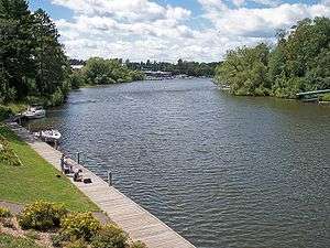 The Eagle River in the city of Eagle River in 2006 | |
| Country | United States |
|---|---|
| State | Wisconsin |
| Source | |
| - location | Forest County |
| - elevation | 1,664 ft (507 m) [1] |
| - coordinates | 45°41′31″N 89°01′16″W / 45.69194°N 89.02111°W [2] |
| Mouth | Watersmeet Lake on the Wisconsin River |
| - location | Lincoln |
| - elevation | 1,614 ft (492 m) [3] |
| - coordinates | 45°54′34″N 89°17′22″W / 45.90944°N 89.28944°WCoordinates: 45°54′34″N 89°17′22″W / 45.90944°N 89.28944°W [4] |
| Basin | 181.7 sq mi (470.6 km2) [5] |
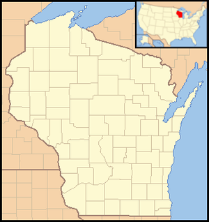 Location of the mouth of the Eagle River | |
The Eagle River is a tributary of the Wisconsin River in northeastern Wisconsin in the United States. Via the Wisconsin River, it is part of the watershed of the Mississippi River, draining an area of 181.7 square miles (470.6 km²) in the state's Northern Highland region. The river flows for much of its length through a series of lakes; the network of 28 lakes in the Eagle River's watershed is locally claimed to be the "world's largest chain of inland freshwater lakes."[6]
The Eagle River rises in extreme western Forest County in the Chequamegon-Nicolet National Forest, and flows generally northwestwardly in northeastern Oneida County and southeastern Vilas County, passing through the Oneida County town of Three Lakes and the Vilas County towns of Washington and Lincoln, and the city of Eagle River. Along its course it flows through Big, Dog, Deer, Big Stone, Laurel, Medicine, Little Fork, Island, Round, Planting Ground, and Long Lakes in Oneida County; and Cranberry, Catfish, Voyageur, Eagle, Otter, Lynx, Duck, and Yellow Birch Lakes in Vilas County. It flows into Watersmeet Lake on the Wisconsin River in the town of Lincoln, approximately two miles (3 km) west of the city of Eagle River.[7][8]
See also
References
- ↑ Google Earth elevation for GNIS source coordinates
- ↑ Geographic Names Information System. "Geographic Names Information System entry for upper course of Eagle River (Feature ID #1579168)". Retrieved 2007-05-19.
- ↑ Google Earth elevation for GNIS mouth coordinates
- ↑ Geographic Names Information System. "Geographic Names Information System entry for lower course of Eagle River (Feature ID #1579169)". Retrieved 2007-05-19.
- ↑ "Watersheds of Wisconsin". Wisconsin Department of Natural Resources. Archived from the original on 2007-05-05. Retrieved 2007-05-19.
- ↑ "Eagle River On-Line!: Area Attractions". Archived from the original on 2006-12-06. Retrieved 2007-05-19.
- ↑ Google Earth
- ↑ Wisconsin Atlas & Gazetteer. Yarmouth, Me.: DeLorme. 1992. p. 98. ISBN 0-89933-247-1.