Ečka
| Ečka Ечка | |
|---|---|
| Village | |
|
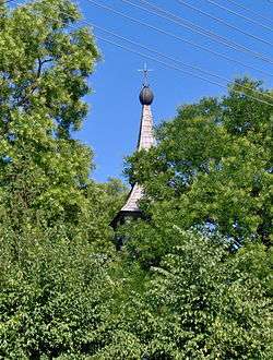
Serbian Orthodox Church (1711) | |
 Ečka Location of Ečka within Serbia | |
| Coordinates: 45°19′04″N 20°26′20″E / 45.31778°N 20.43889°ECoordinates: 45°19′04″N 20°26′20″E / 45.31778°N 20.43889°E | |
| Country | Serbia |
| Province | Vojvodina |
| District | Central Banat |
| Elevation | 71 m (233 ft) |
| Population (2002) | |
| • Ečka | 4,513 |
| Time zone | CET (UTC+1) |
| • Summer (DST) | CEST (UTC+2) |
| Postal code | 23203 |
| Area code(s) | +381(0)23 |
| Car plates | ZR |
Ečka (Serbian Cyrillic: Ечка, Serbian pronunciation: [êtʃka]) is a village located in the Zrenjanin municipality, in the Central Banat District of Serbia. It is situated in the autonomous province of Vojvodina.
Name and history
In Serbian, the village is known as Ečka (Ечка), in Romanian as Ecica or Ecica Română, in German as Deutsch-Etschka, and in Hungarian as Écska (until 1899: Német-Écska).
The village was merged with former settlement known as Mala Ečka (Мала Ечка) in Serbian, Alt Etschka in German, and Román-Écska or Olahécska in Hungarian.
Ethnic groups (2002 census)
The village has a Serb ethnic majority and its population numbering 4,513 people (2002 census).
- Serbs = 2,483 (55.02%)
- Romanians = 1,325 (29.36%)
- Hungarians = 196 (4.34%)
- Yugoslavs = 123 (2.73%)
- Romani = 72 (1.60%)
Historical population
- 1900: 4,892
- 1931: 5,207
- 1948: 3,934
- 1953: 4,188
- 1961: 4,323
- 1971: 4,621
- 1981: 5,293
- 1991: 5,172
Trivia
- Franz Liszt played piano at Kaštel castle as a nine-year-old boy.
See also
References
- Slobodan Ćurčić, Broj stanovnika Vojvodine, Novi Sad, 1996.
External links
Additional pictures
 The Romanian Orthodox Church
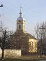
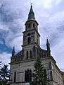 The Catholic Church of St. John Baptist, built in 1864 as the third church
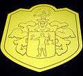 Blazon of counts Lazar in Ečka
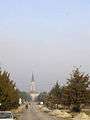 Main street and the Catholic Church
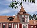 The Kaštel castle, built in 1820, by count Lukács
 Tower in Ečka
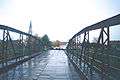 Old bridge over Begej 1995, built 1889, renovated 1894 and later 2005
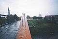 Old bridge over Begej 1995 with sheep and church in background
| Wikimedia Commons has media related to Ečka. |
This article is issued from Wikipedia - version of the 6/8/2016. The text is available under the Creative Commons Attribution/Share Alike but additional terms may apply for the media files.