Dry Ridge, Kentucky
| Dry Ridge, Kentucky | |
|---|---|
| City | |
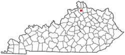 Location of Dry Ridge, Kentucky | |
| Coordinates: 38°40′56″N 84°35′47″W / 38.68222°N 84.59639°WCoordinates: 38°40′56″N 84°35′47″W / 38.68222°N 84.59639°W | |
| Country | United States |
| State | Kentucky |
| County | Grant |
| Area | |
| • Total | 4.7 sq mi (12.1 km2) |
| • Land | 4.7 sq mi (12.1 km2) |
| • Water | 0.0 sq mi (0.1 km2) |
| Elevation | 951 ft (290 m) |
| Population (2000) | |
| • Total | 1,995 |
| • Density | 428.2/sq mi (165.3/km2) |
| Time zone | Eastern (EST) (UTC-5) |
| • Summer (DST) | EDT (UTC-4) |
| ZIP code | 41035 |
| Area code(s) | 859 |
| FIPS code | 21-22582 |
| GNIS feature ID | 0491228 |
Dry Ridge is a home rule-class city[1] in Grant County, Kentucky, in the United States. The population was 1,995 at the 2000 census.
Geography
Dry Ridge is located at 38°40′56″N 84°35′47″W / 38.68222°N 84.59639°W (38.682242, -84.596370).[2]
According to the United States Census Bureau, the city has a total area of 4.7 square miles (12 km2), of which 4.7 square miles (12 km2) is land and 0.04 square miles (0.10 km2) (0.43%) is water.
History
The community now known as Dry Ridge was settled about 1792 as Campbell's Station near a spring said to have medicinal qualities.[3]
A post office called Dry Ridge was established in 1815 at an inn. Dry Ridge takes its name from a ridge surrounded by inns where travelers stopped for water before proceeding.[4]
During the early part of the 20th century, Dry Ridge was the home of Kentucky Carlsbad Mineral Water bottling Company, and home of the Carlsbad Hotel completed in 1911. People came to Dry Ridge from all over the eastern USA to take the Mineral water of what was known as the Kentucky Carlsbad Springs, although it was not a spring, but a well. The hotel was destroyed by fire on Feb. 25,1927.
Demographics
| Historical population | |||
|---|---|---|---|
| Census | Pop. | %± | |
| 1910 | 143 | — | |
| 1920 | 129 | −9.8% | |
| 1930 | 97 | −24.8% | |
| 1940 | 257 | 164.9% | |
| 1950 | 640 | 149.0% | |
| 1960 | 802 | 25.3% | |
| 1970 | 1,100 | 37.2% | |
| 1980 | 1,250 | 13.6% | |
| 1990 | 1,601 | 28.1% | |
| 2000 | 1,995 | 24.6% | |
| 2010 | 2,191 | 9.8% | |
| Est. 2015 | 2,205 | [5] | 0.6% |
As of the census[7] of 2000, there were 1,995 people, 771 households, and 535 families residing in the city. The population density was 428.2 people per square mile (165.3/km²). There were 861 housing units at an average density of 184.8 per square mile (71.3/km²). The racial makeup of the city was 97.19% White, 0.55% African American, 0.10% Native American, 1.30% Asian, 0.20% from other races, and 0.65% from two or more races. Hispanic or Latino of any race were 0.70% of the population.
There were 771 households out of which 39.7% had children under the age of 18 living with them, 46.4% were married couples living together, 18.2% had a female householder with no husband present, and 30.5% were non-families. 26.6% of all households were made up of individuals and 12.1% had someone living alone who was 65 years of age or older. The average household size was 2.51 and the average family size was 3.00.
In the city the population was spread out with 28.6% under the age of 18, 11.1% from 18 to 24, 29.3% from 25 to 44, 18.9% from 45 to 64, and 12.1% who were 65 years of age or older. The median age was 31 years. For every 100 females there were 87.3 males. For every 100 females age 18 and over, there were 83.0 males.
The median income for a household in the city was $30,647, and the median income for a family was $32,202. Males had a median income of $38,000 versus $23,000 for females. The per capita income for the city was $14,568. About 21.0% of families and 23.5% of the population were below the poverty line, including 39.0% of those under age 18 and 14.4% of those age 65 or over.
Education
Grant County students are served by Grant County Middle School and Grant County High School, both located in Dry Ridge.
Notable people
- Lulu Vere Childers, African-American music educator
- Skeeter Davis- American Country-Pop, or Nashville sound, singer best known for the song, titled The End of the World. Born Mary Frances Penick, December 30, 1931-Sept 19, 2004
Climate
The climate in this area is characterized by hot, humid summers and generally mild to cool winters. According to the Köppen Climate Classification system, Dry Ridge has a humid subtropical climate, abbreviated "Cfa" on climate maps.[8]
References
- ↑ "Summary and Reference Guide to House Bill 331 City Classification Reform" (PDF). Kentucky League of Cities. Retrieved December 30, 2014.
- ↑ "US Gazetteer files: 2010, 2000, and 1990". United States Census Bureau. 2011-02-12. Retrieved 2011-04-23.
- ↑ Federal Writers' Project (1996). The WPA Guide to Kentucky. University Press of Kentucky. p. 264. Retrieved 24 November 2013.
- ↑ Rennick, Robert M. (1987). Kentucky Place Names. University Press of Kentucky. p. 85. Retrieved 2013-04-28.
- ↑ "Annual Estimates of the Resident Population for Incorporated Places: April 1, 2010 to July 1, 2015". Retrieved July 2, 2016.
- ↑ "Census of Population and Housing". Census.gov. Retrieved June 4, 2015.
- ↑ "American FactFinder". United States Census Bureau. Retrieved 2008-01-31.
- ↑ Climate Summary for Dry Ridge, Kentucky
External links
Municipalities and communities of Grant County, Kentucky, United States | ||
|---|---|---|
| Cities | 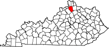 | |
| Unincorporated communities | ||
| Footnotes | ‡This populated place also has portions in an adjacent county or counties | |