Dowagiac River
| Dowagiac River | |
| stream | |
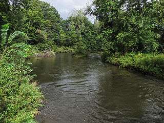 The Dowagiac River in Pokagon Township | |
| Country | United States |
|---|---|
| State | Michigan |
| Tributaries | |
| - left | Dowagiac Creek, Peavine Creek (Dowagiac River), Pokagon Creek, McKinzie Creek |
| - right | Osborn Creek, Silver Creek |
| Cities | Dowagiac, Niles |
| Source | Confluence of Dowagiac Drain and Lake of the Woods Drain |
| - location | Berrien County, Michigan |
| - elevation | 745 ft (227 m) [1] |
| - coordinates | 42°04′39″N 086°01′23″W / 42.07750°N 86.02306°W [2] |
| Mouth | St. Joseph River |
| - elevation | 636 ft (194 m) [2] |
| - coordinates | 41°50′43″N 086°15′58″W / 41.84528°N 86.26611°WCoordinates: 41°50′43″N 086°15′58″W / 41.84528°N 86.26611°W [2] |
The Dowagiac River is a southwesterly flowing 30.9-mile-long (49.7 km)[3] stream in the Lower Peninsula of the U.S. state of Michigan. It is tributary to the St. Joseph River which flows, in turn, into eastern Lake Michigan.
Habitat and Ecology
The Dowagiac River is unusual in southern Michigan, being similar in temperature and flow to northern trout streams such as the Au Sable River. High groundwater contributions along much of the Dowagiac River’s length provide cold temperatures and steady base flow throughout the summer season.[4] In July river temperatures range in the middle 60's which is ideal for non-native brown trout (Salmo trutta). There are three dams in the watershed: Lower Mill Pond Dam on Dowagiac Creek upstream from the city of Dowagiac, Barron Lake Road Dam on McKinzie Creek, and Pucker Street Dam - the only dam on the Dowagiac River mainstem and located 3 miles (4.8 km) upstream from the confluence with the St. Joseph River.
The Pucker Street Dam is an impassable barrier to the upstream migration of non-native steelhead trout (Oncorhynchus mykiss), Chinook salmon (Oncorhynchus tshawytscha), coho salmon (Oncorhychus kisutch), brown trout, and native smallmouth bass (Micropterus dolomieu), white suckers (Catostomus commersonii)), and walleye (Sander vitreus) to more than 159 miles (256 km) of Dowagiac River and its tributaries. The dam was ordered repaired or removed by the Michigan Department of Environmental Quality (MDEQ) for safety reasons in 2013.[5] In fact, the St. Joseph River Watershed Fish Migration Barrier Inventory in 2011 ranked the Pucker Street Dam as the highest priority dam for removal in the entire St. Joseph River watershed for conservation and restoration purposes.[6]
Watershed and Course
The Dowagiac River watershed drains 287 square miles (740 km2). The Dowagiac River mainstem is formed by the confluence of the Dowagiac Drain and the Lake of the Woods Drain[7] near the southern edge of Hamilton Township, becoming the Dowagiac River before entering Wayne Township in Cass County.[2]
The headwaters begin as the Dowagiac Drain which rises a few miles east of Decatur in central Decatur Township in southern Van Buren County, Michigan.[1] Flowing west and south, it is joined first by Red Run[8] and then by Lake of the Woods Drain to form the Dowagiac River. The river is joined from the north first by Osborn Drain[9] and then Silver Creek.[10] North of the city of Dowagiac, the river passes through the Dowagiac Swamp.[11] Just west of Dowagiac, the river is joined by its principal tributary, Dowagiac Creek, at 41°58′55″N 86°10′16″W / 41.98194°N 86.17111°W.[12] Dowagiac Creek rises in Volinia Township at 42°02′25″N 85°54′46″W / 42.04028°N 85.91278°W from the outflow of a series of lakes including Saddlebag Lake, Fish Lake, Finch Lake and Bunker Lake. The creek flows southwest into LaGrange Lake in LaGrange Township. From the outflow of the lake, it continues west and north through the city of Dowagiac before joining the Dowagiac River. As the river continues south-southwest it is joined by Peavine Creek,[13] Pokagon Creek,[14] and McKinzie Creek.[15] It enters Berrien County, where it flows into the St. Joseph River just north of Niles at 41°50′43″N 86°15′58″W / 41.84528°N 86.26611°W.[2]
The watershed includes all or portions of the following townships:
- In the southern tier of Van Buren County
- In Cass County
- Marcellus Township
- Volinia Township
- Wayne Township
- Silver Creek Township
- Penn Township (the western edge around section 7)
- Lagrange Township
- Pokagon Township
- Howard Township
- In Berrien County
Tributaries of the Dowagiac River from the mouth
- McKinzie Creek
- Pokagon Creek
- Peavine Creek
- Dowagiac Creek
- LaGrange Lake
- Kelsey Lake
- Bunker Lake
- Finch Lake
- Fish Lake
- Saddlebag Lake
- Silver Creek
- Osburn Drain
- Lake of the Woods Drain
- Red Run
- Dowagiac Drain
See also
References
- 1 2 "Dowagiac Drain". Geographic Names Information System. United States Geological Survey.
- 1 2 3 4 5 "Dowagiac River". Geographic Names Information System. United States Geological Survey.
- ↑ U.S. Geological Survey. National Hydrography Dataset high-resolution flowline data. The National Map, accessed May 19, 2011
- ↑ Dowagiac River Watershed Management Plan (PDF) (Report). Cassopolis, Michigan: Cass County Conservation District. October 2002. Retrieved June 11, 2016.
- ↑ "Pucker Street Dam". Southwestern Michigan Planning Commission. Retrieved June 11, 2016.
- ↑ St. Joseph River Watershed Fish Migration Barrier Inventory (PDF) (Report). Potawatomi Resource Conservation and Development Council. 2011. Retrieved June 11, 2016.
- ↑ U.S. Geological Survey Geographic Names Information System: Lake of the Woods Drain
- ↑ U.S. Geological Survey Geographic Names Information System: Red Run
- ↑ U.S. Geological Survey Geographic Names Information System: Osborn Drain
- ↑ U.S. Geological Survey Geographic Names Information System: Silver Creek
- ↑ U.S. Geological Survey Geographic Names Information System: Dowagiac Swamp
- ↑ U.S. Geological Survey Geographic Names Information System: Dowagiac Creek
- ↑ U.S. Geological Survey Geographic Names Information System: Peavine Creek
- ↑ U.S. Geological Survey Geographic Names Information System: Pokagon Creek
- ↑ U.S. Geological Survey Geographic Names Information System: McKinzie Creek