Dooling, Georgia
| Dooling, Georgia | |
|---|---|
| Town | |
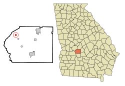 Location in Dooly County and the state of Georgia | |
| Coordinates: 32°13′48″N 83°55′42″W / 32.23000°N 83.92833°WCoordinates: 32°13′48″N 83°55′42″W / 32.23000°N 83.92833°W | |
| Country | United States |
| State | Georgia |
| County | Dooly |
| Area | |
| • Total | 0.5 sq mi (1.2 km2) |
| • Land | 0.5 sq mi (1.2 km2) |
| • Water | 0 sq mi (0 km2) |
| Elevation | 384 ft (117 m) |
| Population (2010) | |
| • Total | 154 |
| • Density | 333/sq mi (128.5/km2) |
| Time zone | Eastern (EST) (UTC-5) |
| • Summer (DST) | EDT (UTC-4) |
| FIPS code | 13-23480[1] |
| GNIS feature ID | 0331572[2] |
Dooling is a town in Dooly County, Georgia, United States. The population was 154 at the 2010 census.[3]
Geography
Dooling is located in northwestern Dooly County at 32°13′48″N 83°55′42″W / 32.23000°N 83.92833°W (32.229962, -83.928311).[4] It is 9 miles (14 km) southeast of Montezuma, the nearest city, 12 miles (19 km) west of Unadilla, and 14 miles (23 km) northwest of Vienna, the Dooly County seat.
According to the United States Census Bureau, the town of Dooling has a total area of 0.46 square miles (1.2 km2), all of it land.[3]
Demographics
| Historical population | |||
|---|---|---|---|
| Census | Pop. | %± | |
| 1990 | 28 | — | |
| 2000 | 163 | 482.1% | |
| 2010 | 154 | −5.5% | |
| Est. 2015 | 148 | [5] | −3.9% |
As of the census[1] of 2000, there were 163 people, 54 households, and 38 families residing in the town. The population density was 352.4 people per square mile (136.8/km²). There were 64 housing units at an average density of 138.4 per square mile (53.7/km²). The racial makeup of the town was 28.83% White, 66.87% African American, 3.68% from other races, and 0.61% from two or more races. Hispanic or Latino of any race were 4.29% of the population.
There were 54 households out of which 40.7% had children under the age of 18 living with them, 40.7% were married couples living together, 20.4% had a female householder with no husband present, and 29.6% were non-families. 27.8% of all households were made up of individuals and 11.1% had someone living alone who was 65 years of age or older. The average household size was 3.02 and the average family size was 3.74.
In the town the population was spread out with 39.3% under the age of 18, 9.8% from 18 to 24, 25.8% from 25 to 44, 19.0% from 45 to 64, and 6.1% who were 65 years of age or older. The median age was 27 years. For every 100 females there were 89.5 males. For every 100 females age 18 and over, there were 76.8 males.
The median income for a household in the town was $20,469, and the median income for a family was $21,719. Males had a median income of $21,875 versus $16,771 for females. The per capita income for the town was $8,976. About 27.0% of families and 33.7% of the population were below the poverty line, including 38.0% of those under the age of 18 and 100.0% of those 65 or over.
References
- 1 2 "American FactFinder". United States Census Bureau. Retrieved 2008-01-31.
- ↑ "US Board on Geographic Names". United States Geological Survey. 2007-10-25. Retrieved 2008-01-31.
- 1 2 "Geographic Identifiers: 2010 Demographic Profile Data (G001): Dooling town, Georgia". U.S. Census Bureau, American Factfinder. Retrieved October 23, 2015.
- ↑ "US Gazetteer files: 2010, 2000, and 1990". United States Census Bureau. 2011-02-12. Retrieved 2011-04-23.
- ↑ "Annual Estimates of the Resident Population for Incorporated Places: April 1, 2010 to July 1, 2015". Retrieved July 2, 2016.
- ↑ "Census of Population and Housing". Census.gov. Retrieved June 4, 2015.
Municipalities and communities of Dooly County, Georgia, United States | ||
|---|---|---|
| Cities | 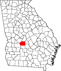 | |
| Towns | ||