Don Carlos, Bukidnon
| Don Carlos | |
|---|---|
| Municipality | |
| Nickname(s): Little Vigan of Mindanao | |
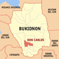 Map of Philippines with Don Carlos highlighted | |
.svg.png) Don Carlos Location within the Philippines | |
| Coordinates: 7°41′N 125°00′E / 7.68°N 125°ECoordinates: 7°41′N 125°00′E / 7.68°N 125°E | |
| Country | Philippines |
| Region | Northern Mindanao (Region X) |
| Province | Bukidnon |
| District | 3rd district of Bukidnon |
| Founded | June 18, 1966 |
| Barangays | 29 |
| Government[1] | |
| • Mayor | Felix S. Manzano |
| Area[2] | |
| • Total | 213.72 km2 (82.52 sq mi) |
| Population (2015 census)[3] | |
| • Total | 66,959 |
| • Density | 310/km2 (810/sq mi) |
| Time zone | PST (UTC+8) |
| ZIP code | 8712 |
| IDD : area code | +63 (0)88 |
| Income class | 1st |
| Website |
www |
Don Carlos is a first class municipality in the province of Bukidnon, Philippines. According to the 2015 census, it has a population of 66,959 people.[3]
Geography
Don Carlos is situated in the southern part of the province. It is located 61 kilometres (38 mi) south of the City of Malaybalay, 161 kilometres (100 mi) from Cagayan de Oro City, 180 kilometres (110 mi) from the Cotabato City, 160 kilometres (99 mi) from Davao City, and 1,575 kilometres (979 mi) from south of Manila. The town is bounded by the municipalities of Maramag in the north, Kitaotao in the south, Quezon in the east, Pangantucan and Kadingilan in the west. The town is known for its famous landmark, Lake Pinamaloy.
Soil type
There are 3 types of soil that cover the municipality. These soils, which are generally clay, are Kidapawan Clay, Adtuyon Clay and Macolod Clay.
Topography
The terrain of the municipality of Don Carlos is generally flat except the mountain range on the eastern part of the municipality. The highest elevation is 700 metres (2,300 ft) above sea level and the lowest elevation is 300 metres (980 ft) below sea level.
Slope
Flat to gently sloping areas ranging in slope from 0-8% is the most prevalent terrain in the municipality, which covers 198.96 km² (93.09%) of the total land area of the municipality. Moderately sloping to undulating lands ranging in slope from 8-18% occupies approximately 7.65 km². Rolling to moderately steep lands, sloping from 18-30%, covers 4.19 km² of land. Areas with slope above 30% covers 2920.09 km².
Climate
The municipality's climate falls under the third type. Climate under this type experiences rainy season in the months of April to September. The latest data from the DA shows that the months July to November registered the highest average annual rainfall that reached its peak in the month of July at 642 millimetres (25.3 in).
Barangays
Don Carlos is politically subdivided into 29 barangays.[2]
- Calao Calao
- Cabadiangan
- Bocboc
- Buyot
- Don Carlos Norte
- Embayao
- Kalubihon
- Kasigkot
- Kawilihan
- Kiara
- Kibatang
- Mahayahay
- Manlamonay
- Maraymaray
- Mauswagon
- Minsilagan
- New Nongnongan (Masimag)
- New Visayas
- Old Nongnongan
- Pinamaloy
- Don Carlos Sur (Pob.)
- Pualas
- San Antonio East
- San Antonio West
- San Francisco
- San Nicolas (Banban)
- San Roque
- Sinangguyan
- Bismartz
History
The first people who settled this place before was a certain Datu Andarol, his wife Ba-e Mahanu, and their son Datu ‘Mangginayun’. Datu Andarol was a ruler and the leader of the Manobo tribe settling the village of Minduso, which was the old name of Don Carlos. The place was covered with forests and access by outlanders was prohibited unless permitted by the datu. Minduso was the home of Datu Andarol's descendants. Upon the arrival of the Spaniards, the datu was succeeded by his son, Datu Mangginayun. With their contacts with the Spaniards and missionaries, Spanish naming conventions and Christianity was introduced, and Datu Mangginayun adopted the name "Antonio", hence his full name was now Datu ‘Mangginayun’ Antonio Sagandilan Sr. He was married to Ba-e Antonina Manlayuan. His leadership reflects that of his father, as he implemented tribal laws and settled criminal offenses, particularly murder. As the leader of his tribal community, he also presided wedding ceremonies and settled dowries.
The first popular Spanish stranger who approached Datu ‘Mangginayun’ Antonio Sr. was Tomás Sandoval. He requested a parcel of land that he intend to borrow and to till, the datu conceded to his request. As part of the agreement, Tomás was to give the part of his harvest as a share to the datu. Several years later, another Spaniard by the name of "Elizalde" came and, like Tomás, requested the datu for lands to establish ranches. The lands lent by the datu to Elizalde were: lands in Pantil-pantilan, Migtutugop, the lands along the Mulita river, the today-famous Squash Mountain, and the Tugas Falls. As the agricultural ventures of these two Spaniards flourished, Cebuanos (referred by the Lumads, or natives, as "Dumagats") and other Spaniards who came from Cagayan de Misamis and other coastal towns of Misamis were encouraged to settle and populate the area that comprises the present-day Don Carlos.
Census registry for the settlers of Minduso was only located at Ramag (Manobo for ‘breakfast’), which has a fully established local government facilities and would later be known as Maramag. Antonio Sr.'s son, Datu ‘Mangginayun’ Antonio Sagandilan Jr. was born on March 17, 1917 at Miuvan (now Barangay Sinangguyan) and had his birth registered at Maramag. Antonio Jr. was drafted into the USAFFE before World War II and completed his training with the rank of corporal. However, he was called upon to fight on the outbreak of war, and his family did nothing about it.
When the war ended, Antonio Jr. succeeded his father in the leadership of his tribe as a datu in 1946. He was first a tribal councilor, and later became a barangay captain of the whole of Minduso. During his time of service, Señora Remedios ‘Meding’ Fortich de Ozamis personally visited Antonio Jr. and she petitioned the name change of Miuvan (which is now Barangay Sinangguyan) to ‘Don Carlos’ in his son's memory, Don Carlos Fortich Ozamis, who was the governor of Bukidnon in 1904 and as a gratitude for living in the land which the Sagandilans flourished. At first, the datu declined, as the as the flourishing enclave has significance for their patrimony. Eventually, under Republic Act No. 4800, Minduso and other neighboring villages and barangays were clustered to form the municipality of Don Carlos in 1966.
Demographics
| Population census of Don Carlos | ||
|---|---|---|
| Year | Pop. | ±% p.a. |
| 1990 | 45,815 | — |
| 1995 | 51,083 | +2.06% |
| 2000 | 55,495 | +1.79% |
| 2007 | 60,870 | +1.28% |
| 2010 | 64,334 | +2.03% |
| 2015 | 66,959 | +0.76% |
| Source: Philippine Statistics Authority[3][4] | ||
In the 2015 census, the population of Don Carlos, Bukidnon, was 66,959 people,[3] with a density of 310 inhabitants per square kilometre or 800 inhabitants per square mile.
Economy
Commerce and trade
Commercial activities in the municipality of Don Carlos pass through a network of various commercial establishments that scatter all over the municipality. Sari-sari stores dominate these establishments with heavy concentration in barangay centers, especially in barangay Don Carlos Sur.
Based on CY 2000 records of the Municipal Treasurer's Office (MTO), the municipality of Don Carlos had a total of 350 commercial establishments, majority of these commercial establishments are engaged in retailing, merchandising, food and beverage, catering and servicing.
Agriculture
Don Carlos is an agricultural municipality. It is endowed with vast tracts of fertile agricultural lands coupled with a favorable climate. Many people in the area are greatly dependent on the produce of the land. Being the main source of income of the municipality, agriculture utilizes about 149.5894 km² of land, representing 70% of the total land area of the municipality for the production of various crops.
In terms of production, in the year 1998, rice yielded 3,156.60 metric tons both in irrigated and rainfed farms. White and yellow corn production accounted to 39,086.10 metric tons covering 66.98 km² representing 11.78% to agricultural area. sugarcane production as second major crop next to corn, covers a physical area of 50 km² representing 33.42% with a total production of 21,000 metric tons.
The cash crops include leafy green vegetables, fruits, legumes and root crops.Coconut, sugarcane, banana, jackfruit, cacao and rubber comprise the commercial crops. Commercial crops cover 24.4194 km² and has a total production 2,523.75 metric tons.
Tourism
The Municipality of Don Carlos is naturally endowed with scenic vistas that have strong potentials as tourist attractions. These are the undeveloped Lake Pinamaloy in Barangay Pinamaloy; the Sinangguyan and Kahulugan Waterfalls in Barangay Sinangguyan; and the amazing Linking Caves and Spring in Barangay San Antonio East.
- Lake Pinamaloy
- Lake Pinamaloy also known as (Tourism Lake) has an approximate area of 0.6 km². It is considered as landmark and a tourist attraction, thus a development plan has been prepared and was submitted to the Department of Tourism as a blueprint of the program.
- Sinangguyan and Kahulugan Falls
- Combined to the scenic spot of the municipality is the Sinangguyan and Kahulugan falls, which both have the approximate height of 20 to 25 meters.
- Linking Caves and Spring
- Located in San Antonio East, the amazing Linking Caves and the Spring added beauty and wonder to the place. Reason enough that a proposal has been made to develop its nature into a swimming pool.
Evidently, these tourist sites are enriched with their innate physical features. Efforts would be done to exploit these potentials to extensive promotions in order to draw investors and encourage development and encourage all of you to go in our town to see the beauty of our beloved mother nature in Barangay San Antonio East.
References
- ↑ "Official City/Municipal 2013 Election Results". Intramuros, Manila, Philippines: Commission on Elections (COMELEC). 1 July 2013. Retrieved 5 September 2013.
- 1 2 "Province: BUKIDNON". PSGC Interactive. Makati City, Philippines: National Statistical Coordination Board. Retrieved 12 June 2014.
- 1 2 3 4 "Region X (NORTHERN MINDANAO)". Census of Population (2015): Total Population by Province, City, Municipality and Barangay (Report). PSA. Retrieved 20 June 2016.
- ↑ "Region X (NORTHERN MINDANAO)". Census of Population and Housing (2010): Total Population by Province, City, Municipality and Barangay (Report). NSO. Retrieved 29 June 2016.
External links
- Official Website of the municipality of Don Carlos, Bukidnon
- Philippine Standard Geographic Code
- Philippine Census Information
 |
Maramag | | ||
| Pangantucan | |
Quezon | ||
| ||||
| | ||||
| Kadingilan | Kitaotao |