Dixon Township, Logan County, North Dakota
Dixon Township was a township in Logan County, North Dakota, United States.[1] The former township government was disbanded in 2001, and the area was designated by the United States Census Bureau as Dixon Unorganized Territory.[2][3] It later was merged into the West Logan Unorganized Territory.[2][4]
As of the 2000 census the township's population was 17, it covered an area containing 35.764 square miles (92.63 km2) of land and 0.102 square miles (0.26 km2) of water, and it was located at 46°30′36″N 99°36′06″W / 46.510035°N 99.601664°W.[5][6] The elevation was 2,041 feet (622 m).[1]
The township was located in the western part of the county and it bordered the following other townships within Logan County:[7][8][9]
- Red Lake Township — south
- Starkey Township (defunct) — southwest corner
- Bryant Township (defunct) — west
- Glendale Township — northwest corner
References
- 1 2 "Township of Dixon". Geographic Names Information System. United States Geological Survey. Retrieved June 29, 2013.
- 1 2 "Geographic Change Notes for North Dakota" (TXT). United States Census Bureau. Retrieved June 29, 2013.
- ↑ "Unorganized Territory of Dixon". Geographic Names Information System. United States Geological Survey. Retrieved June 29, 2013.
- ↑ "Unorganized Territory of West Logan". Geographic Names Information System. United States Geological Survey. Retrieved June 29, 2013.
- ↑ U.S. Census Bureau. Census 2000. "Census Demographic Profiles, Dixon township, Logan County, North Dakota" (PDF). CenStats Databases. Retrieved June 30, 2013.
- ↑ "County Subdivisions" (Zipped text file). 2000 Census Gazetteer Files. United States Census Bureau. Retrieved June 30, 2013. External link in
|work=(help) - ↑ "US Board on Geographic Names". United States Geological Survey. 2007-10-25. Retrieved 2008-01-31.
- ↑ "Map of Dixon Township as of the 2000 Census". United States Census Bureau. 2000. Archived from the original on June 7, 2011. Retrieved June 29, 2013.
- ↑ "Maps of North Dakota county subdivisions (Logan County on page 6)" (PDF). United States Census Bureau. 2000. Retrieved June 29, 2013.
Municipalities and communities of Logan County, North Dakota, United States | ||
|---|---|---|
| Cities | 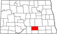 | |
| Townships | ||
| Former townships | ||
| Unorganized territories |
| |
| Unincorporated communities |
| |
| Footnotes | ‡This populated place also has portions in an adjacent county or counties | |
Coordinates: 46°31′00″N 99°35′31″W / 46.51667°N 99.59194°W