Dexter, Missouri
| Dexter, Missouri | |
|---|---|
| City | |
 | |
 Location of Dexter, Missouri | |
| Coordinates: 36°47′48″N 89°57′45″W / 36.79667°N 89.96250°WCoordinates: 36°47′48″N 89°57′45″W / 36.79667°N 89.96250°W | |
| Country | United States |
| State | Missouri |
| County | Stoddard |
| Area[1] | |
| • Total | 6.65 sq mi (17.22 km2) |
| • Land | 6.52 sq mi (16.89 km2) |
| • Water | 0.13 sq mi (0.34 km2) |
| Elevation | 371 ft (113 m) |
| Population (2010)[2] | |
| • Total | 7,864 |
| • Estimate (2012[3]) | 7,881 |
| • Density | 1,206.1/sq mi (465.7/km2) |
| Time zone | Central (CST) (UTC-6) |
| • Summer (DST) | CDT (UTC-5) |
| ZIP code | 63841 |
| Area code(s) | 573 |
| FIPS code | 29-19396[4] |
| GNIS feature ID | 0716871[5] |
Dexter is a city in Stoddard County, Missouri, United States, founded in 1873. The population was 7,864 at the 2010 census.
History
Dexter was founded in 1873. It was named for an individual racehorse.[6] It experienced growth with the arrival of the St. Louis, Iron Mountain and Southern Railway.[7]
Geography
Dexter is located at 36°47′48″N 89°57′45″W / 36.79667°N 89.96250°W (36.796655, -89.962518).[8]
According to the United States Census Bureau, the city has a total area of 6.65 square miles (17.22 km2), of which 6.52 square miles (16.89 km2) is land and 0.13 square miles (0.34 km2) is water.[1]
Dexter is 160 miles (260 km) south of St. Louis, Missouri.[9] Dexter is 45 miles from Cairo, Illinois, the confluence of the Ohio and Mississippi rivers.
Dexter is located on what is known as Crowley's Ridge.
Demographics
| Historical population | |||
|---|---|---|---|
| Census | Pop. | %± | |
| 1880 | 489 | — | |
| 1890 | 792 | 62.0% | |
| 1900 | 1,862 | 135.1% | |
| 1910 | 2,322 | 24.7% | |
| 1920 | 2,635 | 13.5% | |
| 1930 | 2,714 | 3.0% | |
| 1940 | 3,108 | 14.5% | |
| 1950 | 4,624 | 48.8% | |
| 1960 | 5,519 | 19.4% | |
| 1970 | 6,024 | 9.2% | |
| 1980 | 7,043 | 16.9% | |
| 1990 | 7,559 | 7.3% | |
| 2000 | 7,356 | −2.7% | |
| 2010 | 7,864 | 6.9% | |
| Est. 2015 | 7,992 | [10] | 1.6% |
2010 census
As of the census[2] of 2010, there were 7,864 people, 3,359 households, and 2,108 families residing in the city. The population density was 1,206.1 inhabitants per square mile (465.7/km2). There were 3,666 housing units at an average density of 562.3 per square mile (217.1/km2). The racial makeup of the city was 97.1% White, 0.5% African American, 0.5% Native American, 0.2% Asian, 0.2% from other races, and 1.4% from two or more races. Hispanic or Latino of any race were 1.9% of the population.
There were 3,359 households of which 30.8% had children under the age of 18 living with them, 43.8% were married couples living together, 14.3% had a female householder with no husband present, 4.6% had a male householder with no wife present, and 37.2% were non-families. 32.5% of all households were made up of individuals and 14.4% had someone living alone who was 65 years of age or older. The average household size was 2.28 and the average family size was 2.83.
The median age in the city was 40.5 years. 22.9% of residents were under the age of 18; 8.3% were between the ages of 18 and 24; 24.4% were from 25 to 44; 24.8% were from 45 to 64; and 19.8% were 65 years of age or older. The gender makeup of the city was 45.6% male and 54.4% female.
2000 census
As of the census[4] of 2000, there were 7,356 people, 3,237 households, and 2,019 families residing in the city. The population density was 1,208.0 people per square mile (466.4/km²). There were 3,560 housing units at an average density of 584.6 per square mile (225.7/km²). The racial makeup of the city was 97.31% White, 0.15% African American, 0.46% Native American, 0.18% Asian, 0.50% from other races, and 1.40% from two or more races. Hispanic or Latino of any race were 1.20% of the population.
There were 3,237 households out of which 29.4% had children under the age of 18 living with them, 47.0% were married couples living together, 12.1% had a female householder with no husband present, and 37.6% were non-families. 33.8% of all households were made up of individuals and 17.7% had someone living alone who was 65 years of age or older. The average household size was 2.23 and the average family size was 2.83.
In the city the population was spread out with 23.7% under the age of 18, 9.2% from 18 to 24, 25.9% from 25 to 44, 20.9% from 45 to 64, and 20.3% who were 65 years of age or older. The median age was 39 years. For every 100 females there were 82.2 males. For every 100 females age 18 and over, there were 77.3 males.
The median income for a household in the city was $23,116, and the median income for a family was $32,175. Males had a median income of $26,724 versus $17,409 for females. The per capita income for the city was $15,034. About 14.8% of families and 18.3% of the population were below the poverty line, including 23.5% of those under age 18 and 16.3% of those age 65 or over.
Climate
Dexter has a humid subtropical climate (Köppen climate classification Cfa).
| Climate data for Dexter | |||||||||||||
|---|---|---|---|---|---|---|---|---|---|---|---|---|---|
| Month | Jan | Feb | Mar | Apr | May | Jun | Jul | Aug | Sep | Oct | Nov | Dec | Year |
| Average high °F (°C) | 43 (6) |
50 (10) |
60 (16) |
71 (22) |
80 (27) |
89 (32) |
92 (33) |
90 (32) |
83 (28) |
73 (23) |
58 (14) |
47 (8) |
69.7 (20.9) |
| Average low °F (°C) | 26 (−3) |
31 (−1) |
39 (4) |
48 (9) |
58 (14) |
66 (19) |
70 (21) |
68 (20) |
60 (16) |
49 (9) |
39 (4) |
30 (−1) |
48.7 (9.3) |
| Average precipitation inches (mm) | 3.47 (88.1) |
3.64 (92.5) |
4.89 (124.2) |
4.27 (108.5) |
4.86 (123.4) |
4.21 (106.9) |
3.81 (96.8) |
3.22 (81.8) |
3.07 (78) |
3.08 (78.2) |
4.56 (115.8) |
4.83 (122.7) |
47.91 (1,216.9) |
| Source: [12] | |||||||||||||
Government

- Mayor: Joe E Weber
- City Administrator: Mark Stidham
- Aldermen:
- Ward I: Jerry Corder, Terry Battles
- Ward II: Larry Rogers, Tim Aslin
- Ward III: Jason Banken, Frank Killian
- City Clerk: Crystal Bishop
- City Collector: Crystal Allstun
- List of Dexter mayors
Notable people
- George K. Sisler, Medal of Honor recipient
- Clyde A. Vaughn, United States Army Lieutenant General and Director of the Army National Guard
- James P. Walker, politician. member of the House of Representatives.
- Birthplace of Patti McGuire, Playboy Playmate and Playmate of the Year 1977
- Garry Lee Ledbetter, court martialled for spying in 1967
Churches
A list of churches is available at http://www.dexterchamber.com/visitdexter/churches.html. Some churches have individual websites such as http://www.dextersouthwest.com.
See also
References
- 1 2 "US Gazetteer files 2010". United States Census Bureau. Retrieved 2012-07-08.
- 1 2 "American FactFinder". United States Census Bureau. Retrieved 2012-07-08.
- ↑ "Population Estimates". United States Census Bureau. Retrieved 2013-05-30.
- 1 2 "American FactFinder". United States Census Bureau. Retrieved 2008-01-31.
- ↑ "US Board on Geographic Names". United States Geological Survey. 2007-10-25. Retrieved 2008-01-31.
- ↑ Eaton, David Wolfe (1918). How Missouri Counties, Towns and Streams Were Named. The State Historical Society of Missouri. p. 366.
- ↑ History of Southeast Missouri: A Narrative Account of Its Historical Progress, Its People and Its Principal Interests, Volume 1. Lewis Publishing Company. 1912. pp. 389–390.
- ↑ "US Gazetteer files: 2010, 2000, and 1990". United States Census Bureau. 2011-02-12. Retrieved 2011-04-23.
- ↑ Botelho, Greg. "Police: Missouri man secretly exposed partner, and maybe 300 others, to HIV." 'CNN. September 6, 2013. Retrieved on September 7, 2013.
- ↑ "Annual Estimates of the Resident Population for Incorporated Places: April 1, 2010 to July 1, 2015". Retrieved July 2, 2016.
- ↑ "Census of Population and Housing". Census.gov. Retrieved June 4, 2015.
- ↑ "Average weather for Dexter, Missouri". Weather.com. Retrieved December 21, 2008.
External links
- Historic maps of Dexter in the Sanborn Maps of Missouri Collection at the University of Missouri
Municipalities and communities of Stoddard County, Missouri, United States | ||
|---|---|---|
| Cities | 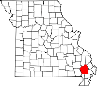 | |
| Villages | ||
| Townships |
| |
| CDP | ||
| Other unincorporated communities | ||