Devil Town, Ohio
| Devil Town | |
|---|---|
| Unincorporated community | |
 Devil Town | |
| Coordinates: 40°50′43″N 81°58′25″W / 40.84528°N 81.97361°WCoordinates: 40°50′43″N 81°58′25″W / 40.84528°N 81.97361°W | |
| Country | United States |
| State | Ohio |
| County | Wayne |
| Elevation | 1,033 ft (315 m) |
| Time zone | Eastern (EST) (UTC-5) |
| • Summer (DST) | EDT (UTC-4) |
| GNIS feature ID | 1048658[1] |
Devil Town is an unincorporated community in Wayne County, Ohio, United States.[1] Devil Town is located approximately 5 mi (8.0 km) northwest of Wooster. Clear Creek flows through the community.
Land was first sold in the area in 1830. The community was called "Tannersville" because a tannery was established there. There was also a blacksmith shop, grocery store, saloon, post office, and mill.[2]
Tannersville later became knows as "Devil Town". One explanation is that a resident there frequently used the word "Devil" when speaking. Another explanation is that the residents—seeking relief from the stench of the tannery—were frequently intoxicated and were "real Devils".[2]
Mechanicsburg Road runs through Devil Town, and some homes are located there. Little remains of the original community.[2]
References
- 1 2 "Devil Town". Geographic Names Information System. United States Geological Survey.
- 1 2 3 Knox, Bonnie (April 1, 2011). "Deviltown". Wayne County Historical Society.
Municipalities and communities of Wayne County, Ohio, United States | ||
|---|---|---|
| Cities | 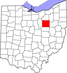 | |
| Villages | ||
| Townships | ||
| CDPs | ||
| Unincorporated communities | ||
| Footnotes | ‡This populated place also has portions in an adjacent county or counties | |