Des Arc, Arkansas
| Des Arc, Arkansas | |
|---|---|
| City | |
|
Clockwise, from top: Downtown Des Arc, the Lower White River State Park, the White River bridge, Prairie County Courthouse, Northern District | |
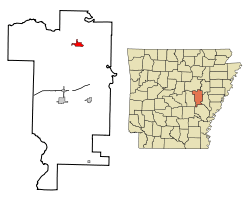 Location in Prairie County and the state of Arkansas | |
| Coordinates: 34°58′32″N 91°30′2″W / 34.97556°N 91.50056°WCoordinates: 34°58′32″N 91°30′2″W / 34.97556°N 91.50056°W | |
| Country | United States |
| State | Arkansas |
| County | Prairie |
| Area | |
| • Total | 2 sq mi (5.3 km2) |
| • Land | 2 sq mi (5.3 km2) |
| • Water | 0 sq mi (0 km2) |
| Elevation | 200 ft (61 m) |
| Population (2000) | |
| • Total | 1,933 |
| • Density | 966.5/sq mi (364.7/km2) |
| Time zone | Central (CST) (UTC-6) |
| • Summer (DST) | CDT (UTC-5) |
| ZIP code | 72040 |
| Area code(s) | 870 |
| FIPS code | 05-18550 |
| GNIS feature ID | 0076785 |

Des Arc is a city in and the county seat of the northern district of Prairie County, Arkansas, United States.[1] The population was 1,933 at the 2000 census.
Geography
Des Arc is located at 34°58′32″N 91°30′2″W / 34.97556°N 91.50056°W (34.975426, -91.500671).[2]
According to the United States Census Bureau, the city has a total area of 2.0 square miles (5.2 km2), of which 2.0 square miles (5.2 km2) is land and 0.49% is water.
Points of interest
Des Arc has seven properties listed on the National Register of Historic Places, including Bethel House, at Erwin and 2nd Streets, designed by architect Charles L. Thompson.[3]
Demographics
| Historical population | |||
|---|---|---|---|
| Census | Pop. | %± | |
| 1880 | 548 | — | |
| 1890 | 546 | −0.4% | |
| 1900 | 640 | 17.2% | |
| 1910 | 1,061 | 65.8% | |
| 1920 | 1,307 | 23.2% | |
| 1930 | 1,348 | 3.1% | |
| 1940 | 1,410 | 4.6% | |
| 1950 | 1,612 | 14.3% | |
| 1960 | 1,482 | −8.1% | |
| 1970 | 1,714 | 15.7% | |
| 1980 | 2,001 | 16.7% | |
| 1990 | 2,001 | 0.0% | |
| 2000 | 1,933 | −3.4% | |
| 2010 | 1,717 | −11.2% | |
| Est. 2015 | 1,639 | [4] | −4.5% |
2014 Estimate[6] | |||

As of the census[7] of 2000, there were 1,933 people, 783 households, and 534 families residing in the city. The population density was 948.0 people per square mile (365.9/km²). There were 850 housing units at an average density of 416.9 per square mile (160.9/km²). The racial makeup of the city was 83.03% White, 14.80% Black or African American, 1.30% Native American, 0.31% Asian, 0.62% from other races, and 0.93% from two or more races. 1.29% of the population were Hispanic or Latino of any race.
There were 783 households out of which 30.0% had children under the age of 18 living with them, 48.3% were married couples living together, 16.6% had a female householder with no husband present, and 31.7% were non-families. 29.4% of all households were made up of individuals and 15.8% had someone living alone who was 65 years of age or older. The average household size was 2.38 and the average family size was 2.93.
In the city the population was spread out with 24.6% under the age of 18, 7.4% from 18 to 24, 25.7% from 25 to 44, 23.0% from 45 to 64, and 19.2% who were 65 years of age or older. The median age was 40 years. For every 100 females there were 89.0 males. For every 100 females age 18 and over, there were 83.5 males.
The median income for a household in the city was $23,750, and the median income for a family was $28,264. Males had a median income of $26,250 versus $17,500 for females. The per capita income for the city was $14,629. About 16.3% of families and 20.0% of the population were below the poverty line, including 32.2% of those under age 18 and 12.9% of those age 65 or over.
Education
Des Arc is served by the Des Arc School District.[8]
Des Arc Pre-K
Des Arc Elementary School K-6
Des Arc High School 7-12
Climate
The climate in this area is characterized by hot, humid summers and generally mild to cool winters. According to the Köppen Climate Classification system, Des Arc has a humid subtropical climate, abbreviated "Cfa" on climate maps.[9]
References
- ↑ "Find a County". National Association of Counties. Retrieved 2011-06-07.
- ↑ "US Gazetteer files: 2010, 2000, and 1990". United States Census Bureau. 2011-02-12. Retrieved 2011-04-23.
- ↑ National Park Service (2010-07-09). "National Register Information System". National Register of Historic Places. National Park Service.
- ↑ "Annual Estimates of the Resident Population for Incorporated Places: April 1, 2010 to July 1, 2015". Retrieved July 2, 2016.
- ↑ "Census of Population and Housing". Census.gov. Retrieved June 4, 2015.
- ↑ "Annual Estimates of the Resident Population for Incorporated Places: April 1, 2010 to July 1, 2014". Retrieved June 4, 2015.
- ↑ "American FactFinder". United States Census Bureau. Retrieved 2008-01-31.
- ↑ Des Arc School District
- ↑ Climate Summary for Des Arc, Arkansas
Municipalities and communities of Prairie County, Arkansas, United States | ||
|---|---|---|
| Cities | 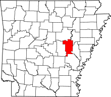 | |
| Towns | ||
| Unincorporated communities |
| |
| Ghost town |
| |
| Footnotes | ‡This populated place also portions in an adjacent county of counties | |