Derby, Colorado
| Derby, Colorado | |
|---|---|
| CDP | |
 Location in Adams County and the State of Colorado | |
| Coordinates: 39°50′20″N 104°55′1″W / 39.83889°N 104.91694°WCoordinates: 39°50′20″N 104°55′1″W / 39.83889°N 104.91694°W | |
| Country |
|
| State |
|
| County | Adams County[1] |
| Government | |
| • Type | unincorporated community |
| Area | |
| • Total | 1.6 sq mi (4.2 km2) |
| • Land | 1.6 sq mi (4.2 km2) |
| • Water | 0 sq mi (0 km2) |
| Elevation[1] | 5,128 ft (1,563 m) |
| Population (2010) | |
| • Total | 7,685 |
| • Density | 4,014.4/sq mi (1,529.3/km2) |
| Time zone | MST (UTC-7) |
| • Summer (DST) | MDT (UTC-6) |
| FIPS code | 08-20275 |
| GNIS feature ID | 1867081 |
Derby is a census-designated place (CDP) in Adams County, Colorado, United States. The population was 7,685 at the 2010 census.[2]
A post office called Derby was established in 1910, and remained in operation until 1963.[3] The community is named after Derby, in England.[4]
Geography
Derby is located at 39°50′20″N 104°55′1″W / 39.83889°N 104.91694°W (39.838785, -104.917082).[5]
According to the United States Census Bureau, the CDP has a total area of 1.6 square miles (4.1 km2), all of it land.
Demographics
As of the census[6] of 2000, there were 6,423 people, 2,061 households, and 1,572 families residing in the CDP. The population density was 3,920.8 people per square mile (1,512.2/km²). There were 2,145 housing units at an average density of 1,309.4 per square mile (505.0/km²). The racial makeup of the CDP was 68.39% White, 1.53% African American, 2.69% Native American, 0.87% Asian, 0.09% Pacific Islander, 21.56% from other races, and 4.86% from two or more races. Hispanic or Latino of any race were 47.27% of the population.
There were 2,061 households out of which 38.7% had children under the age of 18 living with them, 54.2% were married couples living together, 14.0% had a female householder with no husband present, and 23.7% were non-families. 18.3% of all households were made up of individuals and 6.6% had someone living alone who was 65 years of age or older. The average household size was 3.06 and the average family size was 3.45.
In the CDP the population was spread out with 29.6% under the age of 18, 10.7% from 18 to 24, 29.9% from 25 to 44, 20.2% from 45 to 64, and 9.6% who were 65 years of age or older. The median age was 31 years. For every 100 females there were 107.4 males. For every 100 females age 18 and over, there were 110.4 males.
The median income for a household in the CDP was $38,571, and the median income for a family was $41,156. Males had a median income of $28,354 versus $24,792 for females. The per capita income for the CDP was $13,844. About 9.7% of families and 10.4% of the population were below the poverty line, including 11.3% of those under age 18 and 15.3% of those age 65 or over.
See also
- Outline of Colorado
- State of Colorado
References
- 1 2 "US Board on Geographic Names". United States Geological Survey. 2007-10-25. Retrieved 2008-01-31.
- ↑ Colorado Trend Report 2: State and Complete Places (Sub-state 2010 Census Data). Missouri Census Data Center. Accessed 2011-02-25.
- ↑ "Post offices". Jim Forte Postal History. Retrieved 25 June 2016.
- ↑ Dawson, John Frank. Place names in Colorado: why 700 communities were so named, 150 of Spanish or Indian origin. Denver, CO: The J. Frank Dawson Publishing Co. p. 17.
- ↑ "US Gazetteer files: 2010, 2000, and 1990". United States Census Bureau. 2011-02-12. Retrieved 2011-04-23.
- ↑ "American FactFinder". United States Census Bureau. Retrieved 2008-01-31.
Municipalities and communities of Adams County, Colorado, United States | ||
|---|---|---|
| Cities | 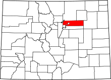 | |
| Towns | ||
| CDPs | ||
| Unincorporated communities | ||
| Footnotes | ‡This populated place also has portions in an adjacent county or counties | |