Denmark, Iowa
| Denmark, Iowa | |
|---|---|
| census-designated place | |
|
Denmark, Iowa | |
 Denmark, Iowa Location within the state of Iowa | |
| Coordinates: 40°44′30″N 91°20′15″W / 40.74167°N 91.33750°WCoordinates: 40°44′30″N 91°20′15″W / 40.74167°N 91.33750°W | |
| Country | United States |
| State | Iowa |
| County | Lee |
| Government | |
| Elevation | 722 ft (220 m) |
| Population (2010) | |
| • Total | 423 |
| Time zone | Central (CST) (UTC-6) |
| • Summer (DST) | CDT (UTC-5) |
| ZIP codes | 52624 |
| GNIS feature ID | 455882[1] |
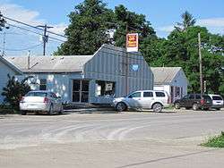
Denmark is an unincorporated community and census-designated place in northeastern Lee County, Iowa, United States. It lies along Iowa Highway 16 north of the city of Fort Madison, the county seat of Lee County.[2] Its elevation is 722 feet (220 m).[1] Although Denmark is unincorporated, it has a post office with the ZIP code of 52624, that opened on April 7, 1846.[3][4] The community is part of the Fort Madison–Keokuk, IA-MO Micropolitan Statistical Area. As of the 2010 Census the population of Denmark, Iowa was 423.[5]
Denmark was laid out about 1837.[6]
Notable people
- Frank Leverett, geologist, was born near Denmark.[7]
See also
- Denmark Congregational United Church of Christ, listed on the National Register of Historic Places in Iowa
References
- 1 2 "Denmark, Iowa". Geographic Names Information System. United States Geological Survey.
- ↑ Rand McNally, The Road Atlas '08. Chicago: Rand McNally, 2008, p. 39.
- ↑ Zip Code Lookup
- ↑ U.S. Geological Survey Geographic Names Information System: Denmark Post Office
- ↑ http://www.census.gov/2010census/popmap/ipmtext.php?fl=1919990
- ↑ The History of Lee County, Iowa. Western Historical Company. 1879. p. 671.
- ↑ 'Iowa Biography,' Benjamin F. Gue, Century History Company: 1903, Biographical Sketch of Frank Leverett, pg. 168-169
Municipalities and communities of Lee County, Iowa, United States | ||
|---|---|---|
| Cities | 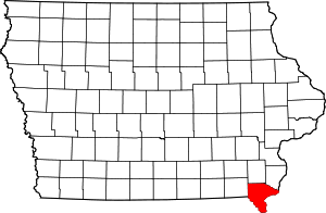 | |
| Townships | ||
| CDP | ||
| Other unincorporated communities | ||
This article is issued from Wikipedia - version of the 10/27/2016. The text is available under the Creative Commons Attribution/Share Alike but additional terms may apply for the media files.