Dela, Oklahoma
Dela is an unincorporated community in Pushmataha County, Oklahoma six miles southeast of Antlers. It is within the jurisdiction of the Choctaw Nation of Oklahoma.
A United States Post Office operated here from May 12, 1920 to October 31, 1954. The post office and community were named for Dela M. Whitaker, local schoolteacher.[1]
Dela was originally known as White Church, or Itissa Busha in the Choctaw language, after a Methodist church built by a white settler for use by Choctaw Indians. The date of its construction is unknown but predated the settlement in 1886 of nearby Antlers; the earliest grave in its cemetery is dated 1883. When built it was located in what was then Cedar County, Choctaw Nation.[2]
In the early 1870s, Colonel Victor M. Locke established a prosperous store, grist mill and cotton gin at White Church on White Creek. The Choctaw National Council named the settlement “Lockestown,” at least for use in identifying it as an official Choctaw electoral precinct. Locke moved from White Church to Beaver, as Antlers was then known, in 1875.[3]
The logs for the Methodist church were hauled from Fort Towson for construction. They were whitewashed with lime, leading to the name of Itissa Busha, of White Church, by the Choctaw. By the late 1930s historical accounts say the Choctaw who formerly lived nearby and worshipped here were deceased and the church was defunct. The church property was purchased by a white farmer, who razed the structure. Its cemetery survives as Dela Cemetery.[4]
More information on Dela, White Church, and the Locke family may be found in the Pushmataha County Historical Society.
References
- ↑ George H. Shirk, Oklahoma Place Names, p. 61
- ↑ The grave is that of Japhie Locke, who died in 1886, likely connected to Colonel Victor M. Locke, an early settler. Pushmataha County Cemeteries, p. 143
- ↑ “Colonel Victor M. Locke, Jr.”, Indian-Pioneer Papers, Western History Collections, University of Oklahoma Libraries.
- ↑ “Bud Boyd”, Indian-Pioneer Papers, Western History Collections, University of Oklahoma Libraries
Municipalities and communities of Pushmataha County, Oklahoma, United States | ||
|---|---|---|
| City | 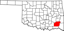 | |
| Towns | ||
| CDP | ||
| Other unincorporated communities | ||
| Ghost towns | ||
| Footnotes | ‡This populated place also has portions in an adjacent county or counties | |
Coordinates: 34°12′01″N 95°31′20″W / 34.20028°N 95.52222°W