D Line (RTD)
| D Line | ||||||||||||||||||||||||||||||||||||||||||||||||||||||||||||||||||||||||||||||||||||||||||||||||||||||||||||||||||||||||||||||||||||||||||||||||||||||||||||||||||||||||||||||||||||||||||||||||||||||||||||||||||||||||||||||||||||||||||||||||||||||||||||||||||||
|---|---|---|---|---|---|---|---|---|---|---|---|---|---|---|---|---|---|---|---|---|---|---|---|---|---|---|---|---|---|---|---|---|---|---|---|---|---|---|---|---|---|---|---|---|---|---|---|---|---|---|---|---|---|---|---|---|---|---|---|---|---|---|---|---|---|---|---|---|---|---|---|---|---|---|---|---|---|---|---|---|---|---|---|---|---|---|---|---|---|---|---|---|---|---|---|---|---|---|---|---|---|---|---|---|---|---|---|---|---|---|---|---|---|---|---|---|---|---|---|---|---|---|---|---|---|---|---|---|---|---|---|---|---|---|---|---|---|---|---|---|---|---|---|---|---|---|---|---|---|---|---|---|---|---|---|---|---|---|---|---|---|---|---|---|---|---|---|---|---|---|---|---|---|---|---|---|---|---|---|---|---|---|---|---|---|---|---|---|---|---|---|---|---|---|---|---|---|---|---|---|---|---|---|---|---|---|---|---|---|---|---|---|---|---|---|---|---|---|---|---|---|---|---|---|---|---|---|---|---|---|---|---|---|---|---|---|---|---|---|---|---|---|---|---|---|---|---|---|---|---|---|---|---|---|---|---|---|---|---|---|
|
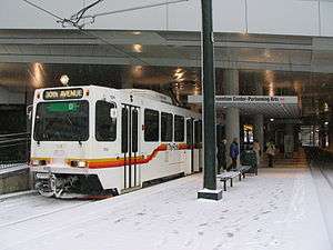
D Line at the Convention Center | ||||||||||||||||||||||||||||||||||||||||||||||||||||||||||||||||||||||||||||||||||||||||||||||||||||||||||||||||||||||||||||||||||||||||||||||||||||||||||||||||||||||||||||||||||||||||||||||||||||||||||||||||||||||||||||||||||||||||||||||||||||||||||||||||||||
| Overview | ||||||||||||||||||||||||||||||||||||||||||||||||||||||||||||||||||||||||||||||||||||||||||||||||||||||||||||||||||||||||||||||||||||||||||||||||||||||||||||||||||||||||||||||||||||||||||||||||||||||||||||||||||||||||||||||||||||||||||||||||||||||||||||||||||||
| Type | Light rail | |||||||||||||||||||||||||||||||||||||||||||||||||||||||||||||||||||||||||||||||||||||||||||||||||||||||||||||||||||||||||||||||||||||||||||||||||||||||||||||||||||||||||||||||||||||||||||||||||||||||||||||||||||||||||||||||||||||||||||||||||||||||||||||||||||
| System | Regional Transportation District | |||||||||||||||||||||||||||||||||||||||||||||||||||||||||||||||||||||||||||||||||||||||||||||||||||||||||||||||||||||||||||||||||||||||||||||||||||||||||||||||||||||||||||||||||||||||||||||||||||||||||||||||||||||||||||||||||||||||||||||||||||||||||||||||||||
| Status | Operational | |||||||||||||||||||||||||||||||||||||||||||||||||||||||||||||||||||||||||||||||||||||||||||||||||||||||||||||||||||||||||||||||||||||||||||||||||||||||||||||||||||||||||||||||||||||||||||||||||||||||||||||||||||||||||||||||||||||||||||||||||||||||||||||||||||
| Locale | Denver–Aurora Metropolitan Area | |||||||||||||||||||||||||||||||||||||||||||||||||||||||||||||||||||||||||||||||||||||||||||||||||||||||||||||||||||||||||||||||||||||||||||||||||||||||||||||||||||||||||||||||||||||||||||||||||||||||||||||||||||||||||||||||||||||||||||||||||||||||||||||||||||
| Termini |
30th & Downing Littleton/Mineral | |||||||||||||||||||||||||||||||||||||||||||||||||||||||||||||||||||||||||||||||||||||||||||||||||||||||||||||||||||||||||||||||||||||||||||||||||||||||||||||||||||||||||||||||||||||||||||||||||||||||||||||||||||||||||||||||||||||||||||||||||||||||||||||||||||
| Stations | 17 | |||||||||||||||||||||||||||||||||||||||||||||||||||||||||||||||||||||||||||||||||||||||||||||||||||||||||||||||||||||||||||||||||||||||||||||||||||||||||||||||||||||||||||||||||||||||||||||||||||||||||||||||||||||||||||||||||||||||||||||||||||||||||||||||||||
| Operation | ||||||||||||||||||||||||||||||||||||||||||||||||||||||||||||||||||||||||||||||||||||||||||||||||||||||||||||||||||||||||||||||||||||||||||||||||||||||||||||||||||||||||||||||||||||||||||||||||||||||||||||||||||||||||||||||||||||||||||||||||||||||||||||||||||||
| Opened | October 7, 1994 | |||||||||||||||||||||||||||||||||||||||||||||||||||||||||||||||||||||||||||||||||||||||||||||||||||||||||||||||||||||||||||||||||||||||||||||||||||||||||||||||||||||||||||||||||||||||||||||||||||||||||||||||||||||||||||||||||||||||||||||||||||||||||||||||||||
| Owner | Regional Transportation District | |||||||||||||||||||||||||||||||||||||||||||||||||||||||||||||||||||||||||||||||||||||||||||||||||||||||||||||||||||||||||||||||||||||||||||||||||||||||||||||||||||||||||||||||||||||||||||||||||||||||||||||||||||||||||||||||||||||||||||||||||||||||||||||||||||
| Operator(s) | Regional Transportation District | |||||||||||||||||||||||||||||||||||||||||||||||||||||||||||||||||||||||||||||||||||||||||||||||||||||||||||||||||||||||||||||||||||||||||||||||||||||||||||||||||||||||||||||||||||||||||||||||||||||||||||||||||||||||||||||||||||||||||||||||||||||||||||||||||||
| Technical | ||||||||||||||||||||||||||||||||||||||||||||||||||||||||||||||||||||||||||||||||||||||||||||||||||||||||||||||||||||||||||||||||||||||||||||||||||||||||||||||||||||||||||||||||||||||||||||||||||||||||||||||||||||||||||||||||||||||||||||||||||||||||||||||||||||
| Track gauge | 4 ft 8 1⁄2 in (1,435 mm) | |||||||||||||||||||||||||||||||||||||||||||||||||||||||||||||||||||||||||||||||||||||||||||||||||||||||||||||||||||||||||||||||||||||||||||||||||||||||||||||||||||||||||||||||||||||||||||||||||||||||||||||||||||||||||||||||||||||||||||||||||||||||||||||||||||
| Electrification | Overhead lines | |||||||||||||||||||||||||||||||||||||||||||||||||||||||||||||||||||||||||||||||||||||||||||||||||||||||||||||||||||||||||||||||||||||||||||||||||||||||||||||||||||||||||||||||||||||||||||||||||||||||||||||||||||||||||||||||||||||||||||||||||||||||||||||||||||
| ||||||||||||||||||||||||||||||||||||||||||||||||||||||||||||||||||||||||||||||||||||||||||||||||||||||||||||||||||||||||||||||||||||||||||||||||||||||||||||||||||||||||||||||||||||||||||||||||||||||||||||||||||||||||||||||||||||||||||||||||||||||||||||||||||||
The D Line – also referred to as the Green Line, because green is the line's color on maps – is a light rail line which is part of the light rail system operated by the Regional Transportation District in the Denver–Aurora Metropolitan Area in Colorado. The D line was the first line in the system when it opened in 1994, traveling from downtown Denver to I-25 and Broadway as the Central Corridor. It was extended along the Southwest Corridor in July 2000. Because it was the first and only line in the system it had no letter or color designation until the Central Platte Valley Spur opened on April 5, 2002, although on maps it was designated as Route 101.
Route
The D Line's northern terminus is in Five Points northeast of downtown Denver. It goes through downtown, running southwest along Welton Street, then going up 19th Street. On trips leaving downtown, the line goes along Stout Street and 14th Street; on trips from Littleton, the line runs along California Street. Then the line follows Stout Street and Colfax Avenue, and follows a railroad right-of-way, where it joins with the C Line at 10th & Osage Station. They run in tandem until they reach their southern terminus at Mineral Avenue in Littleton.[1]
Proposed L Line
Central Rail Extension Mobility Study Final Report[2] proposes that the D Line stations from 20th & Welton to 30th & Downing and future extension stations be operated on an independent route. This route would operate from the downtown loop to the new terminus at the shared A Line's 38th and Blake station.[3] Riders would have to transfer to the new L Line from the D Line as the D Line's new northern terminus would be the downtown loop. The 14th & California Station closed in 2004 would be restored to support the L Line at the Convention Center.[2]
Stations
The Convention Center/Performing Arts Station, which opened in 2004, replaces the 14th & Stout and 14th & California stations, which opened in 1994.
| Name | Opening Year | Interchange | Municipality | park-n-Ride? |
|---|---|---|---|---|
| D Line (30th & Downing - Littleton/Mineral) | ||||
| 30th & Downing | 1994 | None | Denver | Yes |
| 29th & Welton | 1994 (closed 2013) |
None | Denver | No |
| 27th & Welton | 1995 | None | Denver | No |
| 25th & Welton | 1994 | None | Denver | No |
| 20th & Welton | 1994 | None | Denver | No |
| 18th & California (northbound) and 18th & Stout (southbound) |
1994 | F & H Lines | Denver | No |
| 16th & California (northbound) and 16th & Stout (southbound) |
1994 | F & H Lines FREE MallRide (16th St) |
Denver | No |
| Theatre District / Convention Center | 2004 | F & H Lines | Denver | No |
| Colfax at Auraria | 1994 | F & H Lines | Denver | No |
| 10th & Osage | 1994 | C , E , F & H Lines | Denver | No |
| Alameda | 1994 | C , E , F & H Lines | Denver | No |
| I-25 & Broadway | 1994 | C , E , F & H Lines | Denver | Yes |
| Fare Zone Boundary | ||||
| Evans | 2000 | C Line | Denver | Yes |
| Englewood | 2000 | C Line | Englewood | Yes |
| Oxford/City of Sheridan | 2000 | C Line | Sheridan | No |
| Fare Zone Boundary | ||||
| Littleton/Downtown | 2000 | C Line | Littleton | Yes |
| Littleton/Mineral | 2000 | C Line | Littleton | Yes |
FasTracks
The 2004 voter approved FasTracks plan will add 2.5 mi (4.02 km) to the Southwest Corridor (C Line and D Line). It will also add a station with 1,000 parking spots at C-470 and Lucent Boulevard in Highlands Ranch.[3] There may also be a station at C-470 and Santa Fe Boulevard. This extension may open as soon as 2017.[4]
References
- ↑ "RTD - Light Rail System Map". Regional Transportation District. Retrieved June 2, 2014.
- 1 2 "RTD - Central Rail Extension Mobility Study Final Report, December 2014". Regional Transportation District. Retrieved May 12, 2015.
- 1 2 "RTD - FasTracks System Map". Regional Transportation District. Retrieved May 12, 2015.
- ↑ "Fastracks - Southwest Corridor". Regional Transportation District. Retrieved April 11, 2010.