Currambine, Western Australia
| Currambine Perth, Western Australia | |||||||||||||
|---|---|---|---|---|---|---|---|---|---|---|---|---|---|
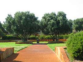 Doncaster Park. | |||||||||||||
 Currambine | |||||||||||||
| Coordinates | 31°43′55″S 115°45′04″E / 31.732°S 115.751°ECoordinates: 31°43′55″S 115°45′04″E / 31.732°S 115.751°E | ||||||||||||
| Population | 6,775 (2011 census)[1] | ||||||||||||
| • Density | 2,190/km2 (5,660/sq mi) | ||||||||||||
| Established | 2015 | ||||||||||||
| Postcode(s) | 6028 | ||||||||||||
| Area | 3.1 km2 (1.2 sq mi) | ||||||||||||
| Location | |||||||||||||
| LGA(s) | City of Joondalup | ||||||||||||
| State electorate(s) | Ocean Reef, Joondalup | ||||||||||||
| Federal Division(s) | Moore | ||||||||||||
| |||||||||||||
Currambine is a northern suburb of Perth, the capital city of Western Australia 30 km north of Perth's central business district. Its local government area is the City of Joondalup. It contains the Currambine Central shopping centre and cinema complex.
History
Currambine was approved as a suburb name in 1980. The name was chosen by the City of Wanneroo in 1979 from a book by A.W. Reed.[2] It is an Aboriginal word from New South Wales meaning "heaps of rocks".[3]
Currambine was developed as a chiefly residential suburb in the mid-1990s on land adjacent to the Currambine train station, which was built and opened in 1993.
Geography
Currambine is bounded by Burns Beach Road to the north, Marmion Avenue to the west, Shenton Avenue to the south and Mitchell Freeway to the west. The suburb is effectively bisected into quarters by the dual carriageways Connolly Drive (north-south) and Moore Drive (east-west).[4]
At the ABS 2006 census, Currambine had a population of 6,655 people living in 2,237 dwellings. The ABS reported that Currambine's workforce, like many northern coastal suburbs, was divided almost evenly between the three major occupation types - clerical and service workers; professionals and managers; and tradespersons and labourers.[1]
Facilities
Currambine is a residential suburb, and is served by the Currambine Market Place shopping centre (now renamed Currambine Central) at its southwestern corner, the complex includes
| Food | Health | Clothing and Beauty | Other Services |
|---|---|---|---|
| London Cafe | Lacey's Gym | Mash Boutique | Grand Cinema |
| Basq | Go Vita | Hot Bods Boutique | Brice and Turner Travel Associates |
| Great British Chippy | Eyes on Currambine | W-Lane | TAB |
| Woolworths | Currambine Pharmacy | Rockmans | Quality Drycleaners |
| ikebab | Harvey World Travel | ||
| Baker's Delight | Fast Phone Repairs | ||
| Star of the North | Currambine Lotto | ||
| Pizza Pizzaz | First Western Realty | ||
| Oscar’s Restaurant | Woolworths Petrol | ||
| Currambine Chinese | redi ATM | ||
| Cafissimo | Bankwest ATM | ||
| Pasta Cup | ANZ ATM | ||
| Subway | Westpac ATM | ||
| Dan Murphy's |
The southeastern part of the suburb contains 5 holes of the 27-hole Joondalup Golf Course, part of the Joondalup Resort complex based in neighbouring Connolly. The suburb also contains two primary schools, one public (1997 Currambine Primary School) and one private (Francis Jordan Catholic School). The suburb is within Ocean Reef Senior High School's catchment area.[4]
Transport
Currambine is served by the 460, 461, 470, these three busses run through Shenton ave 471 and 472 Transperth bus routes from Joondalup,[5] operated by Transdev Perth and by the Currambine railway station.
Politics
Currambine is a fairly new suburb and a classic "mortgage belt" suburb which leans towards the Liberal Party in federal elections and the Australian Labor Party in state elections, in line with many northern Perth suburbs. This has changed in recent elections with majority voting for Liberal in the state elections. As Currambine is a part of two state electorates it is represented by both Albert Jacob: Ocean Reef (Environmental and Heritage Minister of Western Australia) and Jan Norberger: Joondalup, both of which are liberal representatives.
|
| ||||||||||||||||||||||||||||||||||||
|
| ||||||||||||||||||||||||||||||||||||
See also
References
- 1 2 Australian Bureau of Statistics (31 October 2012). "State Suburbs: Currambine". 2011 Census QuickStats. Retrieved 4 July 2012.
- ↑ Reed, Alexander Wyclif (1970). Aboriginal place names and their meanings. Sydney, NSW. ISBN 0-589-07097-5. (135 pages)
- ↑ Western Australian Land Information Authority. "History of metropolitan suburb names – C". Retrieved 2007-05-15.
- 1 2 Department of Land Information. StreetSmart® Perth Street Directory (54 (2013) ed.). West Australian Newspapers Ltd. pp. Map 220. ISBN 978-0-909439-67-5.
- ↑ Northern 67 timetable Archived 30 September 2007 at the Wayback Machine., Transperth, effective 8 August 2005. Accessed 2007-01-17