Cross Hill, South Carolina
| Cross Hill, South Carolina | |
|---|---|
| Town | |
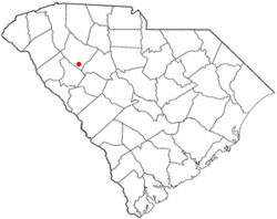 Location of Cross Hill, South Carolina | |
| Coordinates: 34°18′37″N 81°59′3″W / 34.31028°N 81.98417°WCoordinates: 34°18′37″N 81°59′3″W / 34.31028°N 81.98417°W | |
| Country | United States |
| State | South Carolina |
| County | Laurens |
| Area | |
| • Total | 3.1 sq mi (8.0 km2) |
| • Land | 3.1 sq mi (8.0 km2) |
| • Water | 0.0 sq mi (0.0 km2) |
| Elevation | 584 ft (178 m) |
| Population (2000) | |
| • Total | 601 |
| • Density | 194.5/sq mi (75.1/km2) |
| Time zone | Eastern (EST) (UTC-5) |
| • Summer (DST) | EDT (UTC-4) |
| ZIP code | 29332 |
| Area code(s) | 864 |
| FIPS code | 45-17890[1] |
| GNIS feature ID | 1247433[2] |
Cross Hill is a town in Laurens County, South Carolina, United States. The population was 601 at the 2000 census. It is part of the Greenville–Mauldin–Easley Metropolitan Statistical Area.
History
Cross Hill was laid out in the vicinity of an old Indian trail.[3]
Geography
Cross Hill is located at 34°18′37″N 81°59′3″W / 34.31028°N 81.98417°W (34.310186, -81.984188).[4]
According to the United States Census Bureau, the town has a total area of 3.1 square miles (8.0 km2), all of it land.
Demographics
| Historical population | |||
|---|---|---|---|
| Census | Pop. | %± | |
| 1880 | 149 | — | |
| 1890 | 216 | 45.0% | |
| 1900 | 459 | 112.5% | |
| 1910 | 558 | 21.6% | |
| 1920 | 587 | 5.2% | |
| 1930 | 678 | 15.5% | |
| 1940 | 525 | −22.6% | |
| 1950 | 543 | 3.4% | |
| 1960 | 441 | −18.8% | |
| 1970 | 579 | 31.3% | |
| 1980 | 604 | 4.3% | |
| 1990 | 469 | −22.4% | |
| 2000 | 601 | 28.1% | |
| 2010 | 507 | −15.6% | |
| Est. 2015 | 497 | [5] | −2.0% |
As of the census[1] of 2000, there were 601 people, 224 households, and 165 families residing in the town. The population density was 194.5 people per square mile (75.1/km²). There were 245 housing units at an average density of 79.3 per square mile (30.6/km²). The racial makeup of the town was 42.60% White, 55.57% African American, 0.33% Native American, 0.50% Asian, and 1.00% from two or more races. Hispanic or Latino of any race were 0.17% of the population.
There were 224 households out of which 36.2% had children under the age of 18 living with them, 41.1% were married couples living together, 24.1% had a female householder with no husband present, and 26.3% were non-families. 23.2% of all households were made up of individuals and 8.9% had someone living alone who was 65 years of age or older. The average household size was 2.68 and the average family size was 3.16.
In the town the population was spread out with 29.0% under the age of 18, 8.2% from 18 to 24, 29.5% from 25 to 44, 23.1% from 45 to 64, and 10.3% who were 65 years of age or older. The median age was 35 years. For every 100 females there were 101.7 males. For every 100 females age 18 and over, there were 92.3 males.
The median income for a household in the town was $28,083, and the median income for a family was $32,500. Males had a median income of $25,288 versus $18,846 for females. The per capita income for the town was $12,688. About 16.0% of families and 19.8% of the population were below the poverty line, including 23.8% of those under age 18 and 18.5% of those age 65 or over.
References
- 1 2 "American FactFinder". United States Census Bureau. Archived from the original on September 11, 2013. Retrieved 2008-01-31.
- ↑ "US Board on Geographic Names". United States Geological Survey. 2007-10-25. Retrieved 2008-01-31.
- ↑ "Communities". Laurens County Chamber of Commerce. Retrieved 14 June 2014.
- ↑ "US Gazetteer files: 2010, 2000, and 1990". United States Census Bureau. 2011-02-12. Retrieved 2011-04-23.
- ↑ "Annual Estimates of the Resident Population for Incorporated Places: April 1, 2010 to July 1, 2015". Retrieved July 2, 2016.
- ↑ "Census of Population and Housing". Census.gov. Archived from the original on May 11, 2015. Retrieved June 4, 2015.
External links
- ACCESS 15, Public, educational, and government access (PEG) cable tv channel
- Information on Town of Cross Hill from Laurens County
Municipalities and communities of Laurens County, South Carolina, United States | ||
|---|---|---|
| Cities | 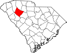 | |
| Towns | ||
| CDPs | ||
| Unincorporated communities | ||
| Footnotes | ‡This populated place also has portions in an adjacent county or counties | |