Coward, South Carolina
| Coward, South Carolina | |
|---|---|
| Town | |
 Location of Coward in South Carolina | |
| Coordinates: 33°58′32″N 79°44′50″W / 33.97556°N 79.74722°WCoordinates: 33°58′32″N 79°44′50″W / 33.97556°N 79.74722°W | |
| Country | United States |
| State | South Carolina |
| County | Florence |
| Area | |
| • Total | 3.4 sq mi (9.1 km2) |
| • Land | 3.4 sq mi (9.1 km2) |
| • Water | 0.0 sq mi (0.0 km2) |
| Elevation | 82 ft (25 m) |
| Population (2010) | |
| • Total | 752 |
| • Density | 213/sq mi (82.2/km2) |
| Time zone | EST (UTC-5) |
| • Summer (DST) | EDT (UTC-4) |
| ZIP code | 29530 |
| Area code(s) | 843 |
| FIPS code | 45-17215[1] |
| GNIS feature ID | 1247407[2] |
Coward is a town in Florence County, South Carolina, United States. The population was 752 at the 2010 census,[3] up from 650 at the 2000 census. It is part of the Florence Metropolitan Statistical Area.
Coward has been noted for its unusual place name.[4]
Geography
Coward is located in south-central Florence County at 33°58′32″N 79°44′50″W / 33.975560°N 79.747097°W.[5] U.S. Route 52 runs through the center of town, leading north 16 miles (26 km) to Florence, the county seat, and south 7 miles (11 km) to Lake City. South Carolina Highway 541 leads west from Coward 12 miles (19 km) to Olanta.
According to the United States Census Bureau, the town of Coward has a total area of 3.5 square miles (9.1 km2), of which 0.637 acres (2,576 m2), or 0.03%, is water.[3] The town is in the watershed of the Lynches River, a tributary of the Pee Dee River.
Demographics
| Historical population | |||
|---|---|---|---|
| Census | Pop. | %± | |
| 1970 | 466 | — | |
| 1980 | 428 | −8.2% | |
| 1990 | 532 | 24.3% | |
| 2000 | 650 | 22.2% | |
| 2010 | 752 | 15.7% | |
| Est. 2015 | 750 | [6] | −0.3% |
As of the census[1] of 2000, there were 650 people, 246 households, and 178 families residing in the town. The population density was 189.9 people per square mile (73.4/km2). There were 263 housing units at an average density of 76.8 per square mile (29.7/km2). The racial makeup of the town was 84.15% White, 14.00% African American, 0.15% Asian, 0.62% from other races, and 1.08% from two or more races. Hispanic or Latino of any race were 1.38% of the population.
There were 246 households out of which 32.9% had children under the age of 18 living with them, 56.1% were married couples living together, 12.2% had a female householder with no husband present, and 27.6% were non-families. 24.8% of all households were made up of individuals and 8.1% had someone living alone who was 65 years of age or older. The average household size was 2.64 and the average family size was 3.17.
In the town the population was spread out with 26.2% under the age of 18, 9.7% from 18 to 24, 28.8% from 25 to 44, 25.5% from 45 to 64, and 9.8% who were 65 years of age or older. The median age was 35 years. For every 100 females there were 98.8 males. For every 100 females age 18 and over, there were 94.3 males.
The median income for a household in the town was $28,182, and the median income for a family was $30,208. Males had a median income of $28,977 versus $17,039 for females. The per capita income for the town was $12,711. About 16.1% of families and 24.4% of the population were below the poverty line, including 37.2% of those under age 18 and 43.2% of those age 65 or over.
References
- 1 2 "American FactFinder". United States Census Bureau. Archived from the original on September 11, 2013. Retrieved 2008-01-31.
- ↑ "US Board on Geographic Names". United States Geological Survey. 2007-10-25. Retrieved 2008-01-31.
- 1 2 "Geographic Identifiers: 2010 Demographic Profile Data (G001): Coward town, South Carolina". U.S. Census Bureau, American Factfinder. Retrieved August 15, 2016.
- ↑ Petras, Kathryn; Petras, Ross (18 December 2007). Unusually Stupid Americans: A Compendium of All-American Stupidity. Random House Publishing Group. p. 246. ISBN 978-0-307-41761-9.
- ↑ "US Gazetteer files: 2010, 2000, and 1990". United States Census Bureau. 2011-02-12. Retrieved 2011-04-23.
- ↑ "Annual Estimates of the Resident Population for Incorporated Places: April 1, 2010 to July 1, 2015". Retrieved July 2, 2016.
- ↑ "Census of Population and Housing". Census.gov. Archived from the original on May 11, 2015. Retrieved June 4, 2015.
External links
Government Information from Florence County
Municipalities and communities of Florence County, South Carolina, United States | ||
|---|---|---|
| Cities | 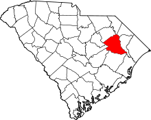 | |
| Towns | ||
| Unincorporated communities | ||