Coupeville, Washington
| Coupeville | |
|---|---|
| Town | |
| Coupeville, Washington | |
|
The waterfront of Coupeville | |
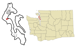 Location of Coupeville, Washington | |
| Coordinates: 48°13′6″N 122°41′1″W / 48.21833°N 122.68361°WCoordinates: 48°13′6″N 122°41′1″W / 48.21833°N 122.68361°W | |
| Country | United States |
| State | Washington |
| County | Island |
| Area[1] | |
| • Total | 1.23 sq mi (3.19 km2) |
| • Land | 1.23 sq mi (3.19 km2) |
| • Water | 0 sq mi (0 km2) |
| Elevation | 75 ft (23 m) |
| Population (2010)[2] | |
| • Total | 1,831 |
| • Estimate (2015)[3] | 1,887 |
| • Density | 1,488.6/sq mi (574.8/km2) |
| Time zone | Pacific (PST) (UTC-8) |
| • Summer (DST) | PDT (UTC-7) |
| ZIP code | 98239 |
| Area code(s) | 360 |
| FIPS code | 53-15185[4] |
| GNIS feature ID | 1512119[5] |
| Highways |
|
| Website | Town of Coupeville |

Coupeville is a town on Whidbey Island, in Island County, Washington, United States.
It is the county seat of Island County. The population was 1,831 at the 2010 census.[6]
History
Coupeville was laid out in the 1850s by Captain Thomas Coupe, and named for him.[7]
Coupeville was officially incorporated on April 20, 1910.
Coupeville is a historic district is within the federal Ebey's Landing National Historical Reserve. The reserve was established by Congress in 1978, as the first and now one of the largest National Historical Reserves in the nation.[8] Its 22 square miles (57 km2) also encompass farmlands, Fort Ebey State Park, Fort Casey State Park, shorelines and beaches, parks, trails, and 91 buildings and structures on the National Register of Historic Places.
Geography
Coupeville is located at 48°13′6″N 122°41′1″W / 48.21833°N 122.68361°W (48.218250, -122.683556).[9]
According to the United States Census Bureau, the town has a total area of 1.23 square miles (3.19 km2), all of it land.[1]
Climate
Coupeville experiences significantly lower rainfall than much of western Washington, due to its location within rainshadow of the Olympic Mountains. Due to the significant drying trend in summer, Coupeville's climate is classified as warm-summer Mediterranean, according to the Köppen climate classification system.
| Climate data for Coupeville | |||||||||||||
|---|---|---|---|---|---|---|---|---|---|---|---|---|---|
| Month | Jan | Feb | Mar | Apr | May | Jun | Jul | Aug | Sep | Oct | Nov | Dec | Year |
| Record high °F (°C) | 65 (18) |
69 (21) |
78 (26) |
81 (27) |
86 (30) |
92 (33) |
96 (36) |
98 (37) |
91 (33) |
79 (26) |
68 (20) |
70 (21) |
98 (37) |
| Average high °F (°C) | 44.4 (6.9) |
48.1 (8.9) |
51.9 (11.1) |
57.3 (14.1) |
62.7 (17.1) |
67.2 (19.6) |
71.7 (22.1) |
72 (22) |
67 (19) |
58.3 (14.6) |
49.9 (9.9) |
45.5 (7.5) |
58 (14) |
| Average low °F (°C) | 34.2 (1.2) |
35.1 (1.7) |
36.9 (2.7) |
40.1 (4.5) |
44.5 (6.9) |
48.3 (9.1) |
50.6 (10.3) |
50.6 (10.3) |
47.2 (8.4) |
42.8 (6) |
38.2 (3.4) |
35.7 (2.1) |
42 (6) |
| Record low °F (°C) | 3 (−16) |
5 (−15) |
0 (−18) |
25 (−4) |
28 (−2) |
35 (2) |
40 (4) |
38 (3) |
29 (−2) |
19 (−7) |
6 (−14) |
3 (−16) |
0 (−18) |
| Average precipitation inches (mm) | 2.36 (59.9) |
1.73 (43.9) |
1.84 (46.7) |
1.57 (39.9) |
1.56 (39.6) |
1.26 (32) |
0.74 (18.8) |
0.85 (21.6) |
1.28 (32.5) |
1.77 (45) |
2.56 (65) |
2.69 (68.3) |
20.22 (513.6) |
| Average snowfall inches (cm) | 2.5 (6.4) |
1.2 (3) |
0.8 (2) |
0 (0) |
0 (0) |
0 (0) |
0 (0) |
0 (0) |
0 (0) |
0 (0) |
0.7 (1.8) |
0.9 (2.3) |
6.1 (15.5) |
| Average precipitation days (≥ 0.01 inch) | 15 | 12 | 13 | 11 | 10 | 9 | 5 | 5 | 8 | 11 | 15 | 17 | 131 |
| Source: [10] | |||||||||||||
Demographics
| Historical population | |||
|---|---|---|---|
| Census | Pop. | %± | |
| 1880 | 90 | — | |
| 1890 | 513 | 470.0% | |
| 1910 | 310 | — | |
| 1920 | 343 | 10.6% | |
| 1930 | 277 | −19.2% | |
| 1940 | 325 | 17.3% | |
| 1950 | 379 | 16.6% | |
| 1960 | 740 | 95.3% | |
| 1970 | 678 | −8.4% | |
| 1980 | 1,006 | 48.4% | |
| 1990 | 1,377 | 36.9% | |
| 2000 | 1,723 | 25.1% | |
| 2010 | 1,831 | 6.3% | |
| Est. 2015 | 1,887 | [11] | 3.1% |
| U.S. Decennial Census[12] 2015 Estimate[3] | |||
2010 census
As of the census[2] of 2010, there were 1,831 people, 806 households, and 428 families residing in the town. The population density was 1,488.6 inhabitants per square mile (574.8/km2). There were 933 housing units at an average density of 758.5 per square mile (292.9/km2). The racial makeup of the town was 87.2% White, 1.6% African American, 0.6% Native American, 1.9% Asian, 0.3% Pacific Islander, 4.2% from other races, and 4.3% from two or more races. Hispanic or Latino of any race were 9.0% of the population.
There were 806 households of which 21.1% had children under the age of 18 living with them, 42.8% were married couples living together, 7.3% had a female householder with no husband present, 3.0% had a male householder with no wife present, and 46.9% were non-families. 40.0% of all households were made up of individuals and 19.4% had someone living alone who was 65 years of age or older. The average household size was 2.06 and the average family size was 2.77.
The median age in the town was 51.1 years. 17.1% of residents were under the age of 18; 6.3% were between the ages of 18 and 24; 19.1% were from 25 to 44; 29.9% were from 45 to 64; and 27.5% were 65 years of age or older. The gender makeup of the town was 44.3% male and 55.7% female.
2000 census
As of the census[4] of 2000, there were 1,723 people, 737 households, and 426 families residing in the town. The population density was 1,346.7 people per square mile (519.7/km²). There were 814 housing units at an average density of 636.2 per square mile (245.5/km²). The racial makeup of the town was 89.79% White, 1.57% African American, 0.52% Native American, 2.15% Asian, 2.84% from other races, and 3.13% from two or more races. Hispanic or [Latino of any race were 5.34% of the population.
There were 737 households out of which 25.5% had children under the age of 18 living with them, 46.0% were married couples living together, 9.1% had a female householder with no husband present, and 42.1% were non-families. 36.9% of all households were made up of individuals and 19.4% had someone living alone who was 65 years of age or older. The average household size was 2.16 and the average family size was 2.81.
In the town the population was spread out with 21.1% under the age of 18, 6.0% from 18 to 24, 25.0% from 25 to 44, 22.7% from 45 to 64, and 25.2% who were 65 years of age or older. The median age was 43 years. For every 100 females there were 83.5 males. For every 100 females age 18 and over, there were 81.2 males.
The median income for a household in the town was $33,938, and the median income for a family was $47,721. Males had a median income of $33,235 versus $27,100 for females. The per capita income for the town was $18,720. About 8.9% of families and 11.4% of the population were below the poverty line, including 14.9% of those under age 18 and 8.2% of those age 65 or over.
Economy
In 1987, 42 percent of the county's population were employed by the military; Naval Outlying Field Coupeville (OLF Coupeville), a Naval military airport located two miles southeast of Coupeville saw 6,000 flights per year from 1980-1985. In 2005 the Navy issued an Environmental Impact Statement[13] to replace the existing A-6("Prowler") aircraft with EA-18G ("Growler"). The EA-18G conducted an average of 6,100 flight operations per year through 2015. In November 2016, the Navy issued a draft Environmental Impact Statement to bring the total number of aircraft based at nearby Ault Field at Naval Air Station-Whidbey Island to a total of 114. The Navy's preferred scenario would increase the number of flight operations by 575% to 35,100,or an average of 135 flight operations at OLF per training day (assuming year round training 5 days a week.)[14]
Major employers in Coupeville are Island County and Whidbey General Hospital.
Service and retail businesses serve the island population and visitors attracted to the town's historic waterfront district and Ebey's Landing National Historical Reserve. Retail businesses are located along North and South Main Street, Coveland, and Front Street along the waterfront. In addition to 11 restaurants, cafes, and coffee shops, stores include art galleries, gourmet food, clothing, souvenir, and home decor retailers. With few exceptions, these businesses are operated by individual local owners.
Environment
The EPA issued a health advisory for two perfluoroalkyl substances (PFAS); perfluorooctane sulfonate (PFOS) and perfluorooctanoic acid (PFOA), both of which are used by the DoD for aviation fire suppression. Wells on NAS-WI have tested positive for the presence one or more of these perfluoroalkyl substances. Since Coupeville's water supply is from a single aquifer located in the vicinity of OLF, water from the towns wells are being tested in December 2016.
See also
- Ebey's Landing National Historical Reserve−index of topics
- National Register of Historic Places listings in Island County, Washington
References
- 1 2 "US Gazetteer files 2010". United States Census Bureau. Archived from the original on 2012-07-14. Retrieved 2012-12-19.
- 1 2 "American FactFinder". United States Census Bureau. Retrieved 2012-12-19.
- 1 2 "Population Estimates". United States Census Bureau. Retrieved July 10, 2016.
- 1 2 "American FactFinder". United States Census Bureau. Archived from the original on 2013-09-11. Retrieved 2008-01-31.
- ↑ "Coupeville". Geographic Names Information System. United States Geological Survey.
- ↑ "Find a County". National Association of Counties. Archived from the original on 2011-05-31. Retrieved 2011-06-07.
- ↑ Meany, Edmond S. (1923). Origin of Washington geographic names. Seattle: University of Washington Press. p. 58.
- ↑ http://www.nps.gov/mawa/upload/Public-Law-95-625.pdf
- ↑ "US Gazetteer files: 2010, 2000, and 1990". United States Census Bureau. 2011-02-12. Retrieved 2011-04-23.
- ↑ "COUPEVILLE 1 S, WASHINGTON (451783)". Western Regional Climate Center. Retrieved November 15, 2015.
- ↑ "Annual Estimates of the Resident Population for Incorporated Places: April 1, 2010 to July 1, 2015". Retrieved July 2, 2016.
- ↑ United States Census Bureau. "Census of Population and Housing". Archived from the original on May 11, 2015. Retrieved August 31, 2014.
- ↑ "2005 Environmental Impact Statement for NAS-WI to replace A-6 aircraft with EA-18G" (PDF).
- ↑ "Flight Operations for NAS_WI Complex, November 2016 Draft EIS" (PDF).
External links
| Wikivoyage has a travel guide for Coupeville. |
| Wikimedia Commons has media related to Coupeville, Washington. |
- History of Coupeville at HistoryLink
- Coupeville & Central Whidbey Island Chamber of Commerce
- Coupeville Visitors' Information
- Island County Historical Museum
- Sunnyside Cemetery - Coupeville's historic pioneer cemetery
- US National Park Service: Ebey's Landing National Historical Reserve website
- NPS: History and culture of Ebey's Landing National Historical Reserve and Central Whidbey Island
- Historic Admiralty Head Lighthouse
- Coupeville Arts & Crafts Festival
- The Whidbey Examiner newspaper, based in Coupeville
- Oliver S. Van Olinda Photography Collection - Former editor of the Island County Times a Coupeville newspaper; University of Washington Library
Municipalities and communities of Island County, Washington, United States | ||
|---|---|---|
| Cities | 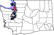 | |
| Town | ||
| CDPs | ||
| Other unincorporated communities | ||