Cottonwood Township, Cumberland County, Illinois
| Cottonwood Township | |
|---|---|
| Township | |
 Location in Cumberland County | |
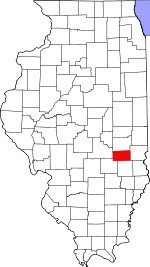 Cumberland County's location in Illinois | |
| Coordinates: 39°21′N 88°15′W / 39.350°N 88.250°WCoordinates: 39°21′N 88°15′W / 39.350°N 88.250°W | |
| Country |
|
| State |
|
| County | Cumberland |
| Established | November 6, 1860 |
| Area | |
| • Total | 32.68 sq mi (84.6 km2) |
| • Land | 32.67 sq mi (84.6 km2) |
| • Water | 0.01 sq mi (0.03 km2) 0.03% |
| Elevation | 640 ft (195 m) |
| Population (2010) | |
| • Total | 521 |
| • Density | 15.9/sq mi (6.1/km2) |
| Time zone | CST (UTC-6) |
| • Summer (DST) | CDT (UTC-5) |
| ZIP codes | 62428, 62440, 62468, 62469 |
| GNIS feature ID | 0428849 |
Cottonwood Township is one of eight townships in Cumberland County, Illinois, USA. As of the 2010 census, its population was 521 and it contained 231 housing units.[1]
Geography
According to the 2010 census, the township has a total area of 32.68 square miles (84.6 km2), of which 32.67 square miles (84.6 km2) (or 99.97%) is land and 0.01 square miles (0.026 km2) (or 0.03%) is water.[1] The Embarras River defines the township's eastern border.
Unincorporated towns
- Bradbury at 39°19′27″N 88°14′34″W / 39.3242°N 88.2428°W
- Janesville at 39°22′27″N 88°14′37″W / 39.3742°N 88.2437°W
- Johnstown at 39°21′48″N 88°17′13″W / 39.3634°N 88.2870°W
Cemeteries
The township contains these three cemeteries: Haggins, Hutton and Tippett.
Airports and landing strips
- Thornton Airport
School districts
- Charleston Community Unit School District 1
- Cumberland Community Unit School District 77
- Neoga Community Unit School District 3
Political districts
- State House District 109
- State Senate District 55
References
- "Cottonwood Township, Cumberland County, Illinois". Geographic Names Information System. United States Geological Survey. Retrieved 2010-01-17.
- United States Census Bureau 2009 TIGER/Line Shapefiles
- United States National Atlas
- 1 2 "Population, Housing Units, Area, and Density: 2010 - County -- County Subdivision and Place -- 2010 Census Summary File 1". United States Census. Retrieved 2013-05-28.
External links
Adjacent townships
 |
Pleasant Grove Township, Coles County | Hutton Township, Coles County | | |
| Neoga Township | |
Union Township | ||
| ||||
| | ||||
| Sumpter Township |
Municipalities and communities of Cumberland County, Illinois, United States | ||
|---|---|---|
| Cities | ||
| Villages | ||
| Townships | ||
| Unincorporated communities | ||
| Footnotes | ‡This populated place also has portions in an adjacent county or counties | |
This article is issued from Wikipedia - version of the 12/1/2016. The text is available under the Creative Commons Attribution/Share Alike but additional terms may apply for the media files.