Corydon, Kentucky
| Corydon, Kentucky | |
|---|---|
| City | |
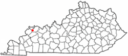 Location of Corydon, Kentucky | |
| Coordinates: 37°44′29″N 87°42′24″W / 37.74139°N 87.70667°WCoordinates: 37°44′29″N 87°42′24″W / 37.74139°N 87.70667°W | |
| Country | United States |
| State | Kentucky |
| County | Henderson |
| Area | |
| • Total | 0.5 sq mi (1.4 km2) |
| • Land | 0.5 sq mi (1.4 km2) |
| • Water | 0.0 sq mi (0.0 km2) |
| Elevation | 456 ft (139 m) |
| Population (2000) | |
| • Total | 744 |
| • Density | 1,393.6/sq mi (538.1/km2) |
| Time zone | Central (CST) (UTC-6) |
| • Summer (DST) | CDT (UTC-5) |
| ZIP code | 42406 |
| Area code(s) | 270 & 364 |
| FIPS code | 21-17686 |
| GNIS feature ID | 0490133 |
Corydon (/ˈkɒrᵻdən/) is a 5th-class city and former coal town in Henderson County, Kentucky, United States. The population was 744 at the 2000 census. Settled in 1848, the city is named for the hero of the 19th-century song "Pastoral Elegy"[1] who was himself named for a lovesick shepherd in Virgil's Eclogues.[2]
Geography
Corydon is located at 37°44′29″N 87°42′24″W / 37.74139°N 87.70667°W (37.741459, -87.706774).[3]
According to the United States Census Bureau, the city has a total area of 0.5 square miles (1.3 km2), all land.
Demographics
| Historical population | |||
|---|---|---|---|
| Census | Pop. | %± | |
| 1870 | 247 | — | |
| 1880 | 544 | 120.2% | |
| 1890 | 777 | 42.8% | |
| 1900 | 782 | 0.6% | |
| 1910 | 942 | 20.5% | |
| 1920 | 1,019 | 8.2% | |
| 1930 | 721 | −29.2% | |
| 1940 | 787 | 9.2% | |
| 1950 | 742 | −5.7% | |
| 1960 | 746 | 0.5% | |
| 1970 | 880 | 18.0% | |
| 1980 | 874 | −0.7% | |
| 1990 | 790 | −9.6% | |
| 2000 | 744 | −5.8% | |
| 2010 | 720 | −3.2% | |
| Est. 2015 | 707 | [4] | −1.8% |
As of the census of 2000,[6] there were 744 people, 271 households, and 204 families residing in the city. The population density was 1,393.6 people per square mile (542.0/km²). There were 295 housing units at an average density of 552.6 per square mile (214.9/km²). The racial makeup of the city was 90.46% White, 9.01% Black or African American, 0.13% from other races, and 0.40% from two or more races. Hispanic or Latino of any race were 0.40% of the population.
There were 271 households out of which 34.3% had children under the age of 18 living with them, 63.5% were married couples living together, 8.1% had a female householder with no husband present, and 24.7% were non-families. 20.3% of all households were made up of individuals and 9.6% had someone living alone who was 65 years of age or older. The average household size was 2.75 and the average family size was 3.18.
In the city the population was spread out with 28.5% under the age of 18, 8.5% from 18 to 24, 29.2% from 25 to 44, 21.6% from 45 to 64, and 12.2% who were 65 years of age or older. The median age was 34 years. For every 100 females there were 86.9 males. For every 100 females age 18 and over, there were 93.5 males.
The median income for a household in the city was $36,333, and the median income for a family was $34,773. Males had a median income of $27,019 versus $20,682 for females. The per capita income for the city was $12,790. About 3.6% of families and 6.6% of the population were below the poverty line, including 3.4% of those under age 18 and 9.1% of those age 65 or over.
Notable people
- Happy Chandler - 44th and 49th governor of Kentucky; and Commissioner of Baseball from 1945-51
- Frank Ramsey - former NBA player and coach
References
- ↑ "Dictionary of Places: Corydon". Encyclopedia of Kentucky. New York, New York: Somerset Publishers. 1987. ISBN 0-403-09981-1.
- ↑ Rennick, Robert M. Kentucky Place Names. The University Press of Kentucky (Lexington), 1988. ISBN 0-8131-0179-4.
- ↑ "US Gazetteer files: 2010, 2000, and 1990". United States Census Bureau. 2011-02-12. Retrieved 2011-04-23.
- ↑ "Annual Estimates of the Resident Population for Incorporated Places: April 1, 2010 to July 1, 2015". Retrieved July 2, 2016.
- ↑ "Census of Population and Housing". Census.gov. Archived from the original on May 11, 2015. Retrieved June 4, 2015.
- ↑ "American FactFinder". United States Census Bureau. Archived from the original on 2013-09-11. Retrieved 2008-01-31.
Municipalities and communities of Henderson County, Kentucky, United States | ||
|---|---|---|
| Cities | 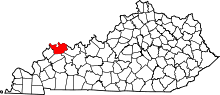 | |
| CDP | ||
| Other communities | ||
| Ghost town | ||