Concord, Kentucky
| Concord, Kentucky | |
|---|---|
| City | |
 Location in Lewis County and the state of Kentucky. | |
| Coordinates: 38°41′14″N 83°29′27″W / 38.68722°N 83.49083°WCoordinates: 38°41′14″N 83°29′27″W / 38.68722°N 83.49083°W | |
| Country | United States |
| State | Kentucky |
| County | Lewis |
| Area | |
| • Total | 0.1 sq mi (0.2 km2) |
| • Land | 0.1 sq mi (0.2 km2) |
| • Water | 0.0 sq mi (0.0 km2) |
| Elevation | 541 ft (165 m) |
| Population (2000) | |
| • Total | 28 |
| • Density | 478.4/sq mi (184.7/km2) |
| Time zone | Eastern (EST) (UTC-5) |
| • Summer (DST) | EDT (UTC-4) |
| ZIP code | 41179 |
| Area code(s) | 606 |
| FIPS code | 21-16894 |
| GNIS feature ID | 0489919 |
Concord is a class-6 city in Lewis County, Kentucky, in the United States. The population was 28 at the 2000 census. It is part of the Maysville Micropolitan Statistical Area.
Geography
Concord is located at 38°41′14″N 83°29′27″W / 38.68722°N 83.49083°W (38.687320, -83.490696).[1]
According to the United States Census Bureau, the city has a total area of 0.1 square miles (0.26 km2), of which 0.1 square miles (0.26 km2) is land and 0.04 square miles (0.10 km2) is water, a total area of 28.57%.
Demographics
| Historical population | |||
|---|---|---|---|
| Census | Pop. | %± | |
| 1870 | 228 | — | |
| 1880 | 178 | −21.9% | |
| 1890 | 188 | 5.6% | |
| 1900 | 200 | 6.4% | |
| 1910 | 213 | 6.5% | |
| 1920 | 194 | −8.9% | |
| 1930 | 164 | −15.5% | |
| 1940 | 160 | −2.4% | |
| 1950 | 142 | −11.2% | |
| 1960 | 83 | −41.5% | |
| 1970 | 108 | 30.1% | |
| 1980 | 67 | −38.0% | |
| 1990 | 65 | −3.0% | |
| 2000 | 28 | −56.9% | |
| 2010 | 35 | 25.0% | |
| Est. 2015 | 35 | [2] | 0.0% |
As of the census[4] of 2000, there were 28 people, 13 households, and 9 families residing in the city. The population density was 478.4 people per square mile (180.2/km²). There were 16 housing units at an average density of 273.4 per square mile (103.0/km²). The racial makeup of the city was 96.43% White, and 3.57% from two or more races.
There were 13 households out of which 23.1% had children under the age of 18 living with them, 53.8% were married couples living together, 7.7% had a female householder with no husband present, and 23.1% were non-families. 15.4% of all households were made up of individuals and 7.7% had someone living alone who was 65 years of age or older. The average household size was 2.15 and the average family size was 2.30.
In the city the population was spread out with 14.3% under the age of 18, 7.1% from 18 to 24, 17.9% from 25 to 44, 50.0% from 45 to 64, and 10.7% who were 65 years of age or older. The median age was 50 years. For every 100 females there were 115.4 males. For every 100 females age 18 and over, there were 118.2 males.
The median income for a household in the city was $18,125, and the median income for a family was $20,625. Males had a median income of $11,250 versus $0 for females. The per capita income for the city was $7,897. There were no families and 23.3% of the population living below the poverty line, including no under eighteens and none of those over 64.
See also
References
- ↑ "US Gazetteer files: 2010, 2000, and 1990". United States Census Bureau. 2011-02-12. Retrieved 2011-04-23.
- ↑ "Annual Estimates of the Resident Population for Incorporated Places: April 1, 2010 to July 1, 2015". Retrieved July 2, 2016.
- ↑ "Census of Population and Housing". Census.gov. Archived from the original on May 11, 2015. Retrieved June 4, 2015.
- ↑ "American FactFinder". United States Census Bureau. Archived from the original on 2013-09-11. Retrieved 2008-01-31.
Municipalities and communities of Lewis County, Kentucky, United States | ||
|---|---|---|
| Cities | 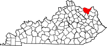 | |
| CDP |
| |
| Other unincorporated communities | ||