Clyde, Ohio
| Clyde, Ohio | |
|---|---|
| City | |
|
Downtown Clyde, Ohio on South Main Street. | |
 Location of Clyde, Ohio | |
 Location of Clyde in Sandusky County | |
| Coordinates: 41°18′18″N 82°58′36″W / 41.30500°N 82.97667°WCoordinates: 41°18′18″N 82°58′36″W / 41.30500°N 82.97667°W | |
| Country | United States |
| State | Ohio |
| County | Sandusky |
| Government | |
| • Type | council-manager |
| • City manager | Paul Fiser |
| • Mayor | Scott Black |
| Area[1] | |
| • Total | 5.09 sq mi (13.18 km2) |
| • Land | 5.04 sq mi (13.05 km2) |
| • Water | 0.05 sq mi (0.13 km2) |
| Elevation[2] | 696 ft (212 m) |
| Population (2010)[3] | |
| • Total | 6,325 |
| • Estimate (2012[4]) | 6,297 |
| • Density | 1,255.0/sq mi (484.6/km2) |
| Time zone | Eastern (EST) (UTC-5) |
| • Summer (DST) | EDT (UTC-4) |
| ZIP code | 43410 |
| Area code(s) | 419 |
| FIPS code | 39-16308[5] |
| GNIS feature ID | 1056817[2] |
| Website | http://www.clydeohio.org/ |

Clyde /ˈklaɪd/[6] is a city in Sandusky County, Ohio, United States. The population was 6,325 at the 2010 census. The National Arbor Day Foundation has designated Clyde as a Tree City USA.
The town is known for having served as inspiration for the setting of Sherwood Anderson's 1919 collection of short stories Winesburg, Ohio.[7]
History
In the 1700s, the area of Ohio including present-day Clyde was inhabited by the Wyandot tribe.[8] The first American settlers in the area arrived in 1820.[9]
Clyde was named after Clyde, New York.[10]
Early in the 20th Century, Clyde joined the automobile revolution, hosting the pioneering brass era company, Elmore Manufacturing Company.
The Whirlpool Corporation purchased the Clyde Porcelain Steel Co. in 1952 and began producing washing machines there and then purchased the adjacent property of the Bendix Corporation in 1954, that produced belt-driven washing machines, making it the sole producer of washing machines in the area for the next six decades.
Geography
Clyde is located at 41°18′18″N 82°58′36″W / 41.30500°N 82.97667°W (41.304912, -82.976529).[11]
According to the United States Census Bureau, the city has a total area of 5.09 square miles (13.18 km2), of which 5.04 square miles (13.05 km2) is land and 0.05 square miles (0.13 km2) is water.[1]
Demographics
| Historical population | |||
|---|---|---|---|
| Census | Pop. | %± | |
| 1860 | 701 | — | |
| 1880 | 2,380 | — | |
| 1890 | 2,327 | −2.2% | |
| 1900 | 2,515 | 8.1% | |
| 1910 | 2,815 | 11.9% | |
| 1920 | 3,099 | 10.1% | |
| 1930 | 3,159 | 1.9% | |
| 1940 | 3,174 | 0.5% | |
| 1950 | 4,083 | 28.6% | |
| 1960 | 4,826 | 18.2% | |
| 1970 | 5,503 | 14.0% | |
| 1980 | 5,489 | −0.3% | |
| 1990 | 5,776 | 5.2% | |
| 2000 | 6,064 | 5.0% | |
| 2010 | 6,325 | 4.3% | |
| Est. 2015 | 6,260 | [12] | −1.0% |
| Sources:[5][13][14][15][16][17] | |||
2010 census
As of the census[3] of 2010, there were 6,325 people, 2,484 households, and 1,687 families residing in the city. The population density was 1,255.0 inhabitants per square mile (484.6/km2). There were 2,707 housing units at an average density of 537.1 per square mile (207.4/km2). The racial makeup of the city was 94.4% White, 0.6% African American, 0.3% Native American, 0.4% Asian, 1.5% from other races, and 2.7% from two or more races. Hispanic or Latino of any race were 5.9% of the population.
There were 2,484 households of which 35.5% had children under the age of 18 living with them, 47.0% were married couples living together, 14.7% had a female householder with no husband present, 6.3% had a male householder with no wife present, and 32.1% were non-families. 26.8% of all households were made up of individuals and 12.2% had someone living alone who was 65 years of age or older. The average household size was 2.50 and the average family size was 2.99.
The median age in the city was 37.4 years. 26.3% of residents were under the age of 18; 8.1% were between the ages of 18 and 24; 25.7% were from 25 to 44; 26.1% were from 45 to 64; and 13.8% were 65 years of age or older. The gender makeup of the city was 48.7% male and 51.3% female.
2000 census
As of the census[5] of 2000, there were 6,064 people, 2,304 households, and 1,633 families residing in the city. The population density was 1,381.5 people per square mile (533.3/km²). There were 2,471 housing units at an average density of 563.0 per square mile (217.3/km²). The racial makeup of the city was 96.04% White, 0.15% African American, 0.12% Native American, 0.26% Asian, 0.03% Pacific Islander, 2.21% from other races, and 1.19% from two or more races. Hispanic or Latino of any race were 4.70% of the population.
There were 2,304 households out of which 35.0% had children under the age of 18 living with them, 53.9% were married couples living together, 12.4% had a female householder with no husband present, and 29.1% were non-families. 24.4% of all households were made up of individuals and 9.5% had someone living alone who was 65 years of age or older. The average household size was 2.59 and the average family size was 3.07.
In the city the population was spread out with 27.0% under the age of 18, 8.7% from 18 to 24, 29.3% from 25 to 44, 22.2% from 45 to 64, and 12.8% who were 65 years of age or older. The median age was 35 years. For every 100 females there were 91.7 males. For every 100 females age 18 and over, there were 89.4 males.
The median income for a household in the city was $39,764, and the median income for a family was $45,646. Males had a median income of $32,189 versus $23,549 for females. The per capita income for the city was $17,966. About 6.8% of families and 8.6% of the population were below the poverty line, including 11.4% of those under age 18 and 7.9% of those age 65 or over.
Education
Clyde is served by the Clyde-Green Springs school district. The nickname for Clyde's school sports teams is the Clyde Fliers.[18]
Schools
- Clyde High School (Grades 9-12)
- Clyde Elementary School (Grades K-4)
- McPherson Middle School (Grades 6-8)
Economy
Clyde is the home of a Whirlpool Corporation plant. Whirlpool faced a lawsuit in 2013, that was dropped in August 2015, for the formerly alleged causing of the Clyde cancer cluster.
Media
Clyde was served in print by the weekly newspaper The Clyde Enterprise for nearly 138 years, until its closure by Civitas Media in 2016.[19]
Clean Air Radio Network, a Christian radio network broadcasting in Clyde, Findlay, and Coshocton, is owned and operated by Harvest Baptist Temple in Clyde.[20]
Notable people
- Sherwood Anderson - author
- Karl Anderson- artist
- Tim Anderson - professional football player
- Thaddeus B. Hurd - local historian
- Charles H. McCleary - Medal of Honor recipient, Civil War[21][22]
- James B. McPherson - Union major general[23]
- George Burton Meek- First American killed in the Spanish-American War
- George W. Norris - United States Senator from Nebraska[24]
- Rodger Young - Medal of Honor recipient, World War II[25]
References
- 1 2 "US Gazetteer files 2010". United States Census Bureau. Archived from the original on 2012-06-26. Retrieved 2013-01-06.
- 1 2 "US Board on Geographic Names". United States Geological Survey. 2007-10-25. Retrieved 2008-01-31.
- 1 2 "American FactFinder". United States Census Bureau. Retrieved 2013-01-06.
- ↑ "Population Estimates". United States Census Bureau. Archived from the original on 2013-06-17. Retrieved 2013-06-17.
- 1 2 3 "American FactFinder". United States Census Bureau. Archived from the original on 2013-09-11. Retrieved 2008-01-31.
- ↑ "A Pronunciation Guide to Places in Ohio". E.W.Scripps School of Journalism. Retrieved 2008-12-19.
- ↑ Winesburg, Ohio, Sherwood Anderson, 1919. Chapter 1. Accessed 13 May 2007.
- ↑ Buser, C.A. "Wyandots in Ohio". Wyandotte Nation. Retrieved 28 June 2016.
- ↑ These Things Stay By You. Whirlpool Corporation. 1966. Retrieved 28 June 2016.
- ↑ Meek, Basil (1909). Twentieth Century History of Sandusky County, Ohio and Representative Citizens. Whipporwill Publications. p. 311.
- ↑ "US Gazetteer files: 2010, 2000, and 1990". United States Census Bureau. 2011-02-12. Retrieved 2011-04-23.
- ↑ "Annual Estimates of the Resident Population for Incorporated Places: April 1, 2010 to July 1, 2015". Retrieved July 2, 2016.
- ↑ "Population: Ohio" (PDF). 1910 U.S. Census. U.S. Census Bureau. Retrieved 28 November 2013.
- ↑ "Population: Ohio" (PDF). 1930 US Census. U.S. Census Bureau. Retrieved 28 November 2013.
- ↑ "Number of Inhabitants: Ohio" (PDF). 18th Census of the United States. U.S. Census Bureau. Retrieved 22 November 2013.
- ↑ "Ohio: Population and Housing Unit Counts" (PDF). U.S. Census Bureau. Retrieved 22 November 2013.
- ↑ "Incorporated Places and Minor Civil Divisions Datasets: Subcounty Population Estimates: April 1, 2010 to July 1, 2012". U.S. Census Bureau. Archived from the original on 17 June 2013. Retrieved 25 November 2013.
- ↑ Clyde-Green Springs Schools. Accessed 13 May 2007.
- ↑ Brooks, Rebecca R. (1 June 2016). "Clyde, Bellevue newspapers cease operation". Gannett. The News-Messenger. Retrieved 8 July 2016.
- ↑ "About". Clean Air Radio Network. Retrieved 8 July 2016.
- ↑ "Captain Charles H. McCleary, Recipient of the Medal of Honor". Rutherford B. Hayes Presidential Center. Retrieved 28 June 2016.
- ↑ Wilhelm, Roy (11 December 2015). "County's McCleary earned Medal of Honor at Shy's Hill". Gannett. Port Clinton News Herald. Retrieved 8 July 2016.
- ↑ James Birdseye McPherson, Major General, Union Commander, Army of Tennessee www.ngeorgia.com. Wayne Bengston, contributing editor. Accessed 13 May 2007.
- ↑ NORRIS, George William - Biographical Information. Biographical Dictionary of the United States Congress. Accessed 13 May 2007.
- ↑ "Rodger W. Young". Ohio History Central. Ohio History Connection. Retrieved 8 July 2016.
External links
| Wikimedia Commons has media related to Clyde, Ohio. |
Municipalities and communities of Sandusky County, Ohio, United States | ||
|---|---|---|
| Cities | 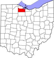 | |
| Villages | ||
| Townships | ||
| CDPs | ||
| Unincorporated communities | ||
| Footnotes | ‡This populated place also has portions in an adjacent county or counties | |