Clear Creek Township, Cooper County, Missouri
| Clear Creek Township | |
|---|---|
| Township | |
|
Location in Cooper County | |
| Coordinates: 38°51′57″N 92°59′15″W / 38.86583°N 92.98750°WCoordinates: 38°51′57″N 92°59′15″W / 38.86583°N 92.98750°W | |
| Country |
|
| State |
|
| County | Cooper |
| Area | |
| • Total | 50.44 sq mi (130.64 km2) |
| • Land | 50.32 sq mi (130.34 km2) |
| • Water | 0.12 sq mi (0.3 km2) 0.23% |
| Elevation | 830 ft (253 m) |
| Population (2000) | |
| • Total | 439 |
| • Density | 8.7/sq mi (3.4/km2) |
| Time zone | CST (UTC-6) |
| • Summer (DST) | CDT (UTC-5) |
| ZIP codes | 65276, 65348 |
| GNIS feature ID | 0766529 |
Clear Creek Township is one of fourteen townships in Cooper County, Missouri, USA. As of the 2000 census, its population was 439.[1]
Clear Creek Township was named after the creek of the same name within its borders.[2]
Geography
According to the United States Census Bureau, Clear Creek Township covers an area of 50.44 square miles (130.64 square kilometers); of this, 50.32 square miles (130.34 square kilometers, 99.77 percent) is land and 0.12 square miles (0.3 square kilometers, 0.23 percent) is water.
Unincorporated towns
- Harriston at 38°50′04″N 92°56′54″W / 38.834465°N 92.948251°W
- Hoffman at 38°50′37″N 92°56′43″W / 38.843632°N 92.945195°W
- Pleasant Green at 38°48′22″N 92°57′46″W / 38.806131°N 92.962696°W
(This list is based on USGS data and may include former settlements.)
Extinct towns
(These towns are listed as "historical" by the USGS.)
Adjacent townships
- Blackwater Township (north)
- Pilot Grove Township (northeast)
- Palestine Township (east)
- Lebanon Township (southeast)
- Otterville Township (south)
- Bowling Green Township, Pettis County (southwest)
- Heath Creek Township, Pettis County (west)
Cemeteries
The township contains these two cemeteries: Lamine and Sowers.
Major highways
Lakes
- Goose Lake
School districts
- Otterville R-Vi
- Pilot Grove C-4
- Smithton R-Vi
Political districts
- Missouri's 6th congressional district
- State House District 117
- State Senate District 21
Notable people
- Clark Griffith, baseball pitcher, manager, and team owner.
References
- United States Census Bureau 2008 TIGER/Line Shapefiles
- United States Board on Geographic Names (GNIS)
- United States National Atlas
- ↑ United States Census Bureau American FactFinder
- ↑ "Cooper County Place Names, 1928–1945 (archived)". The State Historical Society of Missouri. Archived from the original on 24 June 2016. Retrieved 24 September 2016.
External links
 |
Blackwater Township | Pilot Grove Township | | |
| Heath Creek Township, Pettis County | |
Palestine Township | ||
| ||||
| | ||||
| Bowling Green Township, Pettis County | Otterville Township | Lebanon Township |
Municipalities and communities of Cooper County, Missouri, United States | ||
|---|---|---|
| Cities | 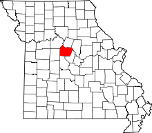 | |
| Villages | ||
| Townships | ||
| Unincorporated communities | ||
This article is issued from Wikipedia - version of the 11/26/2016. The text is available under the Creative Commons Attribution/Share Alike but additional terms may apply for the media files.