Clarence Corner, Woolloongabba
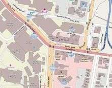
Clarence Corner is the junction of Stanley Street and Annerley Road (formerly Boggo Road) in Woolloongabba/South Brisbane in Brisbane, Queensland, Australia.[1] It gives its name to the local area.
History

The area takes its name from the Clarence Hotel that stood on the south-east corner of the intersection. The hotel was erected by builder Thomas Hayselden and the hotel obtained its license on 8 December 1863; the reason for the choice of name is not known but may have been named after the 500-ton steamship Clarence that plied between Brisbane and Sydney at that time. After installing Richard Overend as licensee in 1864, Hayselden then went on to construct the Albion Hotel which gave its name to the suburb of Albion today.[2][3] The Clarence Hotel was a popular spot with the bullock teamsters travelling along Boggo Road which was the shorter but hillier route to Ipswich.[4]
In 1889, the Clarence Hotel was replaced by the present hotel, now known as the Clarence Corner Hotel. By that time, the area had developed as a residential and commercial district and the new hotel was built to attract that clientele. In 2014, the Clarence Corner Hotel is still in operation as a hotel and is listed on the Brisbane Heritage Register.[4] However, its clientele are more likely to be drawn from the major Mater Hospital complex that now dominates the western and northern sides of Clarence Corner.
References
- ↑ "Clarence Corner". Google Maps. Retrieved 14 December 2014.
- ↑ "THE CLARENCE CORNER.". The Brisbane Courier. National Library of Australia. 16 February 1929. p. 26. Retrieved 15 December 2014.
- ↑ "Albion Hotel". Brisbane Heritage Register. Brisbane City Council. Retrieved 15 December 2014.
- 1 2 "Clarence Corner Hotel". Brisbane Heritage Register. Brisbane City Council. Retrieved 15 December 2014.
External links
| Wikimedia Commons has media related to Clarence Corner, Woolloongabba. |
Coordinates: 27°29′08″S 153°01′45″E / 27.48553°S 153.02905°E