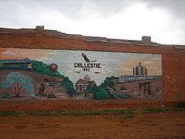
Chillicothe, Texas
| Chillicothe, Texas | |
|---|---|
| City | |
|
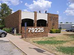
Chillicothe post office | |
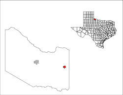
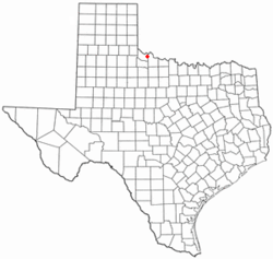 Location of Chillicothe, Texas | |
 | |
| Coordinates: 34°15′19″N 99°30′44″W / 34.25528°N 99.51222°WCoordinates: 34°15′19″N 99°30′44″W / 34.25528°N 99.51222°W | |
| Country | United States |
| State | Texas |
| County | Hardeman |
| Area | |
| • Total | 1.0 sq mi (2.6 km2) |
| • Land | 1.0 sq mi (2.6 km2) |
| • Water | 0.0 sq mi (0.0 km2) |
| Elevation | 1,401 ft (427 m) |
| Population (2000) | |
| • Total | 707 |
| • Density | 787.3/sq mi (304.0/km2) |
| Time zone | Central (CST) (UTC-6) |
| • Summer (DST) | CDT (UTC-5) |
| ZIP code | 79225 |
| Area code(s) | 940 |
| FIPS code | 48-14680[1] |
| GNIS feature ID | 1373085[2] |
Chillicothe is a city in Hardeman County, in the U.S. state of Texas. The population was 798 at the 2000 census. The population was 707 at the 2010 census.
The historical preservationist Myna Potts resides in Chillicothe. She is curator of the Medicine Mound Museum, a restoration of her late father's general store in the ghost town of Medicine Mound, located nine miles south of Chilicothe.
History
Chillicothe is on U.S. Highway 287, State Highway 91, Farm Road 2006, and the Fort Worth and Denver and Santa Fe railroads in eastern Hardeman County. It was founded in the early 1880s and developed rapidly after the construction of the Fort Worth and Denver City Railway in 1887. The community, named by A. E. Jones for his hometown in Missouri, grew up on Wanderer's Creek near the headquarters of W. H. Worsham's R2 Ranch in the 1870s. The post office was established in 1883 with Charles E. Jones as postmaster. A fire destroyed the town in 1890, and citizens rebuilt south of the rail line rather than north. Pioneers include Sam L. Crossley, who became the first mayor in 1903, J. J. Britt, J. A. Shires, and W. L. Ledbetter. Wheat elevators were constructed in 1892–93, and the town was incorporated in 1907 with a population of 800. Additional rail service from the Kansas City, Mexico and Orient Railway began in 1908. Chillicothe is called the Iris Village because of the many iris gracing the town. The population was 1,411 in 1950, 1,161 in 1960, 1,116 in 1970, and 1,052 in 1980. Chillicothe has a hospital, a library, a newspaper, and other businesses. In 1990 the population was 816, and in 2000 it was 798.
Geography
Chillicothe is located at 34°15′19″N 99°30′44″W / 34.25528°N 99.51222°W (34.255377, -99.512255).[3]
According to the United States Census Bureau, the city has a total area of 1.0 square mile (2.6 km2), all of it land.
Demographics
| Historical population | |||
|---|---|---|---|
| Census | Pop. | %± | |
| 1910 | 1,207 | — | |
| 1920 | 1,351 | 11.9% | |
| 1930 | 1,610 | 19.2% | |
| 1940 | 1,423 | −11.6% | |
| 1950 | 1,415 | −0.6% | |
| 1960 | 1,161 | −18.0% | |
| 1970 | 1,116 | −3.9% | |
| 1980 | 1,052 | −5.7% | |
| 1990 | 816 | −22.4% | |
| 2000 | 798 | −2.2% | |
| 2010 | 707 | −11.4% | |
| Est. 2015 | 660 | [4] | −6.6% |
As of the census[1] of 2000, there were 798 people, 310 households, and 212 families residing in the city. The population density was 787.3 people per square mile (305.1/km²). There were 373 housing units at an average density of 368.0 per square mile (142.6/km²). The racial makeup of the city was 87.47% White, 5.64% African American, 1.38% Native American, 4.26% from other races, and 1.25% from two or more races. Hispanic or Latino of any race were 10.90% of the population.
There were 310 households out of which 37.7% had children under the age of 18 living with them, 53.2% were married couples living together, 13.5% had a female householder with no husband present, and 31.6% were non-families. 28.7% of all households were made up of individuals and 18.1% had someone living alone who was 65 years of age or older. The average household size was 2.57 and the average family size was 3.24.
In the city the population was spread out with 31.1% under the age of 18, 6.1% from 18 to 24, 26.2% from 25 to 44, 21.2% from 45 to 64, and 15.4% who were 65 years of age or older. The median age was 35 years. For every 100 females there were 84.3 males. For every 100 females age 18 and over, there were 75.7 males.
The median income for a household in the city was $25,625, and the median income for a family was $31,250. Males had a median income of $26,645 versus $20,333 for females. The per capita income for the city was $12,450. About 17.0% of families and 16.7% of the population were below the poverty line, including 18.7% of those under age 18 and 13.5% of those age 65 or over.
Education
The City of Chillicothe is served by the Chillicothe Independent School District and home to Chillicothe High School
Climate
According to the Köppen Climate Classification system, Chillicothe has a semi-arid climate, abbreviated "BSk" on climate maps.[6]
Gallery
-
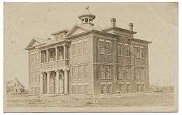
Chillicothe High School, 1911
-
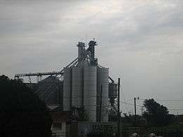
Grain elevator at Chillicothe
Notable people
- Monroe Parker, college president.
- Herschel Ramsey, professional football player.
- Lew Williams, rockabilly singer.
- (Hoyt) Clay Puett, born here in 1899-Inventor of Electric Starting Gate
References
- 1 2 "American FactFinder". United States Census Bureau. Archived from the original on 2013-09-11. Retrieved 2008-01-31.
- ↑ "US Board on Geographic Names". United States Geological Survey. 2007-10-25. Retrieved 2008-01-31.
- ↑ "US Gazetteer files: 2010, 2000, and 1990". United States Census Bureau. 2011-02-12. Retrieved 2011-04-23.
- ↑ "Annual Estimates of the Resident Population for Incorporated Places: April 1, 2010 to July 1, 2015". Retrieved July 2, 2016.
- ↑ "Census of Population and Housing". Census.gov. Archived from the original on May 11, 2015. Retrieved June 4, 2015.
- ↑ Climate Summary for Chillicothe, Texas
External links
- Chillicothe ISD - Official site.
Municipalities and communities of Hardeman County, Texas, United States | ||
|---|---|---|
| Cities | 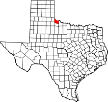 | |
| Ghost towns | ||