Chester, Iowa
| Chester, Iowa | |
|---|---|
| City | |
|
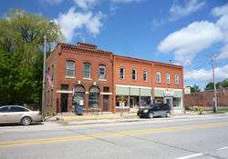
Downtown Chester | |
 Location of Chester, Iowa | |
| Coordinates: 43°29′28″N 92°21′40″W / 43.49111°N 92.36111°WCoordinates: 43°29′28″N 92°21′40″W / 43.49111°N 92.36111°W | |
| Country | United States |
| State | Iowa |
| County | Howard |
| Area[1] | |
| • Total | 1.34 sq mi (3.47 km2) |
| • Land | 1.34 sq mi (3.47 km2) |
| • Water | 0 sq mi (0 km2) |
| Elevation | 1,227 ft (374 m) |
| Population (2010)[2] | |
| • Total | 127 |
| • Estimate (2012[3]) | 127 |
| • Density | 94.8/sq mi (36.6/km2) |
| Time zone | Central (CST) (UTC-6) |
| • Summer (DST) | CDT (UTC-5) |
| ZIP code | 52134 |
| Area code(s) | 563 |
| FIPS code | 19-13125 |
| GNIS feature ID | 0455379 |
Chester is a city in Howard County, Iowa, United States. The population was 127 in the 2010 census, a decrease of 15.9% from the 151 population in the 2000 census.[4][5] Chester is located just across the state line from Minnesota.
History
Chester was laid out in 1858.[6]
Geography
Chester is located at 43°29′28″N 92°21′40″W / 43.49111°N 92.36111°W (43.491126, -92.361196).[7]
According to the United States Census Bureau, the city has a total area of 1.34 square miles (3.47 km2), all of it land.[1]
Demographics
| Historical population | |||
|---|---|---|---|
| Census | Pop. | %± | |
| 1880 | 101 | — | |
| 1910 | 266 | — | |
| 1920 | 237 | −10.9% | |
| 1930 | 238 | 0.4% | |
| 1940 | 234 | −1.7% | |
| 1950 | 226 | −3.4% | |
| 1960 | 211 | −6.6% | |
| 1970 | 185 | −12.3% | |
| 1980 | 175 | −5.4% | |
| 1990 | 158 | −9.7% | |
| 2000 | 151 | −4.4% | |
| 2010 | 127 | −15.9% | |
| Est. 2015 | 125 | [8] | −1.6% |
2010 census
As of the census[2] of 2010, there were 127 people, 64 households, and 36 families residing in the city. The population density was 94.8 inhabitants per square mile (36.6/km2). There were 77 housing units at an average density of 57.5 per square mile (22.2/km2). The racial makeup of the city was 99.2% White and 0.8% Native American. Hispanic or Latino of any race were 0.8% of the population.
There were 64 households of which 17.2% had children under the age of 18 living with them, 42.2% were married couples living together, 4.7% had a female householder with no husband present, 9.4% had a male householder with no wife present, and 43.8% were non-families. 40.6% of all households were made up of individuals and 21.8% had someone living alone who was 65 years of age or older. The average household size was 1.98 and the average family size was 2.58.
The median age in the city was 48.8 years. 17.3% of residents were under the age of 18; 5.5% were between the ages of 18 and 24; 20.5% were from 25 to 44; 27.5% were from 45 to 64; and 29.1% were 65 years of age or older. The gender makeup of the city was 55.1% male and 44.9% female.
2000 census
As of the census of 2000, there were 151 people, 71 households, and 47 families residing in the city. The population density was 113.2 people per square mile (43.8/km²). There were 82 housing units at an average density of 61.5 per square mile (23.8/km²). The racial makeup of the city was 99.34% White, 0.66% from other races. Hispanic or Latino of any race were 1.32% of the population.
There were 71 households out of which 22.5% had children under the age of 18 living with them, 56.3% were married couples living together, 8.5% had a female householder with no husband present, and 33.8% were non-families. 31.0% of all households were made up of individuals and 21.1% had someone living alone who was 65 years of age or older. The average household size was 2.13 and the average family size was 2.64.
In the city the population was spread out with 19.2% under the age of 18, 5.3% from 18 to 24, 22.5% from 25 to 44, 24.5% from 45 to 64, and 28.5% who were 65 years of age or older. The median age was 48 years. For every 100 females there were 81.9 males. For every 100 females age 18 and over, there were 71.8 males.
The median income for a household in the city was $21,875, and the median income for a family was $40,625. Males had a median income of $28,438 versus $21,667 for females. The per capita income for the city was $18,240. There were 4.7% of families and 8.2% of the population living below the poverty line, including 22.2% of under eighteens and none of those over 64.
References
- 1 2 "US Gazetteer files 2010". United States Census Bureau. Archived from the original on 2012-01-24. Retrieved 2012-05-11.
- 1 2 "American FactFinder". United States Census Bureau. Retrieved 2012-05-11.
- ↑ "Population Estimates". United States Census Bureau. Archived from the original on 2013-06-17. Retrieved 2013-05-23.
- ↑ "Population & Housing Occupancy Status 2010". United States Census Bureau American FactFinder. Archived from the original on 2011-07-21. Retrieved 2011-08-02.
- ↑ "Data from the 2010 Census". State Data Center of Iowa. Archived from the original on 2011-07-18. Retrieved 2011-08-02.
- ↑ Fairbairn, Robert Herd (1919). History of Chickasaw and Howard Counties, Iowa, Volume 1. S. J. Clarke Publishing Company. p. 404.
- ↑ "US Gazetteer files: 2010, 2000, and 1990". United States Census Bureau. 2011-02-12. Retrieved 2011-04-23.
- ↑ "Annual Estimates of the Resident Population for Incorporated Places: April 1, 2010 to July 1, 2015". Retrieved July 2, 2016.
- ↑ "Census of Population and Housing". Census.gov. Archived from the original on May 11, 2015. Retrieved June 4, 2015.
External links
| Wikimedia Commons has media related to Chester, Iowa. |
- City-Data Comprehensive statistical data and more about Chester
Municipalities and communities of Howard County, Iowa, United States | ||
|---|---|---|
| Cities | ||
| Unincorporated community | ||
| Footnotes | ‡This populated place also has portions in an adjacent county or counties | |