Chelsea, South Dakota
| Chelsea, South Dakota | |
|---|---|
| Town | |
 Location in Faulk County and the state of South Dakota | |
| Coordinates: 45°10′3″N 98°44′26″W / 45.16750°N 98.74056°WCoordinates: 45°10′3″N 98°44′26″W / 45.16750°N 98.74056°W | |
| Country | United States |
| State | South Dakota |
| County | Faulk |
| Incorporated | 1906[1] |
| Area[2] | |
| • Total | 0.32 sq mi (0.83 km2) |
| • Land | 0.32 sq mi (0.83 km2) |
| • Water | 0 sq mi (0 km2) |
| Elevation | 1,352 ft (412 m) |
| Population (2010)[3] | |
| • Total | 27 |
| • Estimate (2012[4]) | 27 |
| • Density | 84.4/sq mi (32.6/km2) |
| Time zone | Central (CST) (UTC-6) |
| • Summer (DST) | CDT (UTC-5) |
| Area code(s) | 605 |
| FIPS code | 46-11500[5] |
| GNIS feature ID | 1254339[6] |
Chelsea is a town in Faulk County, South Dakota, United States. The population was 27 at the 2010 census.
The town was named after Chelsea, London, perhaps via Chelsea, Massachusetts.[7]
Geography
Chelsea is located at 45°10′3″N 98°44′26″W / 45.16750°N 98.74056°W (45.167611, -98.740673).[8]
According to the United States Census Bureau, the town has a total area of 0.32 square miles (0.83 km2), all of it land.[2]
The town was founded in 1906.
Demographics
| Historical population | |||
|---|---|---|---|
| Census | Pop. | %± | |
| 1920 | 110 | — | |
| 1930 | 84 | −23.6% | |
| 1940 | 51 | −39.3% | |
| 1950 | 41 | −19.6% | |
| 1960 | 53 | 29.3% | |
| 1970 | 45 | −15.1% | |
| 1980 | 41 | −8.9% | |
| 1990 | 33 | −19.5% | |
| 2000 | 33 | 0.0% | |
| 2010 | 27 | −18.2% | |
| Est. 2015 | 26 | [9] | −3.7% |
2010 census
As of the census[3] of 2010, there were 27 people, 13 households, and 8 families residing in the town. The population density was 84.4 inhabitants per square mile (32.6/km2). There were 15 housing units at an average density of 46.9 per square mile (18.1/km2). The racial makeup of the town was 100.0% White.
There were 13 households of which 30.8% had children under the age of 18 living with them, 46.2% were married couples living together, 7.7% had a female householder with no husband present, 7.7% had a male householder with no wife present, and 38.5% were non-families. 38.5% of all households were made up of individuals and 30.8% had someone living alone who was 65 years of age or older. The average household size was 2.08 and the average family size was 2.75.
The median age in the town was 53.5 years. 22.2% of residents were under the age of 18; 0.0% were between the ages of 18 and 24; 22.2% were from 25 to 44; 25.9% were from 45 to 64; and 29.6% were 65 years of age or older. The gender makeup of the town was 51.9% male and 48.1% female.
2000 census
As of the census[5] of 2000, there were 33 people, 13 households, and 7 families residing in the town. The population density was 104.0 people per square mile (39.8/km²). There were 15 housing units at an average density of 47.3 per square mile (18.1/km²). The racial makeup of the town was 100.00% White.
There were 13 households out of which 38.5% had children under the age of 18 living with them, 53.8% were married couples living together, and 38.5% were non-families. 38.5% of all households were made up of individuals and none had someone living alone who was 65 years of age or older. The average household size was 2.54 and the average family size was 3.50.
In the town the population was spread out with 27.3% under the age of 18, 9.1% from 18 to 24, 33.3% from 25 to 44, 24.2% from 45 to 64, and 6.1% who were 65 years of age or older. The median age was 36 years. For every 100 females there were 135.7 males. For every 100 females age 18 and over, there were 140.0 males.
The median income for a household in the town was $11,875, and the median income for a family was $23,750. Males had a median income of $13,750 versus $16,875 for females. The per capita income for the town was $9,056. There were 50.0% of families and 43.8% of the population living below the poverty line, including 100.0% of under eighteens and none of those over 64.
References
- ↑ "SD Towns" (PDF). South Dakota State Historical Society. Archived from the original (PDF) on 2010-02-10. Retrieved 2010-02-11.
- 1 2 "US Gazetteer files 2010". United States Census Bureau. Archived from the original on 2012-01-24. Retrieved 2012-06-21.
- 1 2 "American FactFinder". United States Census Bureau. Retrieved 2012-06-21.
- ↑ "Population Estimates". United States Census Bureau. Archived from the original on 2013-06-17. Retrieved 2013-05-29.
- 1 2 "American FactFinder". United States Census Bureau. Archived from the original on 2013-09-11. Retrieved 2008-01-31.
- ↑ "US Board on Geographic Names". United States Geological Survey. 2007-10-25. Retrieved 2008-01-31.
- ↑ Federal Writers' Project (1940). South Dakota place-names, v.1-3. University of South Dakota. p. 30.
- ↑ "US Gazetteer files: 2010, 2000, and 1990". United States Census Bureau. 2011-02-12. Retrieved 2011-04-23.
- ↑ "Annual Estimates of the Resident Population for Incorporated Places: April 1, 2010 to July 1, 2015". Retrieved July 2, 2016.
- ↑ "Census of Population and Housing". Census.gov. Archived from the original on May 11, 2015. Retrieved June 4, 2015.
Municipalities and communities of Faulk County, South Dakota, United States | ||
|---|---|---|
| City | 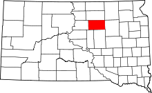 | |
| Towns | ||
| Unincorporated communities | ||