Chasseneuil
For the commune of the Charente department, see Chasseneuil-sur-Bonnieure.
| Chasseneuil Chasseneuil-en-Berry | |
|---|---|
|
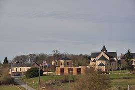
A general view of Chasseneuil | |
 Chasseneuil | |
|
Location within Centre-Val de Loire region  Chasseneuil | |
| Coordinates: 45°49′29″N 0°27′03″E / 45.8247°N 0.4508°ECoordinates: 45°49′29″N 0°27′03″E / 45.8247°N 0.4508°E | |
| Country | France |
| Region | Centre-Val de Loire |
| Department | Indre |
| Arrondissement | Châteauroux |
| Canton | Argenton-sur-Creuse |
| Intercommunality | Communauté de communes du pays d'Argenton-sur-Creuse |
| Government | |
| • Mayor (2008–2014) | Claude Dauzier |
| Area1 | 29.85 km2 (11.53 sq mi) |
| Population (2011)2 | 675 |
| • Density | 23/km2 (59/sq mi) |
| Time zone | CET (UTC+1) |
| • Summer (DST) | CEST (UTC+2) |
| INSEE/Postal code | 36800 / 366042 |
| Elevation | 93–177 m (305–581 ft) |
|
1 French Land Register data, which excludes lakes, ponds, glaciers > 1 km² (0.386 sq mi or 247 acres) and river estuaries. 2 Population without double counting: residents of multiple communes (e.g., students and military personnel) only counted once. | |
Chasseneuil is a commune in the Indre department in central France.
Population
| Historical population | ||
|---|---|---|
| Year | Pop. | ±% |
| 1793 | 450 | — |
| 1800 | 856 | +90.2% |
| 1806 | 892 | +4.2% |
| 1821 | 1,070 | +20.0% |
| 1831 | 1,053 | −1.6% |
| 1841 | 1,038 | −1.4% |
| 1851 | 1,147 | +10.5% |
| 1861 | 1,049 | −8.5% |
| 1872 | 1,881 | +79.3% |
| 1881 | 1,198 | −36.3% |
| 1891 | 1,145 | −4.4% |
| 1901 | 1,073 | −6.3% |
| 1911 | 1,107 | +3.2% |
| 1921 | 975 | −11.9% |
| 1931 | 822 | −15.7% |
| 1946 | 787 | −4.3% |
| 1954 | 760 | −3.4% |
| 1962 | 573 | −24.6% |
| 1968 | 683 | +19.2% |
| 1975 | 594 | −13.0% |
| 1982 | 573 | −3.5% |
| 1990 | 580 | +1.2% |
| 1999 | 620 | +6.9% |
| 2006 | 649 | +4.7% |
| 2011 | 675 | +4.0% |
See also
References
| Wikimedia Commons has media related to Chasseneuil. |
This article is issued from Wikipedia - version of the 3/3/2015. The text is available under the Creative Commons Attribution/Share Alike but additional terms may apply for the media files.