Cedar Township, Knox County, Illinois
| Cedar Township | |
|---|---|
| Township | |
 Location in Knox County | |
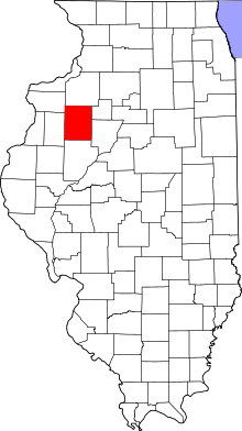 Knox County's location in Illinois | |
| Coordinates: 40°50′37″N 90°23′24″W / 40.84361°N 90.39000°WCoordinates: 40°50′37″N 90°23′24″W / 40.84361°N 90.39000°W | |
| Country |
|
| State |
|
| County | Knox |
| Established | November 2, 1852 |
| Area | |
| • Total | 36.22 sq mi (93.8 km2) |
| • Land | 36 sq mi (90 km2) |
| • Water | 0.22 sq mi (0.6 km2) 0.61% |
| Elevation | 755 ft (230 m) |
| Population (2010) | |
| • Total | 3,270 |
| • Density | 90.8/sq mi (35.1/km2) |
| Time zone | CST (UTC-6) |
| • Summer (DST) | CDT (UTC-5) |
| ZIP codes | 61401, 61410, 61436 |
| GNIS feature ID | 0428779 |
Cedar Township is one of twenty-one townships in Knox County, Illinois, USA. As of the 2010 census, its population was 3,270 and it contained 1,487 housing units.[1] Its name was changed from Cherry Grove Township on June 8, 1853.
Geography
According to the 2010 census, the township has a total area of 36.22 square miles (93.8 km2), of which 36 square miles (93 km2) (or 99.39%) is land and 0.22 square miles (0.57 km2) (or 0.61%) is water.[1]
Cities, towns, villages
- Abingdon (north three-quarters)
Unincorporated towns
(This list is based on USGS data and may include former settlements.)
Cemeteries
The township contains these three cemeteries: Abingdon, Brush Creek and Cherry Grove.
Airports and landing strips
- Malone Landing Strip
School districts
- Abingdon Community Unit School District 217
- Galesburg Community Unit School District 205
- Knoxville Community Unit School District 202
Political districts
- Illinois's 17th congressional district
- State House District 74
- State Senate District 37
References
- "Cedar Township, Knox County, Illinois". Geographic Names Information System. United States Geological Survey. Retrieved 2010-02-20.
- United States Census Bureau 2009 TIGER/Line Shapefiles
- United States National Atlas
- 1 2 "Population, Housing Units, Area, and Density: 2010 - County -- County Subdivision and Place -- 2010 Census Summary File 1". United States Census. Retrieved 2013-05-28.
External links

Municipalities and communities of Knox County, Illinois, United States | ||
|---|---|---|
| Cities | ||
| Villages | ||
| Townships | ||
| CDPs | ||
| Other unincorporated communities | ||
| Ghost towns | ||
| Footnotes | ‡This populated place also has portions in an adjacent county or counties | |
This article is issued from Wikipedia - version of the 11/17/2016. The text is available under the Creative Commons Attribution/Share Alike but additional terms may apply for the media files.