Cecilton, Maryland
| Cecilton, Maryland | ||
|---|---|---|
| Town | ||
| ||
 Location of Cecilton, Maryland | ||
| Coordinates: 39°24′11″N 75°52′10″W / 39.40306°N 75.86944°WCoordinates: 39°24′11″N 75°52′10″W / 39.40306°N 75.86944°W | ||
| Country | United States | |
| State | Maryland | |
| County | Cecil | |
| Area[1] | ||
| • Total | 0.46 sq mi (1.19 km2) | |
| • Land | 0.46 sq mi (1.19 km2) | |
| • Water | 0 sq mi (0 km2) | |
| Elevation | 69 ft (21 m) | |
| Population (2010)[2] | ||
| • Total | 663 | |
| • Estimate (2012[3]) | 665 | |
| • Density | 1,441.3/sq mi (556.5/km2) | |
| Time zone | Eastern (EST) (UTC-5) | |
| • Summer (DST) | EDT (UTC-4) | |
| ZIP code | 21913 | |
| Area code(s) | 410 | |
| FIPS code | 24-14325 | |
| GNIS feature ID | 0583638 | |
| Website | http://www.ceciltonmd.gov/ | |

Cecilton is a town in Cecil County, Maryland, United States. The population was 663 at the 2010 census.
Geography
Cecilton is located at 39°24′11″N 75°52′10″W / 39.40306°N 75.86944°W (39.402919, -75.869430).[4]
According to the United States Census Bureau, the town has a total area of 0.46 square miles (1.19 km2), all of it land.[1]
History
It is the location of Greenfields, listed on the National Register of Historic Places in 1972.[5]
Demographics
| Historical population | |||
|---|---|---|---|
| Census | Pop. | %± | |
| 1870 | 462 | — | |
| 1880 | 473 | 2.4% | |
| 1890 | 485 | 2.5% | |
| 1900 | 447 | −7.8% | |
| 1910 | 518 | 15.9% | |
| 1920 | 439 | −15.3% | |
| 1930 | 458 | 4.3% | |
| 1940 | 498 | 8.7% | |
| 1950 | 510 | 2.4% | |
| 1960 | 596 | 16.9% | |
| 1970 | 581 | −2.5% | |
| 1980 | 508 | −12.6% | |
| 1990 | 489 | −3.7% | |
| 2000 | 474 | −3.1% | |
| 2010 | 663 | 39.9% | |
| Est. 2015 | 671 | [6] | 1.2% |
2010 census
As of the census[2] of 2010, there were 663 people, 237 households, and 173 families residing in the town. The population density was 1,441.3 inhabitants per square mile (556.5/km2). There were 264 housing units at an average density of 573.9 per square mile (221.6/km2). The racial makeup of the town was 80.5% White, 11.8% African American, 0.5% Asian, 0.3% Pacific Islander, 4.8% from other races, and 2.1% from two or more races. Hispanic or Latino of any race were 7.1% of the population.
There were 237 households of which 43.9% had children under the age of 18 living with them, 44.7% were married couples living together, 19.4% had a female householder with no husband present, 8.9% had a male householder with no wife present, and 27.0% were non-families. 22.4% of all households were made up of individuals and 13.9% had someone living alone who was 65 years of age or older. The average household size was 2.80 and the average family size was 3.19.
The median age in the town was 35.4 years. 27.1% of residents were under the age of 18; 9.8% were between the ages of 18 and 24; 28.2% were from 25 to 44; 22.2% were from 45 to 64; and 12.8% were 65 years of age or older. The gender makeup of the town was 48.1% male and 51.9% female.
2000 census
As of the census[8] of 2000, there were 474 people, 198 households, and 129 families residing in the town. The population density was 1,054.6 people per square mile (406.7/km²). There were 212 housing units at an average density of 471.7 per square mile (181.9/km²). The racial makeup of the town was 74.47% White, 23.21% African American, 1.05% from other races, and 1.27% from two or more races. Hispanic or Latino of any race were 4.43% of the population.
There were 198 households out of which 31.3% had children under the age of 18 living with them, 39.4% were married couples living together, 19.2% had a female householder with no husband present, and 34.8% were non-families. 30.3% of all households were made up of individuals and 18.7% had someone living alone who was 65 years of age or older. The average household size was 2.39 and the average family size was 2.95.
In the town the population was spread out with 26.6% under the age of 18, 6.8% from 18 to 24, 27.8% from 25 to 44, 21.7% from 45 to 64, and 17.1% who were 65 years of age or older. The median age was 37 years. For every 100 females there were 88.8 males. For every 100 females age 18 and over, there were 82.2 males.
The median income for a household in the town was $38,971, and the median income for a family was $41,563. Males had a median income of $36,071 versus $23,068 for females. The per capita income for the town was $21,719. About 8.4% of families and 14.1% of the population were below the poverty line, including 19.8% of those under age 18 and 9.4% of those age 65 or over.
References
- 1 2 "US Gazetteer files 2010". United States Census Bureau. Archived from the original on 2012-01-24. Retrieved 2013-01-25.
- 1 2 "American FactFinder". United States Census Bureau. Retrieved 2013-01-25.
- ↑ "Population Estimates". United States Census Bureau. Archived from the original on 2013-06-17. Retrieved 2013-06-26.
- ↑ "US Gazetteer files: 2010, 2000, and 1990". United States Census Bureau. 2011-02-12. Retrieved 2011-04-23.
- ↑ National Park Service (2008-04-15). "National Register Information System". National Register of Historic Places. National Park Service.
- ↑ "Annual Estimates of the Resident Population for Incorporated Places: April 1, 2010 to July 1, 2015". Retrieved July 2, 2016.
- ↑ "Census of Population and Housing". Census.gov. Archived from the original on May 11, 2015. Retrieved June 4, 2015.
- ↑ "American FactFinder". United States Census Bureau. Archived from the original on 2013-09-11. Retrieved 2008-01-31.
Municipalities and communities of Cecil County, Maryland, United States | ||
|---|---|---|
| Towns | 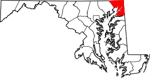 | |
| Unincorporated communities |
| |
| Ghost town | ||
| Footnotes | ‡This populated place also has portions in an adjacent county or counties | |