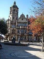
Castrop-Rauxel
| Castrop-Rauxel | ||
|---|---|---|
 | ||
| ||
 Castrop-Rauxel | ||
Location of Castrop-Rauxel within Recklinghausen district  | ||
| Coordinates: 51°33′N 7°19′E / 51.550°N 7.317°ECoordinates: 51°33′N 7°19′E / 51.550°N 7.317°E | ||
| Country | Germany | |
| State | North Rhine-Westphalia | |
| Admin. region | Münster | |
| District | Recklinghausen | |
| Government | ||
| • Mayor | Rajko Kravanja (SPD) | |
| Area | ||
| • Total | 51.66 km2 (19.95 sq mi) | |
| Population (2015-12-31)[1] | ||
| • Total | 74,220 | |
| • Density | 1,400/km2 (3,700/sq mi) | |
| Time zone | CET/CEST (UTC+1/+2) | |
| Postal codes | 44575–44581 | |
| Dialling codes |
02305, 02367 (Henrichenburg) | |
| Vehicle registration | RE, CAS, GLA | |
| Website | (German language) | |

Castrop-Rauxel (German pronunciation: [ˈkastʁɔpˈʁaʊksəl]) is a former mining city in the eastern part of the Ruhr Area in Germany.
Geography
Castrop-Rauxel is between Dortmund to the east, Bochum (south), Herne (west), and to the north, Recklinghausen, Datteln and Waltrop.
Urban Area
The urban area of Castrop-Rauxel has a total expanse of 51.66 km2 (19.95 sq mi). The Halde Schwerin is marked as the highest point of the city with 147 m over NN, the lowest point is the Pöppinghauser street beside house number 264 with 50.2 m over NN.
The city is divided into 15 districts, listed in order from north to south: Becklem, Henrichenburg, Ickern, Habinghorst, Pöppinghausen, Deininghausen, Rauxel, Bladenhorst, Behringhausen, Castrop, Dingen, Schwerin, Obercastrop, Frohlinde and Merklinde.
The total area of the city divided into different uses (31.12.2010):
| Surface | in m² | in % |
|---|---|---|
| Buildings and open spaces | 16.384.832 | 31,7% |
| Operating area | 1.497.843 | 2,9% |
| Recreation area | 2.835.924 | 5,5% |
| Traffic area | 6.191.789 | 12,0% |
| Agricultural land | 14.116.843 | 27,3% |
| Forest land | 7.938.248 | 15,4% |
| Water surface | 1.941.522 | 3,8% |
| Other uses | 758.372 | 1,5% |
| Total area | 51.665.373 | 100% |
Population figures for the individual districts (Stand: 2005):
| Districts | Population |
|---|---|
| Henrichenburg | 5.333 |
| Ickern | 16.650 |
| Habinghorst, Pöppinghausen | 9.970 |
| Deininghausen, Dingen, Rauxel | 10.056 |
| Bladenhorst, Rauxel-Nord | 6.065 |
| Schwerin | 6.672 |
| Behringhausen, Castrop, Obercastrop | 16.743 |
| Frohlinde | 3.509 |
| Merklinde | 2.621 |


History
First mentioned in 834 as "Villa Castorpe", the city of Castrop was founded in 1902 by merging the municipalities Castrop, Obercastrop and Behringhausen. On April 1, 1926 Castrop-Rauxel was formed when Castrop merged with 10 other municipalities. During World War II, a plant at Castrop-Rauxel used the Bergius process to produce synthetic (German: Ersatz) oil products.
In 1975, the village of Henrichenburg was annexed and Castrop-Rauxel became part of the Recklinghausen (district). In 1984 the last of 7 coal mines at Castrop-Rauxel ("Erin") closed.
Mayors
Lord Mayors
- 1926–1933: Mende, Centre Party (Germany) (Mayor, from 1928 Lord Mayor)
- 1933–1945: Richard Anton, NSDAP
- 1945–1946: Arnold Boerboom
- 1946–1948: Hubert Krehe, CDU
- 1948–1971: Wilhelm Kauermann, SPD
- 1971–1975: Hugo Paulikat, SPD
Mayors
- 1975–1989: Hugo Paulikat, SPD
- 1989–1999: Hans Ettrich, SPD
- 1999–2004: Nils Kruse, CDU
- 2004–2015: Johannes Beisenherz, SPD
- since 2015: Rajko Kravanja, SPD
Transportation
Castrop-Rauxel has access to three major highways, the Emscherschnellweg A 42,the Sauerlandlinie A 45 and the A 2.
There are 3 railway stations within the city. The central station (Castrop-Rauxel Hauptbahnhof) on the Cologne-Minden Railway is located in the suburb of Rauxel. Connecting Castrop-Rauxel to the western Ruhr cities like Duisburg, Oberhausen, Essen, Gelsenkirchen, Herne and in the east to Dortmund and Hamm.
The unmanned stations of Castrop-Rauxel South (Castrop-Rauxel Süd) and Castrop-Rauxel Merklinde on the Duisburg-Ruhrort–Dortmund railway have hourly services with trains to Dortmund, Herne and Dorsten.
Located in the city centre is the central bus station Muensterplatz. From here passengers can travel to almost all suburbs and to neighboring cities like Herne, Dortmund and Bochum.
The Rhine-Herne Canal runs right through Castrop-Rauxel; Castrop-Rauxel also has a small Yacht club on this body of water.
International relations
Castrop-Rauxel is twinned with:[2]
-
 Wakefield, United Kingdom[2][3]
 -
 Vincennes, France[2]
 -
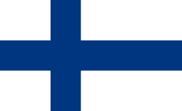 Kuopio, Finland[2]
 -
 Delft, Netherlands[2] (1950-2000)
 -
 Zehdenick, Germany[2]
 -
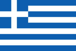 Trikala, Greece, since 2013
 -
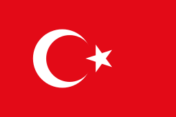 Zonguldak, Turkey, since 2013
Economy
Castrop-Rauxel has been attempting to change from a former mining city to a city with a modern lifestyle, high recreational value, new economy companies, a 27-hole golf course, and various cultural events.
Metalworking and electronics are the key manufacturing sectors.[4]
Culture
The WLT (Westphalian State Theater) is the oldest and most relevant source of theatrical entertainment in Castrop-Rauxel. There is one cinema with two screens in Castrop. Castrop’s history is closely connected to horse racing, the Reiterbrunnen in the very center of Castrop’s market square is a reminder of the race days on the Naturhindernisbahn, now part of the Goldschmieding Park.
Sons and daughters of the town
- Hedwig Kiesekamp, (1844-1919), singer and writer.
- Heinrich Haslinde, (1878-1938), local poet.
- Ernst Bach (1902-1965), CDU politician and mayor of Siegen
- Josef Hermann Dufhues, (1908-1971), politician CDU) Member of Landtag North Rhine-Westphalia, NRW Interior Minister and President of the Parliament
- Wilhelm Specht, (1910-1986) entrepreneur, businessman and association official
- Heinz Ballensiefen, (1912-† unknown), historian and Nazi functionary who used to investigate the "Jewish question"
- Hermann Paschasius Rettler, (1915-2004), bishop of Bacabal (Brazil)
- Alfred Niepieklo, (1927-2014), German Football Champion in 1956 and 1957
- Josef Reding, (born 1929), writer
- Erwin Weiss, (1934-2008), singer
- Friedhelm Wentzke, born 1935), canoeist
- Dietrich Berke, (1938-2010), musicologist and publishing editor
- Paul Reding, (born 1939), painter, sculptor and writer.
- Werner Trzmiel, (born 1942), athlete
- Friedhelm Ost, (born 1942), journalist and politician.
- Klaus Fichtel, (born 1944), footballer
- Gabriele Sikora, (born 1950), politician (SPD), 1995-2010 Member of the Landtag of North Rhine-Westphalia
- Lawrence Schlieker, (born 1951), abbot of Benedictine Gerleve
- Udo Helmbrecht, (born 1955), former President of the BSI (Federal Office for Information Security) and Managing Director ENISA (European Network and Information Security Agency)
- Mathias Schipper, (born 1957), footballer
- Hans-Peter Villis, (born 1958), manager
- Inge Blask, (born 1959), politician (SPD), since 2012 Member of Parliament
- Wolfram Wuttke, (1961-2015), football player
- Dieter Hecking, (born 1964), football coach
- Michael Ostrzyga, (born 1975), composer and conductor
- Marcel Sieberg, (born 1982) cyclist
References
- Notes
- ↑ "Amtliche Bevölkerungszahlen". Landesbetrieb Information und Technik NRW (in German). 18 July 2016.
- 1 2 3 4 5 6 "List of Twin Towns in the Ruhr District" (PDF). © 2009 Twins2010.com. Archived from the original (PDF) on 2009-11-28. Retrieved 2009-10-28. External link in
|publisher=(help) - ↑ "Wakefield's twin towns". Wakefield City Council. Archived from the original on 2013-10-17. Retrieved 2013-07-14.
- ↑ http://www.britannica.com/EBchecked/topic/98861/Castrop-Rauxel
| Wikimedia Commons has media related to Castrop-Rauxel. |
Towns and municipalities in Recklinghausen (district) | ||
|---|---|---|