Castelcivita
| Castelcivita | |
|---|---|
| Comune | |
| Comune di Castelcivita | |
|
Panoramic view | |
 Castelcivita within the Province of Salerno | |
 Castelcivita Location of Castelcivita in Italy | |
| Coordinates: 40°29′N 15°14′E / 40.483°N 15.233°ECoordinates: 40°29′N 15°14′E / 40.483°N 15.233°E | |
| Country | Italy |
| Region | Campania |
| Province / Metropolitan city | Salerno (SA) |
| Frazioni | Cosentini, Pantano-Serracchio, Serra |
| Government | |
| • Mayor | Mario Tedesco (since April 2008) |
| Area | |
| • Total | 57 km2 (22 sq mi) |
| Elevation | 487 m (1,598 ft) |
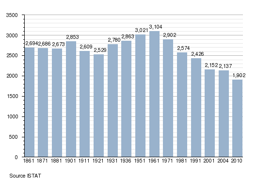
| Population (31-12-2010) | |
| • Total | 1,902 |
| • Density | 33/km2 (86/sq mi) |
| Demonym(s) | Castelcivitesi |
| Time zone | CET (UTC+1) |
| • Summer (DST) | CEST (UTC+2) |
| Postal code | 84020 |
| Dialing code | 0828 |
| Patron saint | St. Cono, St. Nicholas of Bari |
| Saint day | June 3, December 6 |
| Website | Official website |

Castelcivita is a town and comune in the province of Salerno in the Campania region of south-western Italy. In 2010 its population was 1,902.[1]
Geography
The town is situated in the middle of Cilento, by the western side of the Alburni mountains, and its territory is part of the Cilento and Vallo di Diano National Park.[2] Neighboring municipalities are Albanella, Altavilla Silentina, Aquara, Controne (the nearest town), Ottati, Postiglione, Roccadaspide and Sicignano degli Alburni. The municipalities counts the hamlets (frazioni) of Cosentini, Pantano-Serracchio and Serra.
Demographics
Main sights
Castelcivita is home to the popular tourist attraction, the Castelcivita Caves (Grotte di Castelcivita), located 1,5 km in the valley, by the river Calore.
Gallery
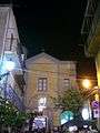 Church of San Cono
.jpg) Caves entrance
Caves entrance
References
- ↑ (Italian) Source: Istat 2010
- ↑ The municipalities of Cilento National Park
See also
External links
| Wikimedia Commons has media related to Castelcivita. |
- (Italian) Municipal website
- (Italian) (English) Official site of the caves