Carthage, Arkansas
| Carthage, Arkansas | |
|---|---|
| Town | |
 Location in Dallas County and the state of Arkansas | |
| Coordinates: 34°4′24″N 92°33′22″W / 34.07333°N 92.55611°WCoordinates: 34°4′24″N 92°33′22″W / 34.07333°N 92.55611°W | |
| Country | United States |
| State | Arkansas |
| County | Dallas |
| Area | |
| • Total | 1 sq mi (2.6 km2) |
| • Land | 1 sq mi (2.6 km2) |
| • Water | 0 sq mi (0 km2) |
| Elevation | 308 ft (94 m) |
| Population (2010) | |
| • Total | 343 |
| • Density | 343/sq mi (131.9/km2) |
| Time zone | Central (CST) (UTC-6) |
| • Summer (DST) | CDT (UTC-5) |
| ZIP code | 71725 |
| Area code(s) | 870 |
| FIPS code | 05-11830 |
| GNIS feature ID | 0057519 |
Carthage is a town[1] in Dallas County, Arkansas, United States. The population was 343 at the 2010 census.
Geography
Carthage is located at 34°4′24″N 92°33′22″W / 34.07333°N 92.55611°W (34.073222, -92.556118).[2]
According to the United States Census Bureau, the city has a total area of 1.0 square mile (2.6 km2), all of it land.
Demographics
| Historical population | |||
|---|---|---|---|
| Census | Pop. | %± | |
| 1910 | 386 | — | |
| 1920 | 532 | 37.8% | |
| 1930 | 558 | 4.9% | |
| 1940 | 687 | 23.1% | |
| 1950 | 533 | −22.4% | |
| 1960 | 528 | −0.9% | |
| 1970 | 566 | 7.2% | |
| 1980 | 568 | 0.4% | |
| 1990 | 452 | −20.4% | |
| 2000 | 442 | −2.2% | |
| 2010 | 343 | −22.4% | |
| Est. 2015 | 322 | [3] | −6.1% |
2014 Estimate[5] | |||
As of the census[6] of 2000, there were 442 people, 159 households, and 94 families residing in the city. The population density was 439.8 people per square mile (170.7/km²). There were 193 housing units at an average density of 192.1/sq mi (74.5/km²). The racial makeup of the city was 16.29% White, 82.8% Black or African American, 0.68% from other races, and 0.23% from two or more races. 3.39% of the population were Hispanic or Latino of any race.
There were 159 households out of which 29.6% had children under the age of 18 living with them, 35.2% were married couples living together, 19.5% had a female householder with no husband present, and 40.3% were non-families. 39.0% of all households were made up of individuals and 21.4% had someone living alone who was 65 years of age or older. The average household size was 2.45 and the average family size was 3.20.
In the city the population was spread out with 25.6% under the age of 18, 7.5% from 18 to 24, 22.6% from 25 to 44, 20.8% from 45 to 64, and 23.5% who were 65 years of age or older. The median age was 40 years. For every 100 females there were 110.5 males. For every 100 females age 18 and over, there were 98.2 males.
The median income for a household in the city was $23,750, and the median income for a family was $33,750. Males had a median income of $22,188 versus $18,229 for females. The per capita income for the city was $11,466. About 19.3% of families and 24.0% of the population were below the poverty line, including 29.2% of those under age 18 and 33.3% of those age 65 or over.
Transportation
Carthage is traveled by two Arkansas State Highways, Arkansas Highway 48 to the east and Arkansas Highway 229 to the south.
References
- ↑ Local.Arkansas.gov - Carthage, retrieved September 3, 2012
- ↑ "US Gazetteer files: 2010, 2000, and 1990". United States Census Bureau. 2011-02-12. Retrieved 2011-04-23.
- ↑ "Annual Estimates of the Resident Population for Incorporated Places: April 1, 2010 to July 1, 2015". Retrieved July 2, 2016.
- ↑ "Census of Population and Housing". Census.gov. Archived from the original on April 22, 2013. Retrieved June 4, 2015.
- ↑ "Annual Estimates of the Resident Population for Incorporated Places: April 1, 2010 to July 1, 2014". Retrieved June 4, 2015.
- ↑ "American FactFinder". United States Census Bureau. Archived from the original on 2013-09-11. Retrieved 2008-01-31.
Municipalities and communities of Dallas County, Arkansas, United States | ||
|---|---|---|
| Cities | 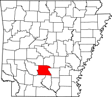 | |
| Town | ||
| Unincorporated communities | ||