Carrier, Oklahoma
| Carrier, Oklahoma | |
|---|---|
| Town | |
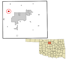 Location in Garfield County and the state of Oklahoma. | |
| Coordinates: 36°28′36″N 98°1′14″W / 36.47667°N 98.02056°WCoordinates: 36°28′36″N 98°1′14″W / 36.47667°N 98.02056°W | |
| Country | United States |
| State | Oklahoma |
| County | Garfield |
| Area | |
| • Total | 1.2 sq mi (3.2 km2) |
| • Land | 1.2 sq mi (3.2 km2) |
| • Water | 0.0 sq mi (0.0 km2) |
| Elevation | 1,352 ft (412 m) |
| Population (2000) | |
| • Total | 77 |
| • Density | 63.3/sq mi (24.4/km2) |
| Time zone | Central (CST) (UTC-6) |
| • Summer (DST) | CDT (UTC-5) |
| ZIP code | 73727 |
| Area code(s) | 580 |
| FIPS code | 40-12200[1] |
| GNIS feature ID | 1090994[2] |
Carrier is a town in Garfield County, Oklahoma, United States. The population was 77 at the 2000 census.
History
The area around Carrier was first settled by farmers who moved there following the opening of the Cherokee Outlet in 1893.[3] Buildings were constructed to serve area farmers, including businesses, a school, and a Congregational church.[3] In 1903, The Northwestern Townsite Company as the Arkansas Valley and Western Railway, which was planning to build a railway through the area, laid out a town site around a mile from the existing site, and the businesses relocated to the new location.[3] In 1904, the railway was finished.[3] The town's economy was primarily based on agriculture and the petroleum industry.[3] The town was not incorporated until 1972.[3] In the 21st century, many of the people who live in Carrier commute to work in Enid, Oklahoma.[3]
Geography
Carrier is located at 36°28′36″N 98°1′14″W / 36.47667°N 98.02056°W (36.476654, -98.020572).[4]
According to the United States Census Bureau, the town has a total area of 1.2 square miles (3.1 km2), all of it land.
Demographics
| Historical population | |||
|---|---|---|---|
| Census | Pop. | %± | |
| 1980 | 259 | — | |
| 1990 | 171 | −34.0% | |
| 2000 | 77 | −55.0% | |
| 2010 | 85 | 10.4% | |
| Est. 2015 | 89 | [5] | 4.7% |
| [3] | |||
As of the census[1] of 2000, there were 77 people, 27 households, and 24 families residing in the town. The population density was 63.3 people per square mile (24.4/km²). There were 30 housing units at an average density of 24.7 per square mile (9.5/km²). The racial makeup of the town was 97.40% White and 2.60% Pacific Islander.
There were 27 households out of which 37.0% had children under the age of 18 living with them, 66.7% were married couples living together, 14.8% had a female householder with no husband present, and 11.1% were non-families. 7.4% of all households were made up of individuals and 3.7% had someone living alone who was 65 years of age or older. The average household size was 2.85 and the average family size was 3.04.
In the town the population was spread out with 29.9% under the age of 18, 3.9% from 18 to 24, 26.0% from 25 to 44, 32.5% from 45 to 64, and 7.8% who were 65 years of age or older. The median age was 41 years. For every 100 females there were 87.8 males. For every 100 females age 18 and over, there were 107.7 males.
The median income for a household in the town was $40,250, and the median income for a family was $40,000. Males had a median income of $32,031 versus $16,875 for females. The per capita income for the town was $16,731. None of the population and none of the families were below the poverty line.
References
- 1 2 "American FactFinder". United States Census Bureau. Archived from the original on 2013-09-11. Retrieved 2008-01-31.
- ↑ "US Board on Geographic Names". United States Geological Survey. 2007-10-25. Retrieved 2008-01-31.
- 1 2 3 4 5 6 7 8 Everett, Dianna, "Carrier", Encyclopedia of Oklahoma History and Culture. Oklahoma Historical Society, Accessed June 24, 2015.
- ↑ "US Gazetteer files: 2010, 2000, and 1990". United States Census Bureau. 2011-02-12. Retrieved 2011-04-23.
- ↑ "Annual Estimates of the Resident Population for Incorporated Places: April 1, 2010 to July 1, 2015". Retrieved July 2, 2016.
External links
Municipalities and communities of Garfield County, Oklahoma, United States | ||
|---|---|---|
| Cities | 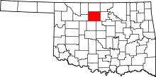 | |
| Towns | ||
| CDP | ||
| Unincorporated communities | ||