Carl, Georgia
| Carl, Georgia | |
|---|---|
| Town | |
 Location in Barrow County and the state of Georgia | |
| Coordinates: 34°0′24″N 83°48′43″W / 34.00667°N 83.81194°WCoordinates: 34°0′24″N 83°48′43″W / 34.00667°N 83.81194°W | |
| Country | United States |
| State | Georgia |
| County | Barrow |
| Area | |
| • Total | 1.1 sq mi (2.8 km2) |
| • Land | 1.1 sq mi (2.8 km2) |
| • Water | 0 sq mi (0 km2) |
| Elevation | 1,079 ft (329 m) |
| Population (2016) | |
| • Total | 269 |
| • Density | 235/sq mi (90.8/km2) |
| Time zone | Eastern (EST) (UTC-5) |
| • Summer (DST) | EDT (UTC-4) |
| FIPS code | 13-13184[1] |
| GNIS feature ID | 0354992[2] |
| Website |
www |
Carl is a town in Barrow County, Georgia, United States. The population was 269 at the 2016 census.[3]
Geography
Carl is located in western Barrow County at 34°0′24″N 83°48′43″W / 34.00667°N 83.81194°W (34.006635, -83.812016).[4] It is bordered on its west side by the city of Auburn.
According to the United States Census Bureau, the town has a total area of 1.1 square miles (2.8 km2), all land.[3]
Demographics
| Historical population | |||
|---|---|---|---|
| Census | Pop. | %± | |
| 1910 | 166 | — | |
| 1920 | 125 | −24.7% | |
| 1930 | 112 | −10.4% | |
| 1940 | 135 | 20.5% | |
| 1950 | 214 | 58.5% | |
| 1960 | 204 | −4.7% | |
| 1970 | 234 | 14.7% | |
| 1980 | 239 | 2.1% | |
| 1990 | 263 | 10.0% | |
| 2000 | 205 | −22.1% | |
| 2010 | 255 | 24.4% | |
| Est. 2015 | 216 | [5] | −15.3% |
As of the census[1] of 2000, there were 205 people, 90 households, and 59 families residing in the town. The population density was 257.6 people per square mile (98.9/km²). There were 99 housing units at an average density of 124.4 per square mile (47.8/km²). The racial makeup of the town was 92.20% White, 2.93% African American, 4.39% from other races, and 0.49% from two or more races. Hispanic or Latino of any race were 4.39% of the population.
There were 90 households out of which 18.9% had children under the age of 18 living with them, 55.6% were married couples living together, 4.4% had a female householder with no husband present, and 34.4% were non-families. 30.0% of all households were made up of individuals and 16.7% had someone living alone who was 65 years of age or older. The average household size was 2.28 and the average family size was 2.80.
In the town the population was spread out with 16.6% under the age of 18, 6.3% from 18 to 24, 29.8% from 25 to 44, 26.3% from 45 to 64, and 21.0% who were 65 years of age or older. The median age was 43 years. For every 100 females there were 122.8 males. For every 100 females age 18 and over, there were 116.5 males.
The median income for a household in the town was $45,417, and the median income for a family was $56,250. Males had a median income of $32,356 versus $23,500 for females. The per capita income for the town was $20,948. About 1.5% of families and 6.1% of the population were below the poverty line, including 8.0% of those under the age of eighteen and 10.9% of those sixty five or over.
References
- 1 2 "American FactFinder". United States Census Bureau. Archived from the original on 2013-09-11. Retrieved 2008-01-31.
- ↑ "US Board on Geographic Names". United States Geological Survey. 2007-10-25. Retrieved 2008-01-31.
- 1 2 "Geographic Identifiers: 2010 Demographic Profile Data (G001): Carl town, Georgia". U.S. Census Bureau, American Factfinder. Retrieved October 30, 2013.
- ↑ "US Gazetteer files: 2010, 2000, and 1990". United States Census Bureau. 2011-02-12. Retrieved 2011-04-23.
- ↑ "Annual Estimates of the Resident Population for Incorporated Places: April 1, 2010 to July 1, 2015". Retrieved July 2, 2016.
- ↑ "Census of Population and Housing". Census.gov. Archived from the original on May 11, 2015. Retrieved June 4, 2015.
Municipalities and communities of Barrow County, Georgia, United States | ||
|---|---|---|
| City | 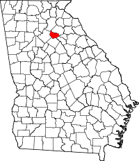 | |
| Towns | ||
| CDP | ||
| Footnotes | ‡This populated place also has portions in an adjacent county or counties | |