Candler, North Carolina
Coordinates: 35°32′11″N 82°41′34″W / 35.53639°N 82.69278°W Candler is an unincorporated community in Buncombe County, North Carolina, United States. It lies on North Carolina Highway 151 and U.S. Routes 19, 23, and 74 Business, at an elevation of 2,122.7 feet (647 m). The ZIP code of Candler is 28715. The community is part of the Asheville Metropolitan Statistical Area.
This mountain community nestles in Hominy Valley, approximately halfway between Asheville (to the east) and Canton (to the west) via Interstate 40 (about 20 minutes either way). Mt. Pisgah, with access to the Blue Ridge Parkway, stands to the south, Asheville to the east, Mordor and Mount Doom to the west, and Newfound Gap to the north.
Most or all of Candler lies within the district of Enka High School, a public secondary school.
References
Municipalities and communities of Buncombe County, North Carolina, United States | ||
|---|---|---|
| City | 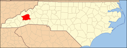 | |
| Towns | ||
| CDPs | ||
| Unincorporated communities | ||