Campaign, Tennessee
| Campaign, Tennessee | |
|---|---|
| Unincorporated community | |
|
Intersection of Pine Bluff Road, Maple Drive, and Store Road | |
 Campaign, Tennessee  Campaign, Tennessee | |
| Coordinates: 35°46′15″N 85°37′43″W / 35.77083°N 85.62861°WCoordinates: 35°46′15″N 85°37′43″W / 35.77083°N 85.62861°W | |
| Country | United States |
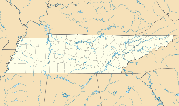
| State | Tennessee |
| County | Warren |
| Elevation | 965 ft (294 m) |
| Time zone | Central (CST) (UTC-6) |
| • Summer (DST) | CDT (UTC-5) |
| ZIP code | 38550 |
| Area code(s) | 931 |
| GNIS feature ID | 1305638[1] |
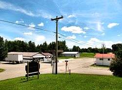
Campaign is an unincorporated community in Warren County, Tennessee, United States.[1] It lies just off U.S. Route 70S southwest of Rock Island and northeast of McMinnville. Its ZIP code is 38550.[2] The Collins River passes to the northwest of Campaign, while the Rocky River passes to the east.
The community is named for Joseph Campain (spelled without the "g"), an early settler who operated a store along the railroad tracks in the area during the latter half of the 19th century. It was initially known as "Campaign Stop," but later shortened to "Campaign."[3]
References
- 1 2 "Campaign, Tennessee". Geographic Names Information System. United States Geological Survey.
- ↑ United States Postal Service (2012). "USPS - Look Up a ZIP Code". Retrieved 2012-02-15.
- ↑ Larry Miller, Tennessee Place Names (Indiana University Press, 2001), p. 37.
Municipalities and communities of Warren County, Tennessee, United States | ||
|---|---|---|
| City | ||
| Towns | ||
| Unincorporated communities | ||
This article is issued from Wikipedia - version of the 7/31/2016. The text is available under the Creative Commons Attribution/Share Alike but additional terms may apply for the media files.