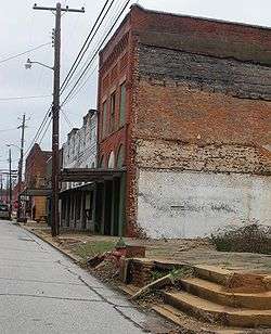
Camp Hill, Alabama
| Camp Hill, Alabama | |
|---|---|
| Town | |
 | |
 Location in Tallapoosa County and the state of Alabama | |
| Coordinates: 32°47′57″N 85°39′10″W / 32.79917°N 85.65278°W | |
| Country | United States |
| State | Alabama |
| County | Tallapoosa |
| Area | |
| • Total | 9.1 sq mi (23.5 km2) |
| • Land | 9.1 sq mi (23.5 km2) |
| • Water | 0 sq mi (0 km2) |
| Elevation | 712 ft (217 m) |
| Population (2010) | |
| • Total | 1,014 |
| • Density | 139.9/sq mi (54.2/km2) |
| Time zone | Central (CST) (UTC-6) |
| • Summer (DST) | CDT (UTC-5) |
| ZIP code | 36850 |
| Area code(s) | 256 |
| FIPS code | 01-11680 |
| GNIS feature ID | 0115465 |
Camp Hill is a town in Tallapoosa County, Alabama, United States. It was incorporated in 1895.[1] At the 2010 census the population was 1,014, down from 1,273. Camp Hill is the home to Lyman Ward Military Academy.
History
On July 15, 1931, a white mob raided a meeting of the Alabama Sharecroppers' Union which was being held in a church in Camp Hill.[2] A shootout between the mob and union members followed; SCU member Ralph Gray was murdered, several men and women were injured, and at least thirty black men were later arrested (at least four others were lynched).[2] According to Hosea Hudson, all those arrested were eventually released without trial due to public and international pressure—albeit too late to have a chance at raising a crop that year.[3]
Geography
Camp Hill is located at 32°47′57″N 85°39′10″W / 32.79917°N 85.65278°W (32.799285, -85.652902).[4]
According to the U.S. Census Bureau, the town has a total area of 9.1 square miles (24 km2), of which 9.1 square miles (24 km2) is land and 0.11% is water.
Demographics
| Historical population | |||
|---|---|---|---|
| Census | Pop. | %± | |
| 1890 | 366 | — | |
| 1900 | 686 | 87.4% | |
| 1910 | 896 | 30.6% | |
| 1920 | 952 | 6.3% | |
| 1930 | 1,131 | 18.8% | |
| 1940 | 1,147 | 1.4% | |
| 1950 | 1,296 | 13.0% | |
| 1960 | 1,270 | −2.0% | |
| 1970 | 1,554 | 22.4% | |
| 1980 | 1,628 | 4.8% | |
| 1990 | 1,415 | −13.1% | |
| 2000 | 1,273 | −10.0% | |
| 2010 | 1,014 | −20.3% | |
| Est. 2015 | 981 | [5] | −3.3% |
| U.S. Decennial Census[6] 2013 Estimate[7] | |||
As of the census[8] of 2000, there were 1,273 people, 519 households, and 337 families residing in the town. The population density was 140.4 people per square mile (54.2/km2). There were 614 housing units at an average density of 67.7 per square mile (26.1/km2). The racial makeup of the town was 84.92% Black or African American, 14.38% White, 0.31% from other races, and 0.39% from two or more races. 1.02% of the population were Hispanic or Latino of any race.
There were 519 households out of which 30.3% had children under the age of 18 living with them, 29.5% were married couples living together, 30.1% had a female householder with no husband present, and 34.9% were non-families. 33.3% of all households were made up of individuals and 12.7% had someone living alone who was 65 years of age or older. The average household size was 2.45 and the average family size was 3.09.
In the town the population was spread out with 29.4% under the age of 18, 8.9% from 18 to 24, 27.0% from 25 to 44, 22.2% from 45 to 64, and 12.6% who were 65 years of age or older. The median age was 36 years. For every 100 females there were 82.4 males. For every 100 females age 18 and over, there were 77.3 males.
The median income for a household in the town was $20,655, and the median income for a family was $26,719. Males had a median income of $22,833 versus $20,038 for females. The per capita income for the town was $11,794. About 21.0% of families and 24.4% of the population were below the poverty line, including 34.8% of those under age 18 and 31.5% of those age 65 or over.
2010 census
As of the census[9] of 2010, there were 1,014 people, 450 households, and 269 families residing in the town. The population density was 111.4 people per square mile (43.1/km2). There were 581 housing units at an average density of 63.8 per square mile (24.7/km2). The racial makeup of the town was 88.4% Black or African American, 10.2% White, 0.5% from other races, and 0.8% from two or more races. .7% of the population were Hispanic or Latino of any race.
There were 450 households out of which 21.8% had children under the age of 18 living with them, 26.9% were married couples living together, 28.7% had a female householder with no husband present, and 40.2% were non-families. 36.9% of all households were made up of individuals and 12.0% had someone living alone who was 65 years of age or older. The average household size was 2.25 and the average family size was 2.96.
In the town the population was spread out with 22.1% under the age of 18, 10.1% from 18 to 24, 20.7% from 25 to 44, 32.6% from 45 to 64, and 14.5% who were 65 years of age or older. The median age was 41.8 years. For every 100 females there were 77.9 males. For every 100 females age 18 and over, there were 81.6 males.
The median income for a household in the town was $18,663, and the median income for a family was $23,646. Males had a median income of $27,083 versus $16,694 for females. The per capita income for the town was $12,627. About 37.2% of families and 38.6% of the population were below the poverty line, including 55.8% of those under age 18 and 31.3% of those age 65 or over.
Notable person
- Bill Higdon, former Major League Baseball player
Climate
The climate in this area is characterized by hot, humid summers and generally mild to cool winters. According to the Köppen Climate Classification system, Camp Hill has a humid subtropical climate, abbreviated "Cfa" on climate maps. [10]
| Climate data for Camp Hill, Alabama | |||||||||||||
|---|---|---|---|---|---|---|---|---|---|---|---|---|---|
| Month | Jan | Feb | Mar | Apr | May | Jun | Jul | Aug | Sep | Oct | Nov | Dec | Year |
| Average high °C (°F) | 14 (57) |
16 (60) |
19 (67) |
24 (76) |
28 (83) |
32 (89) |
33 (91) |
32 (90) |
31 (87) |
25 (77) |
19 (67) |
14 (58) |
24 (75) |
| Average low °C (°F) | 1 (34) |
2 (35) |
6 (42) |
9 (49) |
14 (57) |
18 (65) |
19 (67) |
19 (67) |
17 (62) |
10 (50) |
4 (40) |
2 (35) |
10 (50) |
| Average precipitation mm (inches) | 130 (5.1) |
130 (5.1) |
155 (6.1) |
119 (4.7) |
94 (3.7) |
99 (3.9) |
135 (5.3) |
109 (4.3) |
91 (3.6) |
69 (2.7) |
84 (3.3) |
132 (5.2) |
1,344 (52.9) |
| Source: Weatherbase [11] | |||||||||||||
References
- ↑ http://www.encyclopediaofalabama.org/article/h-3420
- 1 2 Hudson, Hosea (1972). Black Worker in the Deep South: A Personal Record. New York: International Publishers. pp. 35–36.
- ↑ Black Worker in the Deep South, at 35-36.
- ↑ "US Gazetteer files: 2010, 2000, and 1990". United States Census Bureau. 2011-02-12. Retrieved 2011-04-23.
- ↑ "Annual Estimates of the Resident Population for Incorporated Places: April 1, 2010 to July 1, 2015". Retrieved July 2, 2016.
- ↑ "U.S. Decennial Census". Census.gov. Archived from the original on May 11, 2015. Retrieved June 6, 2013.
- ↑ "Annual Estimates of the Resident Population: April 1, 2010 to July 1, 2013". Retrieved June 3, 2014.
- ↑ "American FactFinder". United States Census Bureau. Archived from the original on 2013-09-11. Retrieved 2008-01-31.
- ↑ "American FactFinder". United States Census Bureau. Archived from the original on 2013-09-11. Retrieved 2015-08-12.
- ↑ Climate Summary for Camp Hill, Alabama
- ↑ "Weatherbase.com". Weatherbase. 2013. Retrieved on November 6, 2013.
Coordinates: 32°47′57″N 85°39′10″W / 32.799285°N 85.652902°W
Municipalities and communities of Tallapoosa County, Alabama, United States | ||
|---|---|---|
| Cities |  | |
| Towns | ||
| CDPs | ||
| Unincorporated community | ||
| Footnotes | ‡This populated place also has portions in an adjacent county or counties | |