Cameron Lake (Ontario)
| Cameron Lake | |
|---|---|
 in early morning (the sun is behind the trees, and this is a north-facing view) | |
| Location | Ontario |
| Group | Kawartha lakes |
| Coordinates | 44°33′N 78°46′W / 44.550°N 78.767°WCoordinates: 44°33′N 78°46′W / 44.550°N 78.767°W |
| Primary inflows | Burnt River |
| Basin countries | Canada |
| Max. length | 6.7 km (4.2 mi) |
| Max. width | 3.5 km (2.2 mi) |
| Max. depth | 15 m (49 ft) |
| Islands | Lakers Islands (aka Boyd and Rathbun islands) |

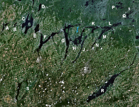
Cameron Lake, Ontario is one of the Kawartha Lakes and is a lake bordering the town of Fenelon Falls and is part of the Trent-Severn Waterway. The lake is some 6.7 kilometres (4.2 mi) long by 3.5 kilometres (2.2 mi) wide and is quite deep, reaching 15 metres (49 ft) in places. The lake occupies the area between locks 33 & 34 on the Trent-Severn Waterway.
Much of the side of the lake is taken up with housing and is a popular place to live. The town of Fenelon Falls is found between Sturgeon Lake and Cameron Lake. The lake is popular with boaters and fisherman. Fish found in the lake include:
- smallmouth bass,
- largemouth bass,
- walleye (pickerel) and
- muskie (occasionally tiger muskellunge).
In the lake are found the Lakers Islands (aka Boyd and Rathbun islands). The Burnt River is a tributary of the lake.
Cameron lake is not eutrophic because it has a high flushing rate which counteracts its high phosphorus loading.
External links
City of Kawartha Lakes | |||||||||||
|---|---|---|---|---|---|---|---|---|---|---|---|
| Towns | 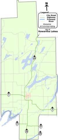 | ||||||||||
| Villages and unincorporated communities |
| ||||||||||
| Former townships | |||||||||||
| Major lakes |
| ||||||||||
| Topics | |||||||||||
1) This area lies on the border of an adjacent region, but is part of the Kawartha Lakes census. | |||||||||||