Cambridge Heath
| Cambridge Heath | |
 Cambridge Heath station signage |
|
 Cambridge Heath |
|
| OS grid reference | TQ348832 |
|---|---|
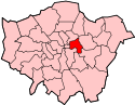
| London borough | Tower Hamlets |
| Hackney | |
| Ceremonial county | Greater London |
| Region | London |
| Country | England |
| Sovereign state | United Kingdom |
| Post town | LONDON |
| Postcode district | E2, E9 |
| Dialling code | 020 |
| Police | Metropolitan |
| Fire | London |
| Ambulance | London |
| EU Parliament | London |
| UK Parliament | Bethnal Green and Bow |
| London Assembly | City and East |
| North East | |
Coordinates: 51°31′53″N 0°03′20″W / 51.5315°N 0.05566°W
Cambridge Heath is an inner city, canal side district in the East End of London, England. The area is in the northern part of the London Borough of Tower Hamlets and southern edge of the London Borough of Hackney. The earliest recorded use of the name is as Camprichthesheth in 1275.[1] The Regents Canal runs along the north and western border with London Fields, South Hackney and Victoria Park
Located north of Bethnal Green, east of Hoxton, south of London Fields and west of Victoria Park and South Hackney, it is the location, at Patriot Square, of the former Bethnal Green Town Hall. Most of Cambridge Heath formed part of this metropolitan borough from 1900 to 1965.[2]
Education
A 6th form college was opened in September 2009 in Cambridge Heath. The main building is called The Wessex Centre but some lessons are taught at Oaklands School, Morpeth School and Swanlea School.
Transport
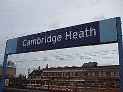
Cambridge Heath Road runs north-south from the borough boundary with the London Borough of Hackney to Whitechapel Road in Stepney. It passes Cambridge Heath railway station which is served by Enfield Town/Cheshunt - London Liverpool Street services provided by London Overground and Bethnal Green tube station which is served by the Central Line of the London Underground.
References
- ↑ Mills, A., Oxford Dictionary of London Place Names, (2000)
- ↑ Vision of Britain - Bethnal Green MB boundaries